Alamo Plaza in San Antonio in Bexar County, Texas — The American South (West South Central)
Robert H.H. Hugman
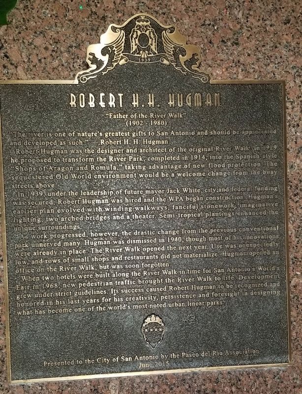
Robert Hugman was the designer and architect of the original River Walk. In 1929, he proposed to transform the River Park, completed in 1914, into the Spanish style "Shops of Aragon and Romula," taking advantage of new flood protection. The sequestered Old World environment would be a welcome change from the busy streets above.
In 1939, under the leadership of future mayor, Jack White, city and federal funding was secured, Robert Hugman was hired and the WPA began construction. Hugman's earlier plan evolved with winding walkways, fanciful stonework, imaginative lighting, two arched bridges and a theater. Semi-tropical plantings enhanced the unique surroundings.
As work progressed, however, the drastic change from the previous conventional park unnerved many. Hugman was dismissed in 1940, though most of his innovations were already in place. The River Walk opened the next year. Use was unexpectedly low, and rows of small shops and restaurants did not materialize. Hugman opened an office on the River Walk, but was soon forgotten.
When two hotels were built along the River Walk in time for San Antonio's World's Fair in 1968, new pedestrian traffic brought the River Walk to life. Development grew under strict guidelines. Its success caused Robert Hugman to be recognized and honored in his last years for his creativity, persistence and foresight in designing what has become one of the world's most noted urban linear parks.
Erected 2015 by Paseo del Rio Association and the City of San Antonio.
Topics. This historical marker is listed in these topic lists: Industry & Commerce • Parks & Recreational Areas • Waterways & Vessels. A significant historical year for this entry is 1929.
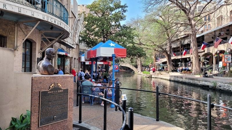
Location. 29° 25.434′ N, 98° 29.283′ W. Marker is in San Antonio, Texas, in Bexar County. It is in Alamo Plaza. Marker can be reached from the intersection of East Commerce Street and Losoya Street. The marker is located on the west side of the San Antonio River along the river walk. Touch for map. Marker is at or near this postal address: 431 East Commerce Street, San Antonio TX 78205, United States of America. Touch for directions.
Other nearby markers. At least 8 other markers are within walking distance of this marker. A different marker also named Robert H.H. Hugman (here, next to this marker); Father of the River Walk (here, next to this marker); Mr. & Mrs. Alfred Beyer (within shouting distance of this marker); Commerce Street Bridge (within shouting distance of this marker); Commerce Street (within shouting distance of this marker); 141st Infantry Regiment (about 300 feet away, measured in a direct line); 250th Anniversary of the Founding of San Antonio (about 300 feet away); Pat O'Brien's (about 300 feet away). Touch for a list and map of all markers in San Antonio.
Also see . . . Hugman, Robert Harvey Harold (1902–1980).
When Hugman returned in 1927 to open an architecture practice in San Antonio, the city was in the midst of a flood prevention program begun just prior to the devastating flood of 1921. Even before the flood, the city council had rejected engineers’ recommendations to clear trees along the picturesque nearly half-mile Great Bend in the heart of downtown and pave its bed as a flood channel. Instead, the city was building a bypass channel with a low dam at its upstream end to deflect the river’s normal flow around the bend, preserving the bend while allowing floodwaters to flow over the dam and into the bypass channel. Source: The Handbook of Texas(Submitted on December 21, 2021, by James Hulse of Medina, Texas.)
Credits. This page was last revised on July 5, 2023. It was originally submitted on December 21, 2021, by James Hulse of Medina, Texas. This page has been viewed 287 times since then and 46 times this year. Photos: 1, 2. submitted on December 22, 2021, by James Hulse of Medina, Texas. 3. submitted on July 5, 2023, by James Hulse of Medina, Texas.


