Mt. Carmel in McCormick County, South Carolina — The American South (South Atlantic)
Calhoun Mill
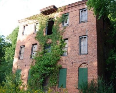
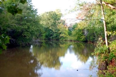
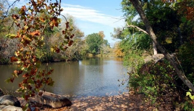
Built ca. 1854 on a mill site in use since the 1770s, this large brick building on Little River was used for grinding corn, wheat, and other grains. A post office and various commercial enterprises operated near the mill during the 1800s. The mill yard was a popular place for political rallies and social gatherings well into the 20th century.
Erected 1986 by McCormick County Historical Society & McCormick County Historical Commission. (Marker Number 33-10.)
Topics and series. This historical marker is listed in these topic lists: Industry & Commerce • Notable Buildings • Notable Places • Waterways & Vessels. In addition, it is included in the South Carolina, McCormick County Historical Commission, and the South Carolina, McCormick County Historical Society series lists. A significant historical year for this entry is 1854.
Location. Marker is missing. It was located near 34° 1.955′ N, 82° 28.55′ W. Marker was in Mt. Carmel, South Carolina, in McCormick County. Marker could be reached from the intersection of Mt. Carmel Road (State Highway 823) and State Highway 40. The marker is currently missing. It was removed when the intersection of SC Highway 823 and Road 40 was altered. However, its text was documented in South Carolina Highway Historical Marker Guide, 2nd Edition, published by the South Carolina Department of Archives and History, 1998. Touch for map. Marker was in this post office area: Mount Carmel SC 29840, United States of America. Touch for directions.
Other nearby markers. At least 10 other markers are within 6 miles of this location, measured as the crow flies. Birthplace of Calhoun (approx. 2.4 miles away); Mt. Carmel Historical District (approx. 2½ miles away); Fort Charlotte (approx. 2.6 miles away); Mulberry A.M.E. Church (approx. 2.6 miles away); Willington (approx. 4.2 miles away); Willington Academy (approx. 4.2 miles away); Cherry Hill / Noble Cemetery (approx. 4.2 miles away); Battle of Long Cane (approx. 4.7 miles away); Site of Willington Presbyterian Church (approx. 5.2 miles away); Site of Willington Academy (approx. 5.2 miles away). Touch for a list and map of all markers in Mt. Carmel.
Also see . . .
1. Calhoun Mill. Calhoun Mill is a mid-nineteenth century brick building which possesses a high degree of architectural quality, representing a unique and fine example of mill construction. (Submitted on May 12, 2009, by Brian Scott of Anderson, South Carolina.)
2. Joseph Calhoun. Joseph Calhoun (October 22, 1750 – April 14, 1817) was a Republican member of the South Carolina House of Representatives (1804-1805) and represented South Carolina in the United States House
of Representatives (1807-1811). (Submitted on May 12, 2009, by Brian Scott of Anderson, South Carolina.)
Additional commentary.
1. Calhoun Mill
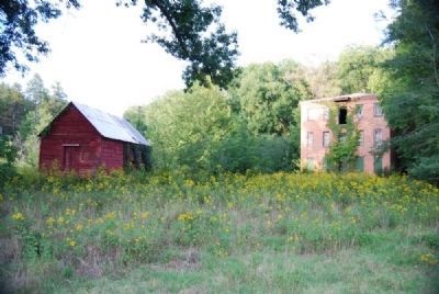
Situated on the west bank of the Little River approximately three miles northeast of the town of Mount Carmel, McCormick County, Calhoun Mill was constructed by 1860 on a mill site in use since the 1770s. The three-story mill building is of brick construction. Also included in the nominated property are six outbuildings, a race, and a dam.
Exterior
The mill is a three-story, rectangular brick building with a basement and low hipped metal roof. It rests on a high foundation of fieldstone and brick, which is topped by a brick water table. The exterior brick walls, laid in common bond, are three bricks thick.
The façade (west elevation) is five bays wide with a central door. Windows were originally nine-over-nine sash on the first and second floors, and six-over-nine sash on the third floor. Most of the windows have been replaced by two-over-two sash, and many have been boarded up.
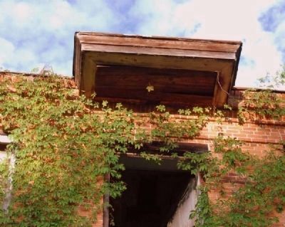
The windows are spanned by segmental brick arches which are concealed by flat arches on the exterior of the walls. A granite lintel is above the first-story door. A single wooden door is found in the center of the façade on all three stories. A small hood projects from the roof above the third story door. Eight earthquake bolts are visible on each elevation. The building has a corbelled brick cornice.
The north elevation has three bays. A door on the western bay has a segmental brick arch. Beneath the two first story windows are arched openings for access to the basement. At the rear of the building is the race, which is now overgrown and congested with debris.
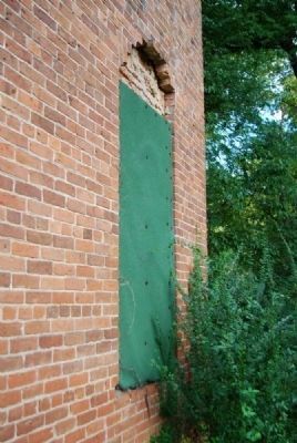
The south elevation has three windows on each story. Beneath the center and right windows are arched openings which originally allowed access to the basement, but are now bricked up. The east elevation is also three bays wide.
Interior
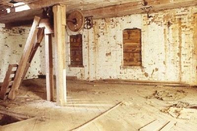
The interior of the building is relatively stable with the second and third floors appearing to be in good condition. The floor of the first story has suffered major deterioration and would require extensive repair. The interior has intermediate wooden girders supported on wooden piers. Most of the machinery for the milling operation has been removed, although the grist mill works remain in the building.
Outbuildings
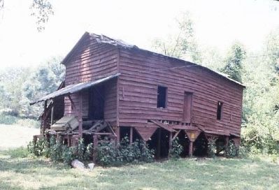
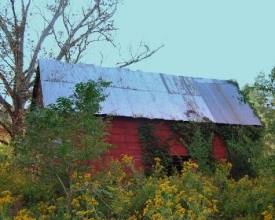
Located in a rural setting surrounded by woodlands, the nominated property includes six out buildings and a mill dam associated with the milling operation. Located immediately north of the mill is the late 19th century cotton gin, a one-story, weatherboarded rectangular building, set on wooden piers. The metal roof is gabled. Shed additions are located on the north and west elevations of the building. This building is presently used for storage. A storage shed, located northwest of the mill, is of wooden construction set on fieldstone piers, with a gabled metal roof. According to local tradition, this building was originally used for seed storage. Another shed, also constructed of wood with a gabled metal roof, is located northwest of the first shed. Both sheds date from the late 19th century.
Situated on a hill north of the mill is the 10th century mill operator’s residence, a one-story weatherboarded rectangular building. The façade features four windows with a central double entrance. The truncated hipped roof is of pressed metal shingles. The house, set on low brick piers, has batten shutters. The interior of the building is relatively intact and features flushboard walls and the original door molding, baseboards, and mantels. The mill operator’s house is currently used for storage. A smokehouse is located to the right of this house. A small rectangular frame wellhouse is located to the extreme northwest of the mill property. The building has a gabled metal roof. Also located on the mill property is an early 20th century building probably built for use as a tenant house. The weatherboarding building is one-story with a hipped metal roof. A real ell addition has a gabled roof.
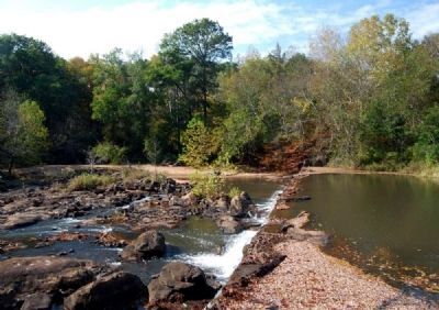
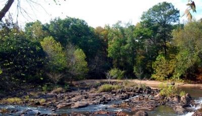
A concrete damn which provided power for milling operations is located upstream of the mill on the Little River. This dam replaced a pervious wooden structure ca. 1910.
Significance
Located in rural McCormick County, South Carolina, Calhoun Mill us a mid-19th century brick building which possesses a high degree of architectural quality. While the present building was constructed ca. 1860, the property included in the nomination has been associated with a mill operation since the 1770s. The mill building, together with six outbuildings, a race, and a dam, are significant for their impact on the economical, social, and cultural development of this area, which was known by the name of Calhoun’s Mill for many years. Calhoun Mill served as a commercial center for the Mount Carmel area, providing employment and services, and supporting a thriving community of other businesses nearby. The ca. 1860 mill was used for grinding corn, wheat, and other grains. This site served as a popular place for political rallies and social gatherings well into the 20th century, according to local residents. A post office was located at the mill between 1822 and 1894.
Historical
Although the present building was constructed ca. 1860, milling operations were established on this site in the 1770s. Reverend William Tennent crossed the Little River at a place known as Hutchinson’s Mills on September 3, 1775.
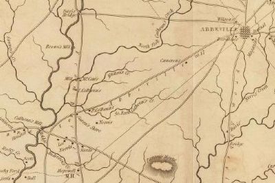
An article in the Abbeville Press and Banner on May 31, 1876, stated Hutchinson’s Mills later became known by the name of Calhoun’s Mills. The first specific mention of Calhoun ownership is found in the will of Colonel Joseph Calhoun, a prominent politician, in 1817 when he bequeathed the property to his son Captain Joseph Calhoun. Calhoun’s Mill is also noted on the Mills Atlas of the Abbeville District in 1825.
Ownership of the mill left the Calhoun family and was assumed by Dionysius M. Rogers sometime after 183, when Captain Joseph Calhoun died intestate. In 1852, the Due West Telescope reported the loss by fire of Robert’s Mills (formerly Calhoun’s Mills) for a total loss of $12,000. The mill is noted in the Industrial Census of 1860 as Rogers and Calhoun Mills. Under the entry is the notation “commended operation March 27.” The 1870 Industrial Census lists the mill solely as Roger’s Mill.
The mill left Rogers ownership in 1876, and was sold again in 1883, 1901, and 1915. According to local tradition, the wooden damn at the mill was replaced by the present concrete dam at this time. In 1925 the mill became the property of Darrell J. McAllister. The mill gradually ceased operation; the roller mill closed in 1936, the grist mill in 1950, and the cotton gin in 1954. John A. McAllister obtained full possession of the land in 1967 and is the present owner.
Architecture
Calhoun Mill is architecturally significant for its brick construction, quality of workmanship, and attention to decorative detail. The mill building is also significant for its size, containing three full stories and a basement.
The usual manner of grist mill construction produced buildings similar to barns which contained no ornamentation and were almost always built of wood. Mills built of brick and stone are rare in all sections of the country; even more unique is the presence of a hipped roof. Calhoun Mill possesses both of these attributes, representing a unique and fine example of mill construction.
In addition to its hipped roof and brick and fieldstone construction, the mill exhibits decorative elements in the presence of a brick water table, small projecting hood on the third story façade, corbelled brick cornice, and original nine-over-nine and six-over-nine window sashes. The walls are three bricks thick, with interior segmental arches over the windows concealed by flat arches on the exterior. Craftsmanship of the building is of high quality. (Source: National Register nomination form.)
— Submitted May 12, 2009, by Brian Scott of Anderson, South Carolina.
2. The Calhoun Mill Complex
The Calhoun Mill complex located three miles northeast of Mt. Carmel, served as a commercial center for the area prior to the emergence of Mt. Carmel, providing employment and services, and supporting a thriving community since the 1770s. Early during the American Revolution, Rev. William Tennent crossed Little River at the then Hutchinson's Mill on September 3, 1775. Joseph Calhoun, a prominent planter and politician, owned the mill by the early 1800s.
During the antebellum era Calhoun Mill was a popular spot for political gatherings. There was a general store and post office. The site provided the headquarters and muster field for the militia. Captain Thomas Parker commanded an artillery company for a number of years.
Architecturally significant. Calhoun Mill. built in 1854. is a three-story. brick building with a basement and low-hipped metal roof. The building constructed on a high foundation of fieldstone and brick. which is topped by a brick water table. is a unique example of mill construction. The mill was used for grinding wheat. corn. and other grains. The thriving commercial center served as a popular place for political rallies well into the twentieth century. The Calhoun Mill complex consisted of the mill building. millrace, concrete dam, and six out buildings: cotton gin. miller's residence. storage buildings. smokehouse. and well house.
Calhoun Mill sustained slight damage from the 1886 earthquake that was so devastating in Charleston. 20
In 1925, ownership of Calhoun Mill passed to D.J. McAllister.
The roller mill (wheat) closed in 1936, the gristmill in 1950. and the cotton gin in 1954. The mill complex is listed on the National Register of Historic Places.
The Joseph Calhoun family lived first at the mill site in a two-story wood frame house. The front part of the bottom floor served as a general store. The family lived in back of the store and on the second floor. After several children died of fever. Calhoun built a handsome home on high ground on the opposite (east) side of Little River called Cedar Hill (known today as the Ollie Watson home on Route 823). Surrounding the home were large cedar and walnut trees, and a grove of magnificent chestnut trees.
A little farther east along Vienna Road was the John Bradley Plantation. A blacksmith shop stood directly across the road from the Bradley home. During the antebellum era a falling meteorite crashed into the ground in a thunderstorm near the shop almost striking a slave named Cato. (Source: The Making of McCormick County by Bobby F. Edmonds (1999), pgs 371-372.)
— Submitted December 8, 2009, by Brian Scott of Anderson, South Carolina.
3. Colonel Joseph Calhoun
Joseph Calhoun, (cousin of John Caldwell Calhoun and John Ewing Colhoun), a Representative from South Carolina; born in Staunton, Augusta County, Va., October 22, 1750; moved with his father to South Carolina in 1756 and settled in Granville District, on Little River, near the present town of Abbeville; received a limited education; engaged in agricultural pursuits; served as a member of the South Carolina house of representatives in 1804 and 1805; colonel of State militia; elected as a Republican to the Tenth Congress to fill the vacancy caused by the death of Levi Casey; reelected to the Eleventh Congress and served from June 2, 1807, to March 3, 1811; declined to be a candidate for reelection in 1810 to the Twelfth Congress; resumed agricultural pursuits and engaged in milling; died in Calhoun Mills, Abbeville District (now Mount Carmel, McCormick County), April 14, 1817; interment in the family burying ground near his home. (Source: Biographical Directory of the U.S. Congress.)
— Submitted May 12, 2009, by Brian Scott of Anderson, South Carolina.
4. Captain Joseph Calhoun
Joseph Calhoun, Second, was born July 22 1787. He was educated by Dr. Moses Waddell, was commisioned in the United States Army and attained the rank of Captain. Was in the Richmond Theatre the night of the Great Fire, December 26, 1811 and was badly wounded in the Battle of Lundy's Lane. He married Frances Darricourt. They had nine children: Rebecca Calhoun (who died young); Thomas Smith Calhoun (who died young); Joseph Selden Calhoun (who died young); Louisa Calhoun (who died young); Eliza Calhoun (who furnished much of the early records here quoted); Elizabeth Mary Calhoun (who died unmarried); Frances Josette Calhoun (who married Dr. J.W. Marshall); Ann Calhoun (who died young); and Joseph Calhoun (who married Mary E. Sayre and had Mary Elizabeth Calhoun, died young; Harriet Louise Calhoun, married H.N. VanDeVander; Lilla Frances Calhoun, married R. Morgan; William Sayre Calhoun, married V.B. Loomis; Joseph Selden Calhoun; Marie Estelle Calhoun; and John Joseph Calhoun. (Source: Notable Southern Families, Vol. I by Zella Armstrong.)
— Submitted May 12, 2009, by Brian Scott of Anderson, South Carolina.
Credits. This page was last revised on June 16, 2016. It was originally submitted on May 12, 2009, by Brian Scott of Anderson, South Carolina. This page has been viewed 4,392 times since then and 69 times this year. Photos: 1. submitted on May 12, 2009, by Brian Scott of Anderson, South Carolina. 2. submitted on July 26, 2009, by Brian Scott of Anderson, South Carolina. 3, 4. submitted on May 12, 2009, by Brian Scott of Anderson, South Carolina. 5. submitted on July 26, 2009, by Brian Scott of Anderson, South Carolina. 6. submitted on November 5, 2010, by Brian Scott of Anderson, South Carolina. 7. submitted on May 12, 2009, by Brian Scott of Anderson, South Carolina. 8. submitted on November 5, 2010, by Brian Scott of Anderson, South Carolina. 9. submitted on May 12, 2009, by Brian Scott of Anderson, South Carolina. 10. submitted on July 26, 2009, by Brian Scott of Anderson, South Carolina. 11, 12, 13. submitted on November 5, 2010, by Brian Scott of Anderson, South Carolina.

