Near Wetumpka in Elmore County, Alabama — The American South (East South Central)
Wetumpka Impact Crater
Educational Viewpoint #5

Photographed by Mark Hilton, December 27, 2021
1. Wetumpka Impact Crater Marker
Educational Viewpoint signs are part of the self-guided tour to see and understand the 85 million year old Wetumpka Impact Crater.
Erected 2019 by the Wetumpka Impact Crater Commission. (Marker Number 5.)
Topics. This historical marker is listed in this topic list: Notable Events.
Location. 32° 31.298′ N, 86° 10.212′ W. Marker is near Wetumpka, Alabama, in Elmore County. It is on Trotters Trail 0.2 miles south of Fairliewood Drive, on the left when traveling south. Touch for map. Marker is in this post office area: Wetumpka AL 36092, United States of America. Touch for directions.

Regionally, this marker is in the Tri-Counties River Region. It is also in the American South and specifically in the Deep South. Globally, it is in North America, a Gulf of Mexico state, the Western
this page online
Other nearby markers. At least 8 other markers are within 3 miles of this marker, measured as the crow flies: A different marker also named Wetumpka Impact Crater (approx. 0.2 miles away); a different marker also named Wetumpka Impact Crater (approx. 0.9 miles away); a different marker also named Wetumpka Impact Crater (approx. 1.6 miles away); a different marker also named Wetumpka Impact Crater (approx. 2.1 miles away); Williams Lowndes Yancey (approx. 2.1 miles away); a different marker also named Wetumpka Impact Crater (approx. 2.1 miles away); Elmore County Korean War Memorial (approx. 2.3 miles away); Wetumpka Timeline (approx. 2.3 miles away). Touch for a list and map of all markers in Wetumpka.
Related markers. Click here for a list of markers that are related to this marker.
Also see . . . For more information visit the City of Wetumpka at 408 South Main Street or our website. (Submitted on December 27, 2021, by Mark Hilton of Montgomery, Alabama.)

Photographed by Mark Hilton, December 27, 2021
2. View of eastern rim of the Wetumpka Impact Crater.

Photographed by Mark Hilton, December 27, 2021
3. View of the near epicenter of the crater.
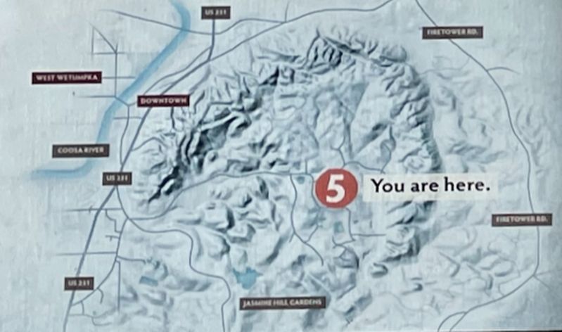
Photographed by Mark Hilton
4. Map closeup of the Wetumpka Impact Crater walls.
Credits. This page was last revised on December 27, 2021. It was originally submitted on December 27, 2021, by Mark Hilton of Montgomery, Alabama. This page has been viewed 682 times since then and 47 times this year. Photos: 1, 2, 3, 4. submitted on December 27, 2021, by Mark Hilton of Montgomery, Alabama.
