Chesapeake City in Cecil County, Maryland — The American Northeast (Mid-Atlantic)
From Creek to Canal
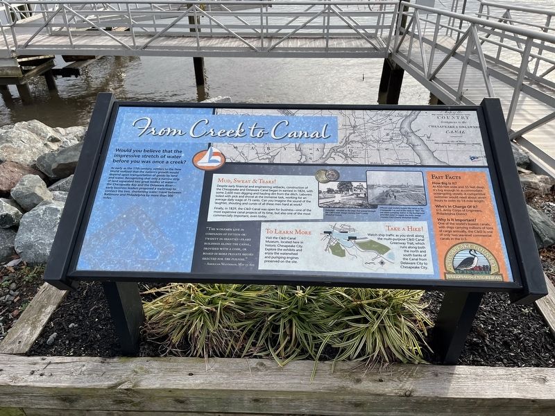
Would you believe that the impressive stretch of water before you was once a creek?
As early as the 17th century, settlers to the New World realized that the nation's growth would depend upon transportation of goods by land and water. Recognizing that only a narrow strip of land separated two great bodies of water—the Chesapeake Bay and the Delaware River—early business leaders proposed a new waterway to connect the two, shortening water travel between Baltimore and Philadelphia by more than 300 miles.
Mud, Sweat & Tears!
Despite early financial and engineering setbacks, construction of the Chesapeake and Delaware Canal began in earnest in 1824, with some 2,600 men digging and hauling dirt from the ditch. Laborers toiled with pick and shovel at the immense task, working for an average daily wage of 75 cents. Can you imagine the sound of the laughter, shouting and curses of all these men hard at work?
Finally, in 1829, the C&D Canal was open for business—one of the most expensive canal projects of its time, but also one of the most commercially important, even today.
"The workmen live in companies of fifteenor twenty in shanties—frame buildings along the canal, provided with a cook, or board in more private houses erected for the purpose."
Click or scan to see
this page online
—American Watchman, May 17, 1825
Fast Facts
How Big Is It?
At 450 feet wide and 35 feet deep, it's big enough to accommodate oceangoing vessels. A competitive swimmer would need about seven hours to swim its 14-mile length.
Who's In Charge Of It?
U.S. Army Corps of Engineers, Philadelphia District
Why Is It Important?
One of the world's busiest canals, with ships carrying millions of tons of cargo annually, the C&D is one of only two sea-level commercial canals in the U.S.
To Learn More
Visit the C&D Canal Museum, located here in historic Chesapeake City. Explore the exhibits and enjoy the waterwheel and pumping engines preserved on the site.
Take a Hike!
Watch ship traffic as you stroll along the multi-purpose C&D Canal Greenway Trail, which runs along both the north and south banks of the Canal from Delaware City to Chesapeake City.
[Captions:]
Onlookers marveled at the ships that passed through the C&D Canal. Image courtesy Cecil County Historical Society.
Officials and workers inspect the canal at the Chesapeake City end of the route in 1867. The old steam pumping station in the background provided water to supply the locks. Image courtesy Cecil County Historical Society.
Erected by Chesapeake

Topics and series. This historical marker is listed in these topic lists: Industry & Commerce • Waterways & Vessels. In addition, it is included in the Chesapeake & Delaware (C&D) Canal series list. A significant historical date for this entry is May 17, 1825.
Location. 39° 31.782′ N, 75° 48.656′ W. Marker is in Chesapeake City, Maryland, in Cecil County. It is at the intersection of Ben Cardin C&D Canal Trail and Lock Street, on the right when traveling east on Ben Cardin C&D Canal Trail. Touch for map. Marker is at or near this postal address: 303 Bank St, Chesapeake City MD 21915, United States of America. Touch for directions.

Regionally, this marker is in Greater Wilmington, on the Eastern Shore, and in Greater Philadelphia. It is also in the American Mid-Atlantic, on the Delmarva Peninsula, in the Tidewater, in the Chesapeake Bay Region, and on the Eastern Seaboard. Globally, it is in the North Atlantic Region, North America, the Western Hemisphere, the Western World, and the Anglosphere. Historically, it finds itself in what was once one of the original Thirteen Colonies and also the Antebellum South.
Other nearby markers. At least 8 other markers are within walking distance of this marker: A Historic Hub of Commerce (approx. 0.2 miles away); a different marker also named From Creek to Canal (approx. 0.2 miles away); The Bayard House (approx. 0.2 miles away); Chesapeake & Delaware Canal (approx. 0.2 miles away); Shipwatch Inn (approx. 0.2 miles away); Long Bridge (approx. 0.2 miles away); Pell Gardens (approx. 0.2 miles away); Cropper House (approx. 0.2 miles away). Touch for a list and map of all markers in Chesapeake City.
Credits. This page was last revised on January 8, 2024. It was originally submitted on January 2, 2022, by Devry Becker Jones of Washington, District of Columbia. This page has been viewed 271 times since then and 18 times this year. Photos: 1, 2. submitted on January 2, 2022, by Devry Becker Jones of Washington, District of Columbia.
