Near Penngrove in Sonoma County, California — The American West (Pacific Coastal)
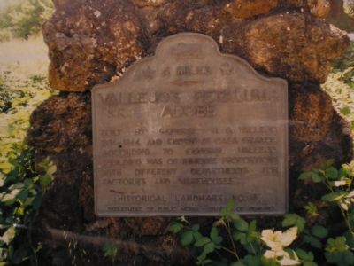
Vallejo’s Petaluma Adobe
← 6 Miles
Photographed by Mathew H. Kohnen, September 4, 2007
1. Vallejo’s Petaluma Adobe Marker
Built by General M.G. Vallejo, 1834–1844, and known as Casa Grande. According to General Vallejo, “building was of immense proportions with different departments for factories and warehouses.”
Erected by Department of Public Works - Division of Highways. (Marker Number 18.)
Topics and series. This historical marker is listed in these topic lists: Agriculture • Architecture • Settlements & Settlers • War, Mexican-American. In addition, it is included in the California Historical Landmarks series list. A significant historical year for this entry is 1844.
Location. This marker has been replaced by another marker nearby. It was located near 38° 18.016′ N, 122° 40.53′ W. Marker was near Penngrove, California, in Sonoma County. It was on Adobe Road near Old Redwood Highway. Plaque was located 6 miles west of site, 300 feet northwest of intersection of Old Redwood Highway & Adobe Road. Touch for map. Marker was at or near this postal address: 3325 Adboe Rd, Penngrove CA 94951, United States of America. Touch for directions.

Regionally, this marker was in California’s Wine Country, in the San Francisco
this page online
Other nearby markers. At least 8 other markers are within 5 miles of this location, measured as the crow flies: Penngrove (approx. 0.6 miles away); Cotati Downtown Plaza (approx. 2½ miles away); Veronda/Falletti Ranch (approx. 2½ miles away); The Willow Creek Inn (approx. 2.8 miles away); Washoe House (approx. 3.4 miles away); Wilmar Union Elementary School District And Wilson Elementary School (approx. 3.9 miles away); Sergeant Richard A. Penry (approx. 4.8 miles away); Bill Soberanes (approx. 4.8 miles away).
More about this marker. This marker was removed by State Parks in 2004 due to it containing incorrect directions and information. The new plaque, dedicated in 2006, is located at the start of the footpath from the parking lot to the adobe.
Related marker.
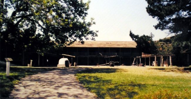
Photographed by Mathew H. Kohnen, September 5, 2007
2. General M.G. Vallejo's Adobe, known as Casa Grande
Additional keywords. adobes
Credits. This page was last revised on December 31, 2024. It was originally submitted on September 18, 2007, by Mathew H. Kohnen of San Jose, California. This page has been viewed 2,296 times since then and 32 times this year. Last updated on January 3, 2022, by James King of San Miguel, California. Photos: 1, 2. submitted on September 18, 2007, by Mathew H. Kohnen of San Jose, California. • J. Makali Bruton was the editor who published this page.
