Delaware City in New Castle County, Delaware — The American Northeast (Mid-Atlantic)
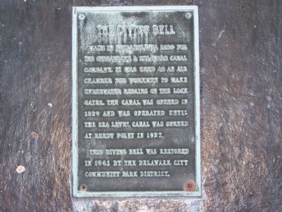
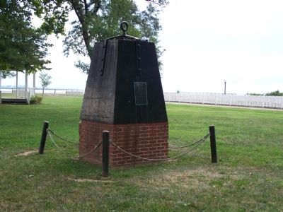
The Diving Bell
Made in Philadelphia 1839 for the Chesapeake and Delaware Canal Company, it was used as an air chamber for workmen to make underwater repairs on the lock gates. The canal was opened in 1829 and was operated until the sea level canal was opened at Reedy Point in 1927.
This diving bell was restored in 1961 by the Delaware City Community Park District.
Topics and series. This historical marker is listed in these topic lists: Industry & Commerce • Waterways & Vessels. In addition, it is included in the Chesapeake & Delaware (C&D) Canal series list. A significant historical year for this entry is 1839.
Location. 39° 34.731′ N, 75° 35.267′ W. Marker is in Delaware City, Delaware, in New Castle County. Marker is on Clinton Street, on the right when traveling north. Located in the center of the park near the end of Clinton St. Touch for map. Marker is in this post office area: Delaware City DE 19706, United States of America. Touch for directions.
Other nearby markers. At least 8 other markers are within walking distance of this marker. The Lock at Delaware City (within shouting distance of this marker); Historic Delaware City (within shouting distance of this marker); Building the C&D Canal (within shouting distance of this marker); Fishing, Hunting & Trapping (within shouting distance of this marker); Small But Mighty (within shouting distance of this marker); Sailing on the C&D Canal (about 300 feet away, measured in a direct line); Waterfront at Delaware City (about 300 feet away); Coastal Defense Forts (about 400 feet away). Touch for a list and map of all markers in Delaware City.
Credits. This page was last revised on January 7, 2022. It was originally submitted on August 13, 2008, by Bill Pfingsten of Bel Air, Maryland. This page has been viewed 1,715 times since then and 34 times this year. Last updated on January 4, 2022, by Carl Gordon Moore Jr. of North East, Maryland. Photos: 1, 2. submitted on August 13, 2008, by Bill Pfingsten of Bel Air, Maryland. • Mark Hilton was the editor who published this page.

