Red Lion Hundred in Delaware City in New Castle County, Delaware — The American Northeast (Mid-Atlantic)
Historic Delaware City
Photographed by Don Morfe, September 28, 2019
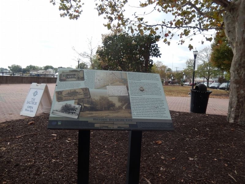
1. Historic Delaware City Marker
Delaware City’s story begins in 1801 when the Newbold brothers, Barzilla, Clayton, and John, of New Jersey, acquired 1600 acres of land on the Delaware River, John Newbold built a wharf that became a center for trading and shipping grain, giving the site the name of Newbold’s Landing.
In 1824, the news (left) that a canal connecting the Delaware River and Chesapeake Bay would have its eastern terminus just south of Newbold’s Landing prompted John Newbold’s sons., Daniel and William, to lay out a new town they named Delaware City. In 1826 they sold the first lots and by 1827 the town had ten houses and a population sufficient to justify a July 4th celebration that included a festive outdoor dinner at a table that filled Delaware Street between Clinton and Washington’ streets.
Delaware City was both a base for canal operations---conducting vessels through the locks and collecting tolls---and a way station for travelers needing hotels, stables, food and other services. The economic boom associated with shipping goods across the peninsula on the canal waned with competition from railroads. After 1927, when the Delaware
this page online
[Captions:]
The urban grid and the width of Washington, Clinton, and Adams streets demonstrated the Newbold brothers' expectation that Delaware City would soon rival Philadelphia. Clinton Street, with its trolley tracks shown below about 1909, honors DeWitt Clinton, governor of New York and chief proponent of New York's Erie Canal, completed in 1825.
In 1887, a fire destroyed a number of buildings along Clinton Street prompting local citizens to form the "Volunteer Fire Company," renamed two years later, the "Delaware City Hose Company." The company's original equipment was hand-operated and hauled to fires by the volunteers on foot.
Erected by City of Delaware City, Delaware; Delaware Land & Water Conservation Trust Fund.
Topics. This historical marker is listed in these topic lists: Industry & Commerce • Settlements & Settlers
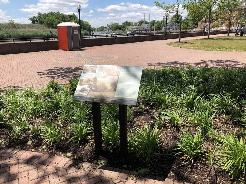
Location. 39° 34.715′ N, 75° 35.278′ W. Marker is in Delaware City, Delaware, in New Castle County. It is in Red Lion Hundred. It is on Clinton Street. The marker is located in Battery Park. Touch for map. Marker is in this post office area: Delaware City DE 19706, United States of America. Touch for directions.

Regionally, this marker is in Greater Wilmington and in Greater Philadelphia. It is also in the American Mid-Atlantic, on the Delmarva Peninsula, and on the Eastern Seaboard. Globally, it is in the North Atlantic Region, North America, the Western Hemisphere, the Western World, and the Anglosphere. Historically, it finds itself in what was once New Netherland and also one of the original Thirteen Colonies.
Other nearby markers. At least 8 other markers are within walking distance of this marker: Building the C&D Canal (a few steps from this marker); The Diving Bell (within shouting distance of this marker); The Lock at Delaware City (within shouting distance of this marker); Fishing, Hunting & Trapping (within shouting distance of this marker); Fort Delaware (about 300 feet away, measured in a direct line); Small But Mighty (about 400 feet away); Sailing on the C&D Canal (about 400 feet away); Waterfront at Delaware City (about 400 feet away). Touch for a list and map of all markers in Delaware City.
Credits. This page was last revised on May 28, 2026. It was originally submitted on October 2, 2019, by Don Morfe of Baltimore, Maryland. This page has been viewed 619 times since then and 63 times this year. Last updated on January 4, 2022, by Carl Gordon Moore Jr. of North East, Maryland. Photos: 1. submitted on October 2, 2019, by Don Morfe of Baltimore, Maryland. 2. submitted on June 2, 2021, by Devry Becker Jones of Washington, District of Columbia. • Mark Hilton was the editor who published this page.
