Jonesboro in Clayton County, Georgia — The American South (South Atlantic)
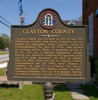
Clayton County
Erected 1956 by Georgia Historical Commission. (Marker Number 031-7.)
Topics and series. This historical marker is listed in these topic lists: Communications • Industry & Commerce. In addition, it is included in the Georgia Historical Society series list. A significant historical date for this entry is June 21, 1917.
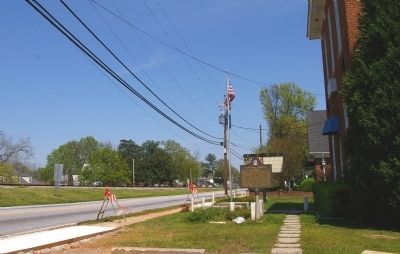
Location. 33° 31.358′ N, 84° 21.241′ W. Marker is in Jonesboro, Georgia, in Clayton County. Marker is at the intersection of North McDonough Street and King Street, on the right when traveling north on North McDonough Street. Touch for map. Marker is in this post office area: Jonesboro GA 30236, United States of America. Touch for directions.
Other nearby markers. At least 8 other markers are within walking distance of this marker. Heritage Place (about 400 feet away, measured in a direct line); Battle of Jonesborough (about 400 feet away); Lee's Corps Withdrawn (about 500 feet away); The Johnson-Blalock House (about 500 feet away); Diverted Attack (approx. 0.4 miles away); Patrick Cleburne Confederate Cemetery (approx. half a mile away); Two Days of Battle at Jonesboro (approx. half a mile away); Stately Oaks (approx. half a mile away). Touch for a list and map of all markers in Jonesboro.
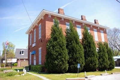
More about this marker. The marker is located in front of the old Clayton County Courthouse. The original wooden courthouse on this site was built in 1861 and burned in 1864, during Sherman's March to the Sea. This building was built in 1869 as a replacement. It served as the Courthouse until 1898, when a new Courthouse was built. It then became a Masonic Hall, which it remains today.
Credits. This page was last revised on January 26, 2020. It was originally submitted on May 13, 2009, by David Seibert of Sandy Springs, Georgia. This page has been viewed 1,711 times since then and 18 times this year. Photos: 1, 2, 3. submitted on May 13, 2009, by David Seibert of Sandy Springs, Georgia. • Craig Swain was the editor who published this page.


