Near Sheridan in Sheridan County, Wyoming — The American West (Mountains)
Mines Shape a Community

Photographed By Barry Swackhamer, July 20, 2021
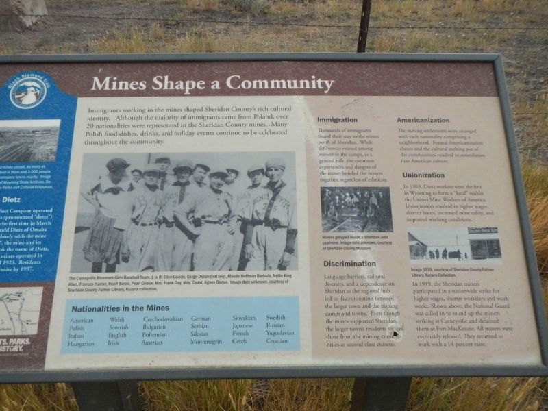
1. Mines Shape a Community Marker
Captions: (center) The Carneyville Bloomers Girls Baseball Team, L to R: Ellen Goode, Gorge Dozah (bat boy), Maude Hoffman Barbula, Nellie King Allen, Pearl Giroux, Mrs. Frank Day, Mrs. Coast, Agnes Giroux. Image date unknown.; (middle right) Miners grouped inside a Sheridan-area calming. Image date unknown.; Image 1919.
American Welsh Czechoslovakian German Slovakian Swedish Polish Scottish Bulgarian Serbian Japanese Russian Italian English Bohemian Silesian French Yugoslavian Hungarian Irish Austrian Montenegrin Greek Croatian
Immigration
Thousands of immigrants found their way to the mines north of Sheridan. While differences existed among miners in the camps, as a general rule, the common experiences and dangers of the mines bonded the miners together, regardless of ethnicity.
Discrimination
Language barriers, cultural diversity, and a dependence on Sheridan as the regional hub led to discrimination between the larger town and mining camps and towns. Even though the mines supported Sheridan, the larger town's residents viewed those from the mining communities as second class citizens.
Americanization
The mining settlements were arranged with each nationally comprising a neighborhood. Formal Americanization classes and the cultural melting pot of the communities resulted in assimilation into American culture.
Unionization
In 1903, Dietz workers were the first in Wyoming to form a "local" within the United Mine Works of America. Unionization resulted in higher wages, shorter hours, increased mine safety, and improved working conditions.
In 1919, the Sheridan mines participated in a nationwide strike for higher wages, shorter workdays and work weeks. Shown above, the National Guard was called in to round up the miners striking at Carneyville and detained them at Fort MacKenzie. All miners were eventually released. They returned to work with a 14 percent raise.
(Note: The lefthand side-bar is missing. The contributor failed to photograph it.)
Erected by Sheridan Community Land Trust and Wyoming State Parks & Cultural Resources.
Topics. This historical marker is listed in these topic lists: Industry & Commerce • Labor Unions.
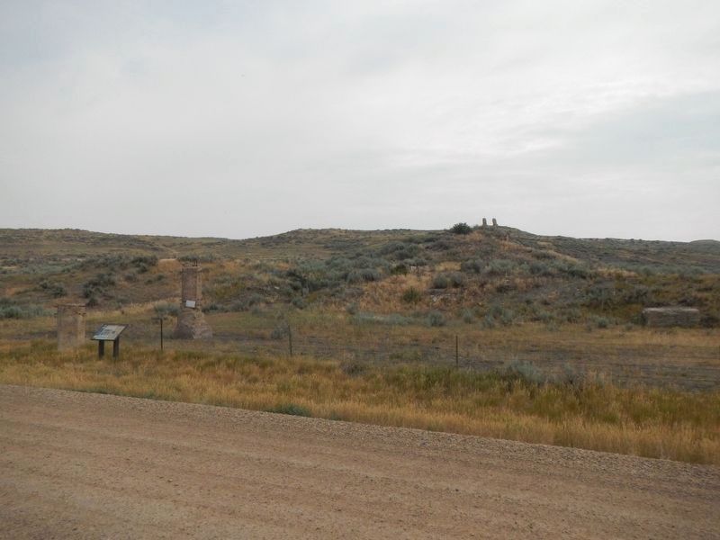
Location. 44° 52.341′ N, 106° 58.499′ W. Marker is near Sheridan, Wyoming, in Sheridan County. Marker is on County Road 1231 near State Highway 338, on the right. The marker is at the end of the county road. Touch for map. Marker is in this post office area: Sheridan WY 82801, United States of America. Touch for directions.
Other nearby markers. At least 8 other markers are within 5 miles of this marker, measured as the crow flies. Mine Communities Supply Miner's Needs (approx. 2.7 miles away); The Aftermath of Mining (approx. 2.9 miles away); Mining Modernizes (approx. 2.9 miles away); Working in the Mines (approx. 3.8 miles away); The Pipe of Peace (approx. 4.7 miles away); Historic Sheridan Inn (approx. 4.7 miles away); Class 0-5-A Mohawk Locomotive (approx. 4.7 miles away); The Black Diamond Trail (approx. 4.9 miles away). Touch for a list and map of all markers in Sheridan.
More about this marker. This maker is a part of the Black Diamond Trail of Sheridan County.
Credits. This page was last revised on January 7, 2022. It was originally submitted on January 7, 2022, by Barry Swackhamer of Brentwood, California. This page has been viewed 99 times since then and 10 times this year. Photos: 1, 2, 3. submitted on January 7, 2022, by Barry Swackhamer of Brentwood, California.

