Marble Canyon in Coconino County, Arizona — The American Mountains (Southwest)
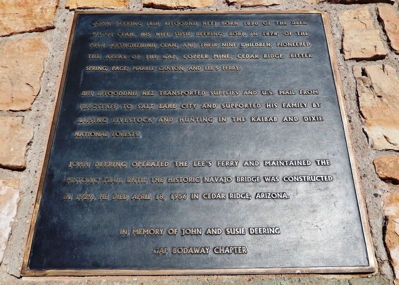
John Deering
(Bih Bitoodnii Nez)
Bih Bitoodnii Nez transported supplies and U.S. Mail from Flagstaff to Salt Lake City and supported his family by raising livestock and hunting in the Kaibab and Dixie National Forests.
John Deering operated the Lee’s Ferry and maintained the historic trail until the historic Navajo Bridge was constructed in 1929. He died April 18, 1956 in Cedar Ridge, Arizona.
Gap Bodaway Chapter
Erected by Gap Bodaway Chapter, Navajo Nation.
Topics. This historical marker is listed in these topic lists: Bridges & Viaducts • Native Americans • Settlements & Settlers • Waterways & Vessels. A significant historical year for this entry is 1870.
Location. 36° 49.016′ N, 111° 37.815′ W. Marker is in Marble Canyon, Arizona, in Coconino County. Marker can be reached from U.S. 89A at milepost 537, on the right when traveling west. Marker is located in the Historic Navajo Bridge interpretive overlook on the east side of the Colorado River. Touch for map. Marker is in this post office area: Marble Canyon AZ 86036, United States of America. Touch for directions.
Other nearby markers. At least 8 other markers are within walking distance of this marker. Lewis Nez (here, next to this marker); Navajo Bridge Erection Toggle Screw / Navajo Bridge (a few steps from this marker); Navajo Bridge (within shouting distance of this marker); a different marker also named Navajo Bridge (approx. 0.2 miles away); Lafe McDaniel (approx. 0.2 miles away); Lee's Ferry (approx. 0.2 miles away); Marble Canyon Lodge (approx. 0.2 miles away); Lee Ferry (approx. 0.4 miles away). Touch for a list and map of all markers in Marble Canyon.
Credits. This page was last revised on January 7, 2022. It was originally submitted on January 7, 2022, by Cosmos Mariner of Cape Canaveral, Florida. This page has been viewed 177 times since then and 22 times this year. Photos: 1, 2. submitted on January 7, 2022, by Cosmos Mariner of Cape Canaveral, Florida.

