Angeles National Forest in Los Angeles County, California — The American West (Pacific Coastal)
Mount Baden-Powell
1857-1941

Photographed by Adam Margolis, June 10, 2012
1. Mount Baden-Powell Marker
This monument is dedicated to the memory of Lord Baden-Powell of Gilwell, O.M.
Founder of Boy Scouting
In the year of his 100th anniversary
50th anniversary of world Scouting
47th anniversary of Scouting in America
September 1957
Erected by The Scouts and Scouters of the Los Angeles Area Council
San Gabriel Valley Council
Verdugo Hills Council
Old Baldy Council
Orange Empire Area Council
San Fernando Valley Council
Crescent Bay Area Council
Northern Orange County Council
Long Beach Area Council
Boy Scouts of America
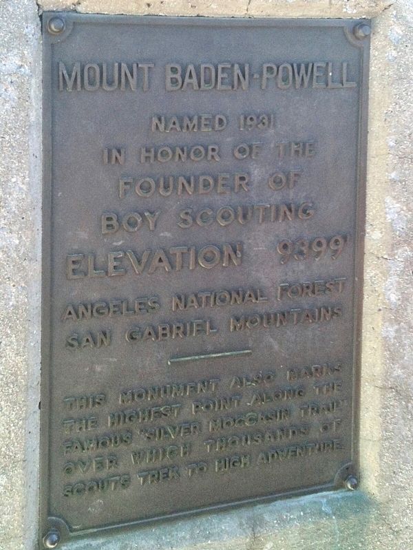
Mount Baden-Powell named 1931 in honor of the founder of Boy Scouting.
Elevation 9399’
Angeles National Forest San Gabriel Mountains
This monument also marks the highest point along the famous "Silver Moccasin Trail" over which thousands of scouts trek to high adventure.
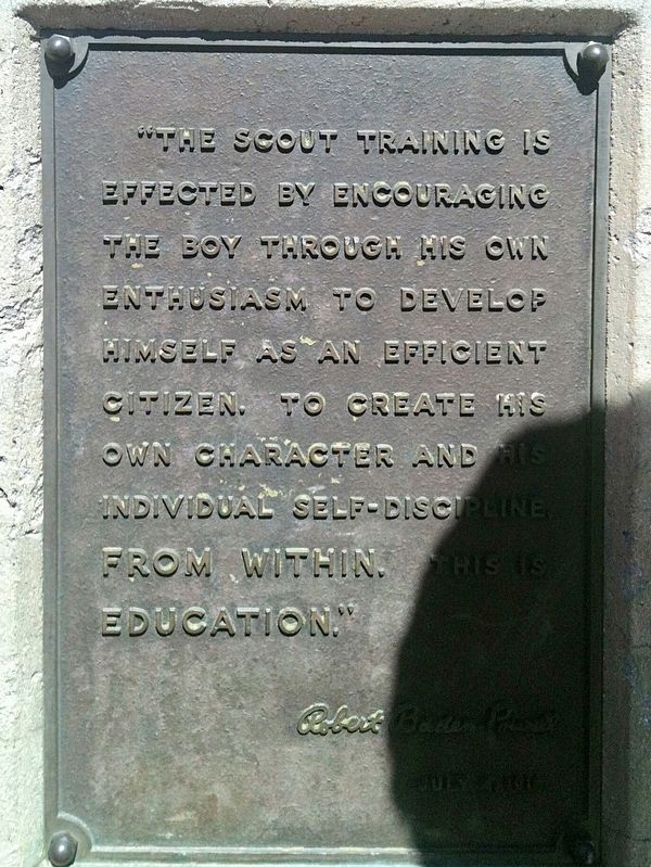
The scout training is effected by encouraging the boy through his open enthusiasm to develop himself as an efficient citizen, to create his own character and his individual self-discipline, from within. This is education.
Erected 1957.
Topics. This historical marker is listed in these topic lists: Fraternal or Sororal Organizations • Parks & Recreational Areas. A significant historical month for this entry is September 1957.
Location. 34° 21.512′ N, 117° 45.881′ W. Marker is in Angeles National Forest, California, in Los Angeles County. It can be reached from the intersection of Angeles Crest Highway (California Route 2) and Vincent Gap. It’s a strenuous 4-mile hike from Vincent Gap with an elevation gain of 2,800 feet. Touch for map. Marker is in this post office area: Wrightwood CA 92397, United States of America. Touch for directions.

Regionally, this marker is in Greater Los Angeles, in the San Bernardino Mountains, and in the Transverse Ranges. It is also on the American Pacific Coast. Globally, it is in North America, on the Ring
this page online
Other nearby markers. At least 8 other markers are within 18 miles of this marker, measured as the crow flies: Crystal Lake (approx. 4.7 miles away); The Devil's Punchbowl (approx. 6.6 miles away); Lest We Forget (approx. 7½ miles away); Phelan Memorial Library (approx. 11.9 miles away); San Gabriel Dam (approx. 12.2 miles away); Cogswell Dam (approx. 13.9 miles away); Demens-Tolstoy House (approx. 17.2 miles away); Schowalter Rock Pile (approx. 17½ miles away). Touch for a list and map of all markers in Angeles National Forest.
Another marker is no longer nearby. Pomona Water Power Plant (was approx. 11.3 miles away but has been confirmed missing).
Photographed by Adam Margolis, June 10, 2012
2. Mount Baden-Powell Marker
Photographed by Adam Margolis, June 10, 2012
3. Mount Baden-Powell Marker

Photographed by Adam Margolis, June 10, 2012
4. Mount Baden-Powell Marker
Credits. This page was last revised on January 17, 2026. It was originally submitted on January 8, 2022, by Adam Margolis of Mission Viejo, California. This page has been viewed 557 times since then and 62 times this year. Photos: 1, 2, 3, 4. submitted on January 8, 2022, by Adam Margolis of Mission Viejo, California. • J. Makali Bruton was the editor who published this page.
