Near Ravenswood in Jackson County, West Virginia — The American South (Appalachia)
Coleman Chapel
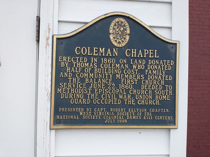
Photographed by Craig Doda, December 25, 2021
1. Coleman Chapel Marker
Erected 1998 by Capt. Robert Ellyson Chapter, West Virginia Society of the National Society Colonial Dames XVII Century.
Topics and series. This historical marker is listed in these topic lists: Religion & Religious Structures • War, US Civil. In addition, it is included in the The Colonial Dames of America, National Society of series list. A significant historical date for this entry is June 22, 1860.
Location. 39° 2.528′ N, 81° 46.812′ W. Marker is near Ravenswood, West Virginia, in Jackson County. It is on Ravenswood Road (Route 68) 0.2 miles south of County Road 4/8, on the right when traveling north. Touch for map. Marker is at or near this postal address: 7362 Ravenswood Rd, Ravenswood WV 26164, United States of America. Touch for directions.

Regionally, this marker is in West Virginia’s Mid-Ohio Valley. It is also in the American South, specifically
this page online
Other nearby markers. At least 8 other markers are within 3 miles of this marker, measured as the crow flies: North End Valley (approx. 1.4 miles away in Ohio); Portland (approx. 2 miles away in Ohio); George Washington (approx. 2.4 miles away in Ohio); Battle of Buffington Island (approx. 2.8 miles away in Ohio); Escape from the Ohio Penitentiary (approx. 2.8 miles away in Ohio); Capture in Columbiana County (approx. 2.8 miles away in Ohio); Path of Destruction and Damage (approx. 2.8 miles away in Ohio); Attack from the West (approx. 2.8 miles away in Ohio).
Another marker is no longer nearby. In Grateful Remembrance (was approx. 2.8 miles away in Ohio but has been permanently removed).

Photographed by Craig Doda, December 25, 2021
2. Coleman Chapel
Credits. This page was last revised on January 18, 2022. It was originally submitted on January 8, 2022, by Craig Doda of Napoleon, Ohio. This page has been viewed 932 times since then and 80 times this year. Photos: 1, 2. submitted on January 8, 2022, by Craig Doda of Napoleon, Ohio. • Devry Becker Jones was the editor who published this page.
