Near Decker in Big Horn County, Montana — The American West (Mountains)
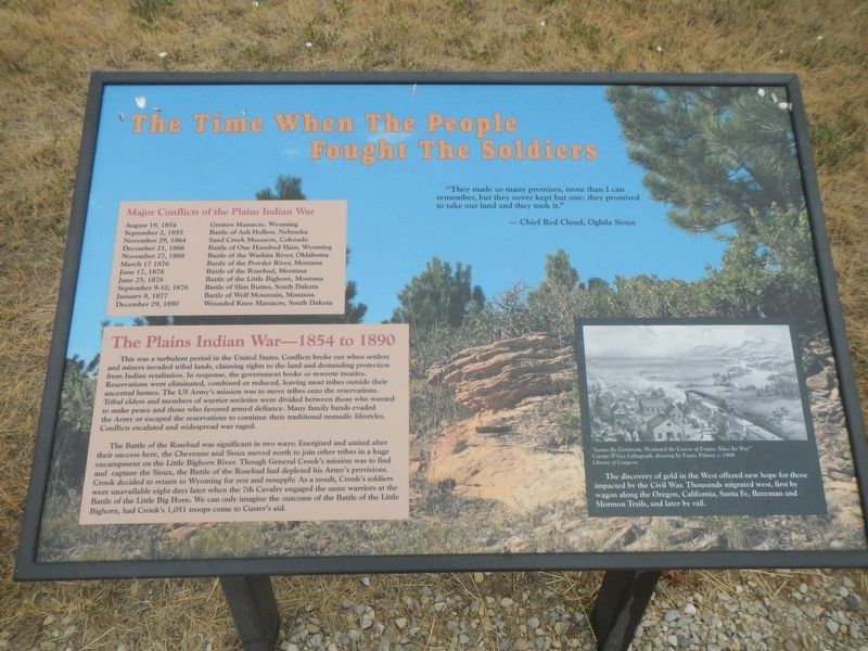
The Time When The People Fought The Soldiers.
Inscription.
"They made us many promises, more than I can remember, but they never kept but one: they promised to take our land and they took it." - Chief Red Cloud, Oglala Sioux
Major Conflicts of the Plains Indian War
August 19, 1854 Gratten Massacre, Wyoming
September 2, 1855 Battle of Ash Hollow, Nebraska
November 29, 1864 Sand Creek Massacre, Colorado
December 21, 1866 Battle of One Hundred Slain, Wyoming
November 27, 1868 Battle of Washita River, Oklahoma
March 17, 1876 Battle of the Powder River, Montana
June 17, 1876 Battle of the Rosebud, Montana
June 25, 1876 Battle of the Little Bighorn, Montana
September, 9-10,1876Battle of Slim Buttes, South Dakota
January 8, 1877 Battle of Wolf Mountain, Montana
December 19, 1890 Wounded Knee Massacre, South Dakota
The Plains Indian War - 1854 to 1890
This was a turbulent period in the United States. Conflicts broke out when settlers and miners invaded tribal lands, claiming rights to the land and demanding protection from Indian retaliation. In response, the government broke or rewrote treaties. Reservations were eliminated, combined or reduced, leaving most tribes outdid their ancestral homes. The US Army's mission was to move tribes onto the reservations. Tribal elders and members of warrior societies were divided between those who wanted to make peace and those who favored armed defiance. Many family bands evaded the Army or escaped the reservations to continue their traditional nomadic lifestyles. Conflicts escalated and widespread war raged.
The Battle of the Rosebud was significant in two ways: Energized and untied after their success here, the Cheyenne and Sioux moved to join other tribes in a huge encampment on the Little Bighorn River. Though General Crook's mission was to find and capture the Sioux, the Battle of the Rosebud had depleted his Army's provisions. Crook decided to return to Wyoming for rest and resupply. As a result, Crook's soldiers were unavailable eight days later when the 7th Cavalry engaged the same warriors at the Battle of the Little Big Horn (sic). We can only imagine the outcome of the Battle of the Little Bighorn, had Crook's 1,051 troops come to Custer's aid.
(side-bar at lower left)
The discovery of gold in the West offered new hop for those impacted by the Civil War. Thousands migrated west, first by wagon along the Oregon, California, Santa Fe, Bozeman and Mormon Trails, and later by rail.
Erected by Montana State Parks.
Topics. This historical marker is listed in this topic list: Wars, US Indian. A significant historical date for this entry is June 17, 1876.
Location.
45° 13.138′ N, 106° 58.428′ W. Marker is near Decker, Montana, in Big Horn County. Marker can be reached from Rosebud Road near State Highway 314, on the right when traveling west. Touch for map. Marker is in this post office area: Decker MT 59025, United States of America. Touch for directions.
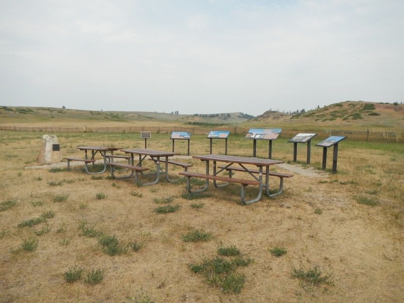
Other nearby markers. At least 5 other markers are within 2 miles of this marker, measured as the crow flies. General Crook's Troops (here, next to this marker); The Way They Saw It (here, next to this marker); The Land Speaks (a few steps from this marker); What Is This Land Worth? (a few steps from this marker); Rosebud Battlefield (approx. 1.2 miles away).
Credits. This page was last revised on January 8, 2022. It was originally submitted on January 8, 2022, by Barry Swackhamer of Brentwood, California. This page has been viewed 142 times since then and 25 times this year. Photos: 1, 2. submitted on January 8, 2022, by Barry Swackhamer of Brentwood, California.

