Kenosha in Kenosha County, Wisconsin — The American Midwest (Great Lakes)
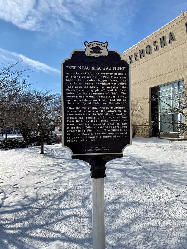
Kee-neau-sha-Kau-ning
After the War of 1812, the US Government increased pressure on the Potawatomi to cede their lands. In 1833, the Potawatomi signed the Treaty of Chicago, ceding their land. By 1838, many Potawatomi were forcibly removed west of the Mississippi. Others resisted removal and remained in Wisconsin. The villages at Kenosha, Racine, and Waukegan moved to Canada. Kenosha is named after the Potawatomi village.
Erected 2020 by Kenosha Public Museum. (Marker Number 588.)
Topics and series. This historical marker is listed in these topic lists: Exploration • Native Americans • War of 1812. In addition, it is included in the Wisconsin Historical Society series list.
Location. 42° 35.169′ N, 87° 48.764′ W. Marker is in Kenosha, Wisconsin, in Kenosha County. Marker is on 1st Avenue. Touch for map. Marker is at or near this postal address: 5500 1st Ave, Kenosha WI 53140, United States of America. Touch for directions.
Other nearby markers. At least 8 other markers are within walking distance of this marker. Early Vessels (within shouting distance of this marker); Kenosha (Southport) Lighthouse (approx. 0.3 miles away); Naval Memorial (approx. 0.3 miles away); The United States Marine Corps (approx. 0.3 miles away); Southport-Kenosha (approx. 0.3 miles away); Simmon's Island Beach House (approx. 0.3 miles away); Simmons Island Park (approx. 0.3 miles away); Remember Pearl Harbor (approx. 0.3 miles away). Touch for a list and map of all markers in Kenosha.
Credits. This page was last revised on January 9, 2022. It was originally submitted on January 25, 2021, by Fitzie Heimdahl of Eau Claire, Wisconsin. This page has been viewed 847 times since then and 26 times this year. Last updated on January 9, 2022, by Devon Polzar of Port Washington, Wisconsin. Photos: 1. submitted on January 25, 2021, by Fitzie Heimdahl of Eau Claire, Wisconsin. 2. submitted on January 9, 2022, by Devon Polzar of Port Washington, Wisconsin. • J. Makali Bruton was the editor who published this page.

