Near Bolivar in Jefferson County, West Virginia — The American South (Appalachia)
Confederate Victory
Photographed by Craig Swain, September 22, 2007
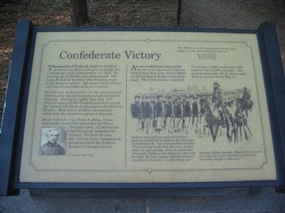
1. Confederate Victory Marker
Sgt. Charles E. Smith
32nd Ohio Infantry
September 14, 1862
Thousands of Federal soldiers huddled in ravines on Bolivar Heights to escape the Confederate shells of September 14, 1862. By evening, the Federals were demoralized. Pvt. Louis B. Hull of the 60th Ohio Infantry wrote in his diary at sunset: "All seem to think that we will have to surrender or be cut to pieces."
By 8:00 a.m. on September 15, the situation had worsened for the surrounded and outnumbered Federals. During the night, Maj. Gen. A.P. Hill's division of 3,000 Confederates had turned the Federal left flank on the south end of Bolivar Heights. With Union artillery ammunition exhausted, the situation appeared hopeless.
About 9:00 a.m., Col. Dixon S. Miles, Union commander, decided to surrender his forces. Moments later, a Confederate shell fragment wounded the Colonel. He died the next day, leaving many unanswered questions about the Federal disaster at Harpers Ferry.
An unconditional surrender accepted by Stonewall Jackson from Union Brig. Gen. Julius White on School House Ridge
this page online
Jackson reviewed the captured Federal garrison on Bolivar Heights on the afternoon of September 15. On Union soldier recalled: "There we were on the hill, our arms stacked before us, and waiting. Soon the celebrated 'Stonewall' Jackson rode along our lines with his staff. He rode a cream colored horse and was plainly dressed in ... a grey dingy suit."Another soldier shouted, "Boys, he's not much for looks, but if we'd had him we wouldn't have been caught in this trap!"
Topics. This historical marker is listed in this topic list: War, US Civil. A significant historical month for this entry is September 1862.
Location. 39° 19′ N, 77° 45.425′ W. Marker is near Bolivar, West Virginia, in Jefferson County. It is on Shenandoah Street, on the right when traveling north. Located near the Visitor Center in Harpers Ferry National Historic Site. Touch for map. Marker is in this post office area: Harpers Ferry WV 25425, United States of America. Touch for directions.

Regionally, this
Photographed by Craig Swain, September 22, 2007
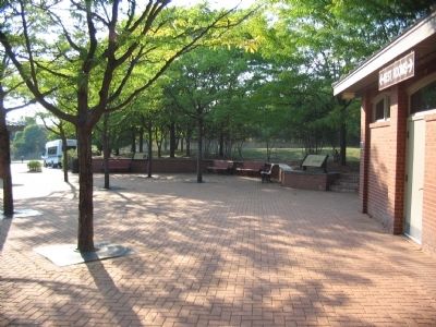
2. Two Markers near the Bus Stop
Other nearby markers. At least 8 other markers are within walking distance of this marker: The Trap Closes (a few steps from this marker); Discover Harpers Ferry (a few steps from this marker); A Union Predicament (a few steps from this marker); Harpers Ferry National Historical Park (within shouting distance of this marker); History in the Mountains (within shouting distance of this marker); On the Border (approx. ¼ mile away); Home Becomes Battlefield (approx. 0.4 miles away); From Civil War to Civil Rights / Battle of Harpers Ferry (approx. 0.4 miles away). Touch for a list and map of all markers in Bolivar.
Another marker is no longer nearby. Jackson at Harpers Ferry (was approx. ¼ mile away but has been replaced with another marker now near it).
More about this marker. On the lower left is a portrait of Col. Miles. In the center is a depiction of Jackson reviewing the surrendered Federals.
A duplicate to this marker stands on the Bolivar Heights walking trail.
Credits. This page was last revised on July 6, 2020. It was originally submitted on May 15, 2009, by Craig Swain of Leesburg, Virginia. This page has been viewed 1,087 times since then and 25 times this year. Photos: 1, 2. submitted on May 15, 2009, by Craig Swain of Leesburg, Virginia.
