Marblehead in Ottawa County, Ohio — The American Midwest (Great Lakes)
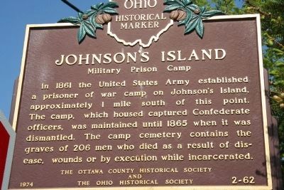
Johnson's Island
Military Prison Camp
Erected 1974 by The Ottawa County Historical Society and the Ohio Historical Society. (Marker Number 2-62.)
Topics and series. This historical marker is listed in this topic list: War, US Civil. In addition, it is included in the National Historic Landmarks, and the Ohio Historical Society / The Ohio History Connection series lists. A significant historical year for this entry is 1861.
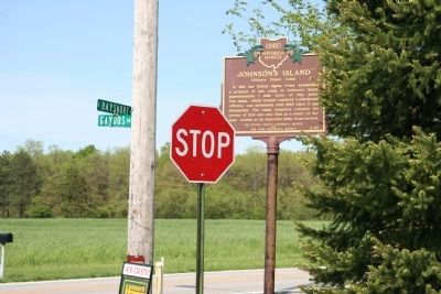
Location. 41° 30.869′ N, 82° 44.014′ W. Marker is in Marblehead, Ohio, in Ottawa County. Marker is at the intersection of East Bay Shore Road and Gaydos Drive, on the right when traveling east on East Bay Shore Road. This historical marker is located at the intersection of east Bay Shore Road and Gaydos Drive (Johnson Island Causeway) and is easily viewed from East Bay Shore Road, as traveling to or from Marblehead, Ohio. Touch for map. Marker is in this post office area: Lakeside Marblehead OH 43440, United States of America. Touch for directions.
Other nearby markers. At least 8 other markers are within walking distance of this marker. The Keeper’s House (approx. 0.4 miles away); Home of Benajah Walcott (approx. 0.4 miles away); a different marker also named The Keeper's House (approx. 0.4 miles away); First Battle Site (approx. half a mile away); In Memory of Mason, Simonds & Mingus (approx. half a mile away); Johnson's Island Prison (approx. one mile away); Johnson's Island Civil War Prison and Fort Site (approx. one mile away); Confederate Stockade Cemetery (approx. one mile away). Touch for a list and map of all markers in Marblehead.
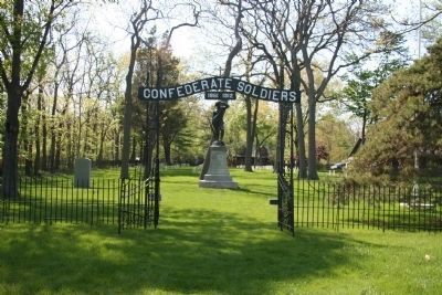
More about this marker. This marker is not located at the actual site of the military prison camp. It is located on the mainland and the actual military prison camp is on Johnson Island, approximately 1 mile to the south. To get to the actual site of the prison one must travel south on Gaydos Drive (Johnson Island Causeway) and pay a two (2) dollar fee to cross over the Johnson Island Causeway. The only part of the prison that is open to the public is the Confederate Cemetery.
Related marker. Click here for another marker that is related to this marker.
Also see . . .
1. Johnson's Island Preservation Society Site. Provides details of the site and state of preservation. (Submitted on May 18, 2009, by Craig Swain of Leesburg, Virginia.)
2. Johnson's Island Archaeology. Site discussing the archeological research done on the island. (Submitted on May 18, 2009, by Craig Swain of Leesburg, Virginia.)
3. Johnson's Island. Civil War Confederate Prisoner of War (Submitted on May 20, 2009, by Dale K. Benington of Toledo, Ohio.)
4. Students digging up past. Article from the Toledo Blade. (Submitted on May 20, 2009, by Dale K. Benington of Toledo, Ohio.)
Credits. This page was last revised on June 16, 2016. It was originally submitted on May 15, 2009, by Dale K. Benington of Toledo, Ohio. This page has been viewed 1,646 times since then and 25 times this year. Photos: 1. submitted on May 15, 2009, by Dale K. Benington of Toledo, Ohio. 2. submitted on May 16, 2009, by Dale K. Benington of Toledo, Ohio. 3. submitted on May 15, 2009, by Dale K. Benington of Toledo, Ohio. • Craig Swain was the editor who published this page.


