Millican in Brazos County, Texas — The American South (West South Central)
Millican, C.S.A.
Photographed by Brian Anderson, July 1, 2018
1. Millican, C.S.A. Marker
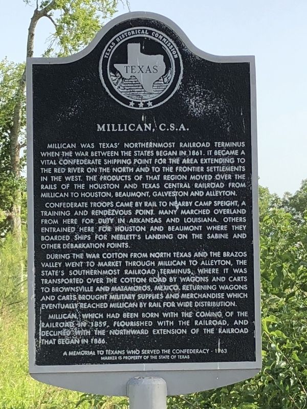
Millican was Texas' northernmost railroad terminus when the war between the states began in 1861. It became a vital Confederate shipping point for the area extending to the Red River on the north and to the frontier settlements in the west. The products of that region moved over the rails of the Houston and Texas Central Railroad from Millican to Houston, Beaumont, Galveston and Alleyton.
Confederate troops came by rail to nearby Camp Speight, a training and rendezvous point. Many marched overland from here for duty in Arkansas and Louisiana. Others entrained here for Houston and Beaumont where they boarded ships for Neblett's Landing on the Sabine and other debarkation points.
During the war cotton from North Texas and the Brazos Valley went to market through Millican to Alleyton, the state's southernmost railroad terminus, where it was transported over the cotton road by wagons and carts to Brownsville and Matamoros, Mexico. Returning wagons and carts brought military supplies and merchandise which eventually reached Millican by rail for wide distribution.
Millican, which had been born with the coming of the railroad
this page online
A memorial to Texans who served the Confederacy - 1963
Erected 1963 by State Historical Survey Committee. (Marker Number 8688.)
Topics. This historical marker is listed in these topic lists: Railroads & Streetcars • War, US Civil. A significant historical year for this entry is 1861.
Location. 30° 28.058′ N, 96° 12.291′ W. Marker is in Millican, Texas, in Brazos County. It is at the intersection of Wellborn Road (Farm to Market Road 2154) and Farm to Market Road 159, on the right when traveling east on Wellborn Road. Touch for map. Marker is in this post office area: Millican TX 77866, United States of America. Touch for directions.

Regionally, this marker is in the Prairies & Lakes Region. It is also in the American South. Globally, it is in North America, a Gulf of Mexico state, the Western Hemisphere, the Western World, and the Anglosphere. Historically, it finds itself in what was once New Spain, the Republic of Texas, one of the Confederate States of America, and the Antebellum South.
Other nearby markers. At
May 26, 2008
2. Former 1963 Marker
Also see . . .
1. Millican, TX - The Handbook of Texas Online. Texas State Historical Association (TSHA) (Submitted on July 2, 2018, by Brian Anderson of New Albany, Ohio.)
2. Houston and Texas Central Railway - The Handbook of Texas Online. Texas State Historical Association (TSHA) (Submitted on July 3, 2018, by Brian Anderson of New Albany, Ohio.)
Credits. This page was last revised on January 21, 2022. It was originally submitted on July 2, 2018, by Brian Anderson of New Albany, Ohio. This page has been viewed 2,985 times since then and 286 times this year. Last updated on January 12, 2022, by Josh Conrad of Austin, Texas. Photos: 1. submitted on July 2, 2018, by Brian Anderson of New Albany, Ohio. 2. submitted on January 12, 2022, by Josh Conrad of Austin, Texas. • J. Makali Bruton was the editor who published this page.
