Near Mobridge in Corson County, South Dakota — The American Midwest (Upper Plains)
Sakakawea
Photographed by Ruth VanSteenwyk, September 18, 2015
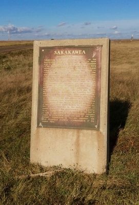
1. Sakakawea Marker
Sakakawea won her place in history as the indomitable guide of Lewis and Clark on their trip to the Pacific in 1805. She was a member of the Shoshoni tribe dwelling near the Big Horn mountains in Montana. In one of the frequent tribal conflicts she was captured and taken to North Dakota as a war captive. Here she was purchased by a fur trader named Tousant Charbonneau, who according to custom made her his wife. Lewis and Clark, in search of an interpreter for their trip west, tried to hire Charbonneau, but he would not go unless his wife was permitted to accompany him. The explorers reluctantly gave their permission. This was a fortunate decision for Lewis and Clark. By her courage, endurance and unerring instinct she guided the expedition over seemingly insuperable obstacles. The leaders frequently gave her credit for the success of the venture. After returning east, Charbonneau and Sakakawea settled down at Fort Manuel, about 30 miles north of here near Kend, South Dakota. On December 20, 1812 it was recorded in the daily journal of events at the fort that Sakakawea died of a putrid fever. There is no further record of her but it is safe to assume that this remarkable woman's grave is somewhere near the site of old Fort Manuel. Sakakawea is beyond question the most illustrious feminine representative of the Indian race.
(Marker Number 622.)
Topics and series. This historical marker is listed in these topic lists: Exploration • Indigenous Peoples and Communities • Women. In addition, it is included in the South Dakota State Historical Society Markers series list. A significant historical date for this entry is December 20, 1812.
Location. 45° 30.957′ N, 100° 29.276′ W. Marker is near Mobridge, South Dakota, in Corson County. It can be reached from State Highway 1806 4 miles south of U.S. 12. The Hwy 1806 is pavement
this page online

Regionally, this marker is on the Cheyenne River Reservation and in West River. It is also in the American Lewis & Clark Corridor, on the prairies, and on the Northern Plains. Globally, it is in North America, the Western Hemisphere, the Western World, and the Anglosphere. Historically, it finds itself in what was once Rupert’s Land and also the Louisiana Purchase.
Other nearby markers. At least 8 other markers are within 3 miles of this marker, measured as the crow flies: Sitting Bull (about 800 feet away, measured in a direct line); Honored Leaders (approx. 2½ miles away); A Final Resting Place (approx. 2½ miles away); Lewis and Clark Expedition (approx. 2½ miles away); River of Hardship (approx. 2½ miles away); Lewis & Clark meet the Arikaras (approx. 2½ miles away); "Sakakawea and Lewis & Clark" (approx. 2½ miles away); "they just did a man's job" (approx. 2½ miles away). Touch for a list and map of all markers in Mobridge.
More about this marker.
Photographed by Ruth VanSteenwyk, September 18, 2015
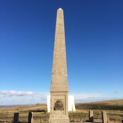
2. Sakakawea Monument
Additional keywords. Sacagawea Sacajawea
Credits. This page was last revised on February 1, 2026. It was originally submitted on November 12, 2015, by Ruth VanSteenwyk of Aberdeen, South Dakota. This page has been viewed 1,174 times since then and 99 times this year. Last updated on January 12, 2022. Photos: 1, 2. submitted on November 12, 2015, by Ruth VanSteenwyk of Aberdeen, South Dakota. • J. Makali Bruton was the editor who published this page.
