Near Cameron in Le Flore County, Oklahoma — The American South (West South Central)
Chief Mosholatubbee
--Amosholi-t-vbi
"Warrior who perseveres"
Born 1770
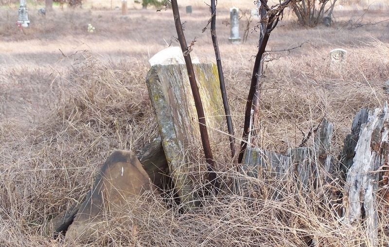
"Chief Moshulatubbee of Northern District, Choctaw Nation in Mississippi, received his name as a young warrior. He was dignified in bearing, of fine physique, steady and thoughtful in disposition. As Chief he was noted for his orders banning liquor traffic and drinking in his county. He strongly favored education, and a mission school (ABCFM) was located at this prairie village near the Natchez Trace in 1824. Moshulatubbee was one of the three head chiefs who signed the early Choctaw treaties with the United States, including that at Dancing Rabbit Creek in 1830, which provided for the removal of the Choctaws from Mississippi. He had high hopes in coming west with his people in 1832, and made his new home in LeFlore County. He died at his home and was buried nearby, his grave covered in unmarked stones. The region from the Arkansas River to the Winding Stair Mountains was called Moshulatubbee District in law books of the Choctaw Nation, 1834 to 1907."
Erected 1965 by Oklahoma Historical Society.
Topics and series. This historical marker is listed in these topic lists: Cemeteries & Burial Sites • Native Americans • Settlements & Settlers . In addition, it is included in the Oklahoma Historical Society series list. A significant historical year for this entry is 1770.
Location. 35° 5.672′ N, 94° 29.948′ W. Marker is near Cameron, Oklahoma, in Le Flore County. Marker is on County Road E805 east of N4790, on the left when traveling east. The marker is located in the Hall Cemetery. Touch for map. Marker is in this post office area: Poteau OK 74953, United States of America. Touch for directions.
Other nearby markers. At least 7 other markers are within 13 miles of this marker, measured as the crow flies. Reynolds Castle (approx. 4.2 miles away); Battle of Backbone Mountain (approx. 7˝ miles away); Fort Coffee (approx. 11˝ miles away); Choctaw Agency (approx. 11˝ miles away); Skullyville (approx. 12 miles away); a different marker also named Skullyville (approx. 12 miles away); Howe War Memorial (approx. 12.6 miles away).
Credits. This page was last revised on January 14, 2022. It was originally submitted on January 13, 2022, by Jason Armstrong of Talihina, Oklahoma. This page has been viewed 362 times since then and 49 times this year. Photos: 1, 2. submitted on January 13, 2022, by Jason Armstrong of Talihina, Oklahoma. • J. Makali Bruton was the editor who published this page.

