Emmitsburg in Frederick County, Maryland — The American Northeast (Mid-Atlantic)
White Ash Tree
Photographed by F. Robby, May 11, 2009
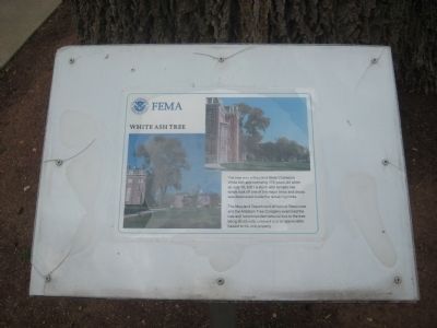
1. White Ash Tree Marker
The Maryland Department of Natural Resources and the Antietam Tree Company examined the tree and recommended removal due to the tree being structurally unsound and an appreciable hazard to life and property.
Topics. This historical marker is listed in these topic lists: Horticulture & Forestry • Natural Features. A significant historical month for this entry is July 1910.
Location. 39° 41.684′ N, 77° 19.6′ W. Marker is in Emmitsburg, Maryland, in Frederick County. It can be reached from Seton Avenue (Business U.S. 15) 0.6 miles Main Street (Maryland Route 140) when traveling south. Monument is located on the grounds of FEMA's National Emergency Training Center. Touch for map. Marker is in this post office area: Emmitsburg MD 21727, United States of America. Touch for directions.

Regionally, this marker is in the Washington Metropolitan Area and in Central Maryland. It is also in the American Mid-Atlantic.
this page online
Other nearby markers. At least 8 other markers are within walking distance of this marker: "To Lift a Nation" (within shouting distance of this marker); Fallen Firefighters Memorial (within shouting distance of this marker); The White House (about 600 feet away, measured in a direct line); Sisters of Charity of Cincinnati (about 700 feet away); Sisters of Charity of Saint Vincent de Paul (about 700 feet away); Sisters of Charity of Saint Elizabeth (about 800 feet away); Sisters of Charity of Seton Hill (approx. 0.2 miles away); Sisters of Charity of Saint Vincent de Paul of New York (approx. 0.2 miles away). Touch for a list and map of all markers in Emmitsburg.
Photographed by F. Robby, May 11, 2009
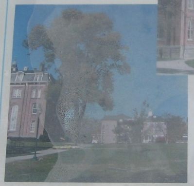
2. White Ash Tree
Closeup of marker showing the tree before its removal. Moisture has seeped between the sign and its protective cover.
Photographed by F. Robby, May 11, 2009
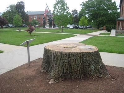
3. White Ash Tree Marker
The "To Lift a Nation" monument to the 9/11 firefighters can be seen in the background.
Photographed by F. Robby, May 11, 2009
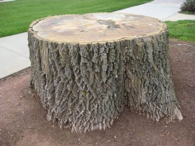
4. White Ash Tree Stump
Credits. This page was last revised on June 16, 2016. It was originally submitted on May 16, 2009, by F. Robby of Baltimore, Maryland. This page has been viewed 2,581 times since then and 15 times this year. Photos: 1, 2, 3, 4. submitted on May 16, 2009, by F. Robby of Baltimore, Maryland.
