Marker Logo
THE HISTORICAL
MARKER DATABASE
“Bite-Size Bits of Local, National, and Global History”
Mardela Springs in Wicomico County, Maryland — The American Northeast (Mid-Atlantic)
 

Livery Stable

Barren Creek Springs Village
 
 
Livery Stable Marker image. Click for full size.
Photographed by Devry Becker Jones (CC0), January 14, 2022
1. Livery Stable Marker
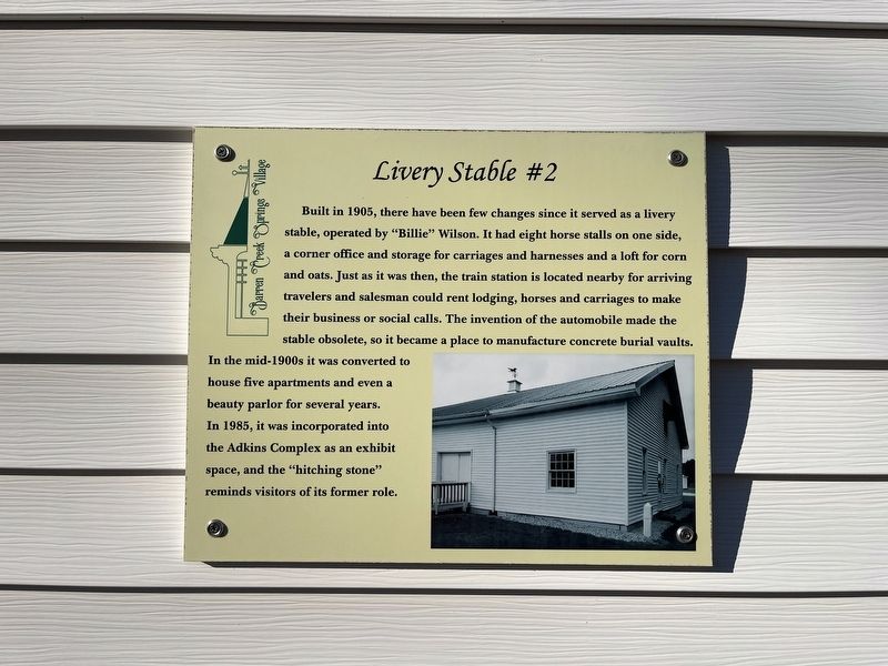
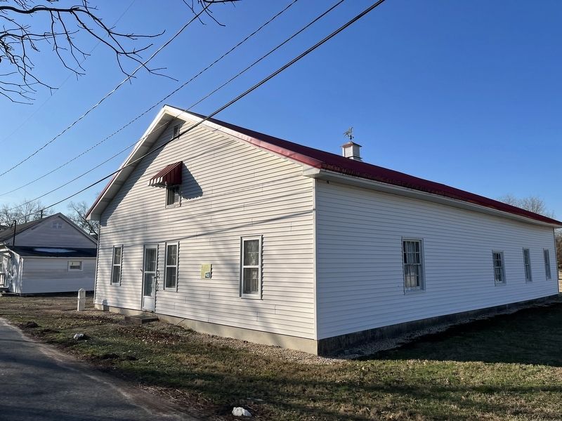
Inscription. Built in 1905, there have been few changes since it served as a livery stable, operated by "Billie" Wilson. It had eight horse stalls on one side, a corner office and storage for carriages and harnesses and a loft for corn and oats. Just as it was then, the train station is located nearby for arriving travelers and salesman could rent for lodging, horses and carriages to make their business or social calls. The invention of the automobile made the stable obsolete, so it became a place to manufacture concrete burial vaults. In the mid-1900s it was converted to house five apartments and even a beauty parlor for several years. In 1985, it was incorporated into the Adkins Complex as an exhibit space, and the "hitching stone" reminds visitors of its former role.
 
Erected by Westside Historical Society. (Marker Number 2.)
 
Topics and series. This historical marker is listed in these topic lists: AnimalsIndustry & CommerceRoads & Vehicles. In addition, it is included in the Maryland, Mardela Springs, Barren Creek Springs Village series list. A significant historical year for this entry is 1905.
 
Location. 38° 27.69′ N, 75° 45.29′ W.
Paid Advertisement
Click or scan to see
this page online
Marker is in Mardela Springs, Maryland, in Wicomico County. It is on Bratten Street just north of Main Street, on the left when traveling north. Touch for map. Marker is at or near this postal address: 102 Bratten St, Mardela Springs MD 21837, United States of America. Touch for directions.

Regionally, this marker is on the Eastern Shore. It is also in the American Mid-Atlantic, on the Delmarva Peninsula, in the Tidewater, and on the Eastern Seaboard. Globally, it is in the North Atlantic Region, North America, the Western Hemisphere, the Western World, and the Anglosphere. Historically, it finds itself in what was once one of the original Thirteen Colonies and also the Antebellum South.

Other nearby markers. At least 8 other markers are within walking distance of this marker: Brattan-Taylor-Calloway Store (within shouting distance of this marker); Lodge Hall (within shouting distance of this marker); BC&A Railroad Freight Depot (within shouting distance of this marker); Young's Purchase Home (within shouting distance of this marker); Gravenor-English School (within shouting distance of this marker); Young's Purchase Farmhouse
The Livery Stable image. Click for full size.
Photographed by Devry Becker Jones (CC0), January 14, 2022
2. The Livery Stable
(within shouting distance of this marker); The Doctor's Office (about 300 feet away, measured in a direct line); Graham-Whitelock Home (about 300 feet away). Touch for a list and map of all markers in Mardela Springs.
 
 
Credits. This page was last revised on January 15, 2022. It was originally submitted on January 15, 2022, by Devry Becker Jones of Washington, District of Columbia. This page has been viewed 272 times since then and 16 times this year. Photos:   1, 2. submitted on January 15, 2022, by Devry Becker Jones of Washington, District of Columbia.

m=190290

CeraNet Cloud Computing sponsors the Historical Marker Database.
This website earns income from purchases you make after using our links to Amazon.com. We appreciate your support.
Paid Advertisement
Jul. 22, 2026
