Rice in Amelia County, Virginia — The American South (Mid-Atlantic)
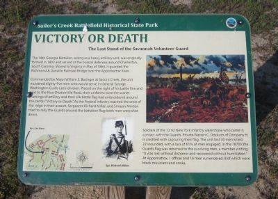
Victory or Death
The Last Stand of the Savannah Volunteer Guard
| — | Sailor's Creek Battlefield Historical State Park | — |
Photographed by Bernard Fisher, April 12, 2012
1. Victory or Death Marker
Commanded by Major William S. Basinger at Sailor’s Creek, the unit mustered eighty-five men who would serve in General George Washington Custis Lee’s division. Placed on the right of his battle line and next to the Rice-Deatonville Road, their uniforms bore the scarlet markings of artillery and their silk battle flag had embroidered around the center “Victory or Death.” As the Federal infantry reached the crest of the ridge in their assault, Sergeants Richard Millen and Simeon Morton tried to rally the Guards around the battalion flag; both men were shot down.
Soldiers of the 121st New York Infantry were those who came in contact with the Guards. Private Warren C. Dockum of Company H, is credited with capturing their flag. The unit lost 30 men killed, 22 wounded, with a loss of 61% of men engaged. In the 1870’s the Guards flag was returned to the
this page online
Erected by Sailor's Creek Battlefield Historical State Park.
Topics. This historical marker is listed in this topic list: War, US Civil. A significant historical month for this entry is May 1864.
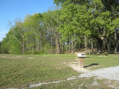
Location. Marker has been reported permanently removed. It was located near 37° 18.166′ N, 78° 13.678′ W. Marker was in Rice, Virginia, in Amelia County. It could be reached from Saylers Creek Road (Virginia Route 617) 0.6 miles north of Scuffletown Road ( Route 620), on the left when traveling north. Located along the Monument Trail. Touch for map. Marker was at or near this postal address: 6541 Saylers Creek Road, Rice VA 23966, United States of America.
We have been informed that this marker is no longer there and will not be replaced. This page is an archival view of what was.
Regionally, this marker was in the Piedmont and in Central Virginia. It was also in the American South and specifically in the Upper South. Globally, it was in North America,

Photographed by Bernard Fisher, April 12, 2012
2. Victory or Death Marker
Other nearby markers. At least 8 other markers are within 2 miles of this location, measured as the crow flies: Battles of Sailor's Creek (approx. 0.3 miles away); General Wheaton's First Division Assault (approx. 0.4 miles away); Marshall’s Crossroads (approx. half a mile away); Rock Formations At Sailor's Creek (approx. half a mile away); The Federal Artillery Barrage (approx. 0.6 miles away); Battle of Sailor's (Sayler's) Creek (approx. 0.6 miles away); a different marker also named Overton/Hillsman House (approx. 0.7 miles away); a different marker also named Holt's Corner (approx. 1½ miles away). Touch for a list and map of all markers in Rice.
Other markers no longer nearby. Ewell’s Line of Defense (was about 300 feet away, measured in a direct line but has been permanently removed); The Final Clash: With Fate Against Them (was about 500 feet away but has been permanently removed); Assaulting the Confederate Battle Line (was approx. 0.2 miles away but has been permanently removed); Crossing Little Sailor's Creek (was approx. 0.3 miles away but has been permanently removed); Overton/Hillsman House (was approx. 0.6 miles away but has been replaced with another marker now near it); Hillsman House (was approx. 0.7 miles away but has been permanently removed); Holt’s Corner (was approx. 1½ miles away but has been permanently removed).
Also see . . . Sailor's Creek Battlefield State Park. Virginia Department of Conservation & Recreation (Submitted on April 15, 2012, by Bernard Fisher of Richmond, Virginia.)
Credits. This page was last revised on February 8, 2026. It was originally submitted on April 15, 2012, by Bernard Fisher of Richmond, Virginia. This page has been viewed 1,834 times since then and 111 times this year. Last updated on February 7, 2026, by Evan Dwyer of Richmond, Virginia. Photos: 1, 2. submitted on April 15, 2012, by Bernard Fisher of Richmond, Virginia.
