Near Cherokee in Swain County, North Carolina — The American South (South Atlantic)
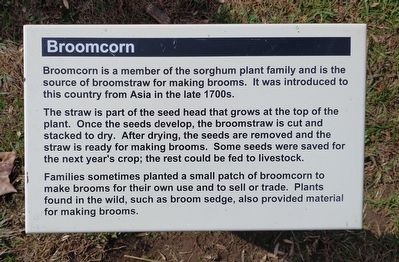
Broomcorn
The straw is part of the seed head that grows at the top of the plant. Once the seeds develop, the broomstraw is cut and stacked to dry. After drying, the seeds are removed and the straw is ready for making brooms. Some seeds were saved for the next year's crop; the rest could be fed to livestock.
Families sometimes planted a small patch of Broomcorn to make brooms for their own use and to sell or trade. Plants found in the wild, such as broom sedge, also provided material for making brooms.
Erected by Great Smoky Mountains National Park.
Topics. This historical marker is listed in these topic lists: Agriculture • Settlements & Settlers.
Location. 35° 30.73′ N, 83° 18.259′ W. Marker is near Cherokee, North Carolina, in Swain County. Marker can be reached from Newfound Gap Road (U.S. 441) 0.7 miles north of Blue Ridge Parkway, on the right when traveling north. Marker is located at the Mountain Farm Museum at the Oconaluftee Visitor Center in Great Smoky Mountains National Park. Touch for map. Marker is at or near this postal address: 1194 Newfound Gap Rd, Cherokee NC 28719, United States of America. Touch for directions.
Other nearby markers. At least 8 other markers are within walking distance of this marker. Sorghum Cane (here, next to this marker); Sorghum Mill and Furnace (here, next to this marker); Corn Cribs (within shouting distance of this marker); Springhouse (within shouting distance of this marker); Blacksmith Shop (within shouting distance of this marker); Hogs (within shouting distance of this marker); Apple House (about 300 feet away, measured in a direct line); The Meathouse (about 300 feet away). Touch for a list and map of all markers in Cherokee.
Also see . . . Mountain Farm Museum and Mingus Mill. Great Smoky Mountains National Park, National Park Service. (Submitted on January 20, 2022.)
Credits. This page was last revised on January 20, 2022. It was originally submitted on January 17, 2022, by Tom Bosse of Jefferson City, Tennessee. This page has been viewed 117 times since then and 15 times this year. Photos: 1, 2. submitted on January 17, 2022, by Tom Bosse of Jefferson City, Tennessee. • Bernard Fisher was the editor who published this page.

