Gifford Pinchot National Forest in Skamania County, Washington — The American West (Northwest)
Survivors Create Spectacular Change
— Mount St. Helens National Volcanic Monument —
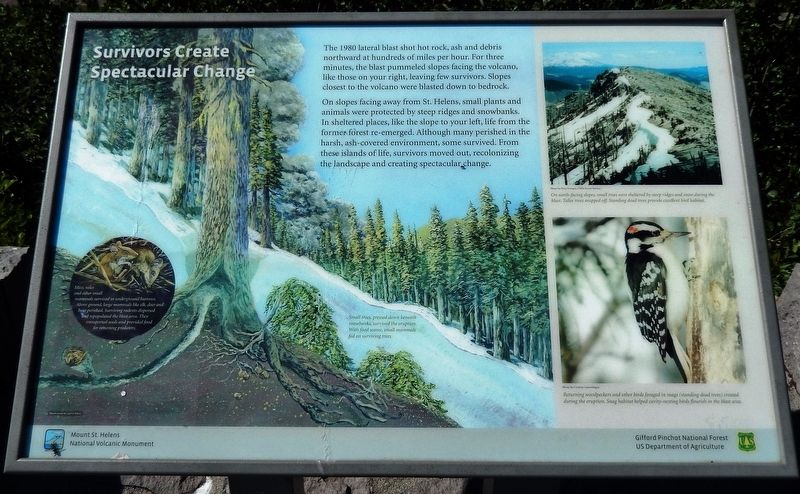
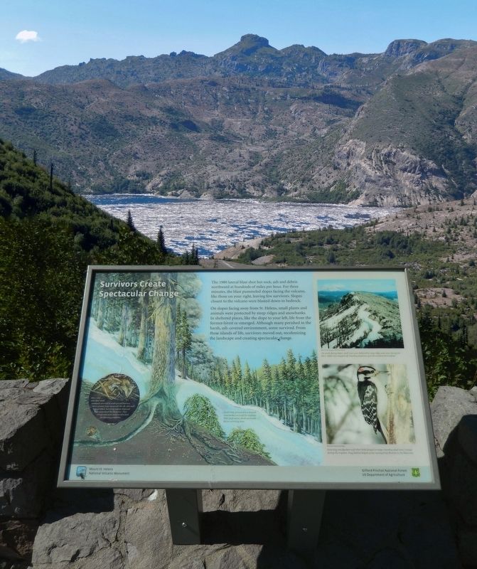
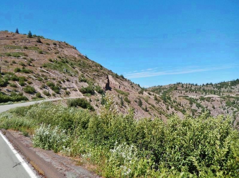
The 1980 lateral blast shot hot rock, ash and debris northward at hundreds of miles per hour. For three minutes, the blast pummeled slopes facing the volcano, like those on your right, leaving few survivors. Slopes closest to the volcano were blasted down to bedrock.
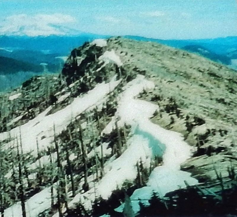
On slopes facing away from St. Helens, small plants and animals were protected by steep ridges and snowbanks. In sheltered places, like the slope to your left, life from the former forest re-emerged. Although many perished in the harsh, ash-covered environment, some survived. From these islands of life, survivors moved out, recolonizing the landscape and creating spectacular change.
[illustration captions]
• Mice, voles and other small mammals survived in underground burrows. Above ground, large mammals like elk, deer and bear perished. Surviving rodents dispersed and repopulated the blast area. They transported seeds and provided food for returning predators.
• Small trees, pressed down beneath snowbanks, survived the eruption. With food scarce, small mammals fed on surviving trees.
Erected by Gifford Pinchot National Forest, US Department of Agriculture.
Topics. This historical marker is listed in these topic lists: Animals • Disasters • Environment • Parks & Recreational Areas. A significant historical date for this entry is May 18, 1980.
Location. 46° 16.47′ N, 122° 6.27′ W. Marker is in Gifford Pinchot National Forest, Washington, in Skamania County. Marker is on Forest Road NF-99, 2.8 miles west of Forest Road NF-380. Marker is located at the Harmony Falls Trailhead, 2.8 miles from the Cascade Peaks Interpretive Center. Touch for map. Marker is in this post office area: Cougar WA 98616, United States of America. Touch for directions.
Other nearby markers. At least 6 other markers are within 5 miles of this marker, measured as the crow flies. Hearts of Volcanoes Beat Beneath Peaceful Facades (approx. 1.7 miles away); Mount St. Helens (approx. 1.7 miles away); The Pumice Plain (approx. 2.3 miles away); The Earth’s Monumental Power (approx. 3.1 miles away); Working with Nature to Rebuild an Ecosystem (approx. 3.1 miles away); More Than He Bargained For (approx. 4.2 miles away).
Also see . . .
1. 1980 Cataclysmic Eruption. USGS website entry
On May 18, 1980, a magnitude 5+ earthquake was accompanied by a debris avalanche, which in turn unloaded the confining pressure at the top of the volcano by removing the cryptodome. This abrupt pressure release allowed hot water in the system to flash to steam, which expanded explosively, initiating a hydrothermal blast directed laterally through the landslide scar.(Submitted on January 18, 2022, by Cosmos Mariner of Cape Canaveral, Florida.)
2. World of Change: Devastation and Recovery at Mt. St. Helens. NASA Earth Observatory website entry:
In the decades since the eruption, Mt. St. Helens has given scientists an unprecedented opportunity to witness the intricate steps through which life reclaims a devastated landscape. The scale of the eruption and the beginning of reclamation in the Mt. St. Helens blast zone are documented in this series of images captured by NASA’s Landsat series of satellites between 1979 and 2016. Not surprisingly, the first noticeable recovery (late 1980s) takes place in the northwestern quadrant of the blast zone, farthest from the volcano. It is another decade (late 1990s) before the terrain east of Spirit Lake is considerably greener.(Submitted on January 18, 2022, by Cosmos Mariner of Cape Canaveral, Florida.)
Credits. This page was last revised on March 18, 2024. It was originally submitted on January 18, 2022, by Cosmos Mariner of Cape Canaveral, Florida. This page has been viewed 143 times since then and 12 times this year. Photos: 1, 2, 3, 4, 5. submitted on January 18, 2022, by Cosmos Mariner of Cape Canaveral, Florida.
