Oakley in Contra Costa County, California — The American West (Pacific Coastal)
"...What we see and have before us is not a river, but much water in a pond"
— Anza Expedition of 1776 —
Inscription.
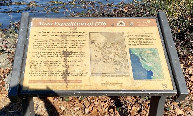
"...what we see and have before us is not a river, but much water in a pond."
In the spring of 1776, Lt. Colonel Jaan Bautista de Anza, Father Pedro Font, and a small group spent four days exploring the East Bay. They wished to verify an earlier expedition's report of a river, the "Rio Grande de San Francisco,” flowing into the Bay. They camped here, examining the shoreline.
Anza and Font began to doubt that these waters were a river. They saw none of the expected signs of seasonal flooding. There seemed to be no current, only the rising and falling of the tides which they carefully measured.
[Anza] “Father, is it not enough that these gentlemen say that they have seen the river...?
[Font] "Señor, it is not enough...no such river is to be seen...."
This was no river, Font concluded, but a freshwater inland sea that extended east to the great, green "tulares," the marshes that once filled much of a e Central Valley.
Font's confusion is understandable, thinking that the water in front of him was an inland freshwater sea. These tidal waters are actually the northern reach of the San Francisco Bay, but they also drain two major rivers, the Sacramento from the north and the San Joaquin from the south.
Erected by East Bay Regional Parks District.
Topics and series. This historical marker is listed in these topic lists: Exploration • Hispanic Americans. In addition, it is included in the Juan Bautista de Anza National Historic Trail series list. A significant historical year for this entry is 1776.
Location. 38° 1.175′ N, 121° 45.029′ W. Marker is in Oakley, California, in Contra Costa County. Marker can be reached from Bridgehead Road. Touch for map. Marker is at or near this postal address: 6400 Bridgehead Road, Oakley CA 94561, United States of America. Touch for directions.
Other nearby markers. At least 8 other markers are within 3 miles of this marker, measured as the crow flies. Anza Expedition Campsite 101 (a few steps from this marker); Carquinez Strait (approx. 1.3 miles away); The Migrating Delta (approx. 1.3 miles away); California's Big Water Projects: How Did We Get Here? (approx. 1.3 miles away); The San Joaquin: A River Runs Dry (approx. 1.4 miles away); Dredges (approx. 1.4 miles away); Stopped by Impenetrable Marshes (approx. 1.4 miles away); July 4, Anno Domini, 1951 (approx. 3.1 miles away). Touch for a list and map of all markers in Oakley.
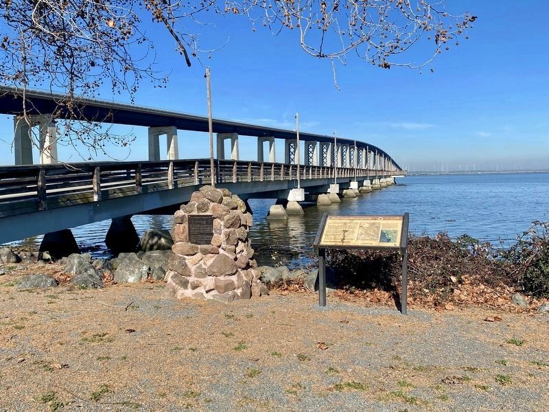
More about this marker. The marker is located on the east side of the foot of the fishing pier at Antioch/Oakley Regional Shoreline.
Also see . . . Anza Trail Historic Sites in California (National Park Service)
. A selection of De Anza expedition-related sites in California. (Submitted on January 19, 2022.)
Credits. This page was last revised on January 19, 2022. It was originally submitted on January 19, 2022, by Andrew Ruppenstein of Lamorinda, California. This page has been viewed 134 times since then and 20 times this year. Photos: 1, 2. submitted on January 19, 2022, by Andrew Ruppenstein of Lamorinda, California.

