Near Manteo in Dare County, North Carolina — The American South (South Atlantic)
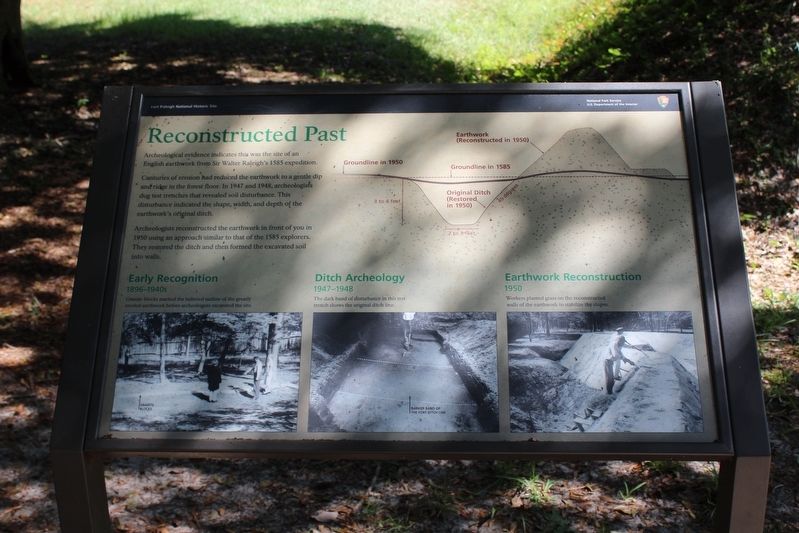
Reconstructed Past
— Fort Raleigh National Historic Site —
Centuries of erosion had reduced the earthwork to a gentle dip and ridge in the forest floor. In 1947 and 1948, archeologists dug test trenches that revealed soil disturbance. this disturbance indicated the shape, width, and depth of the earthwork's original ditch.
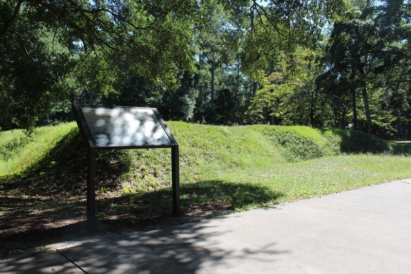
Archeologists reconstructed the earthwork in front of you in1950 using an approach similar to that of the 1585 explorers. They restored the ditch and then formed the excavated soil into walls.
(captions)
Early Recognition
1896-1940s
Granite blocks marked the believed outline of the greatly eroded earthworks before archeologists excavated the site.
Ditch Archeology
1947-1948
The dark band of disturbance in this test trench shows the original ditch line.
Earthwork Reconstruction
1950
Workers plated grass on the reconstructed walls of the earthwork to stabilize the slopes.
Erected by National Park Service, U.S. Department of the Interior.
Topics. This historical marker is listed in these topic lists: Anthropology & Archaeology • Colonial Era • Exploration • Forts and Castles. A significant historical year for this entry is 1585.
Location. 35° 56.299′ N, 75° 42.539′ W. Marker is near Manteo, North Carolina, in Dare County. Marker can be reached from Fort Raleigh Road, 0.4 miles north of U.S. 64, on the left when traveling north. Marker is located within the Fort Raleigh National Historic Site. Touch for map. Marker is in this post office area: Manteo NC 27954, United States of America. Touch for directions.
Other nearby markers. At least 8 other markers are within walking distance of this marker. English Explorers' Earthwork (a few steps from this marker); Thomas Hariot Trail (a few steps from this marker); Exploring the Unknown (within shouting distance of this marker); The New Fort in Virginia / Virginia Dare (about 300 feet away, measured in a direct line); First Light of Freedom (about 500 feet away); A Civil War Refuge (about 500 feet away); A Legacy of Freedom (about 500 feet away); Joachim Gans (approx. 0.4 miles away). Touch for a list and map of all markers in Manteo.
Also see . . . Fort Raleigh National Historic Site. National Park Service (Submitted on January 22, 2022, by Tom Bosse of Jefferson City, Tennessee.)
Photographed By Tom Bosse, September 18, 2021
4. The Project
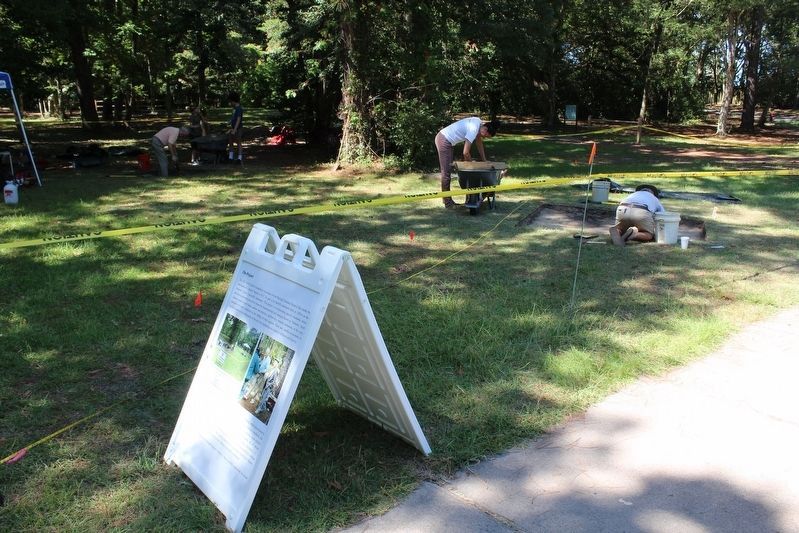
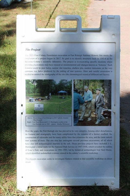
The 2021 First Colony Foundation excavation at Fort Raleigh National Historic Site marks the conclusion of a project begun in 2017. Its goal is to identify structures built in 1585-6 as the Roanoke Colony's scientific laboratory. The project is re-excavating specific locations where preshous excavations may have missed or misinterpreted soil changes known as 'features.' Such features could be post holes, narrow slot trenches, shallow pits, modern intrusions, or the very common tree holes produced by the rotting of root systems. Slow and careful excavation is needed to unravel the stratigraphy of the site (the chronological record of different soil layers).
Over the years, the Fort Raleigh site has proved to be very complex. Among other disturbances, its features and stratigraphy have been complicated by the remains of a former roadbed, the construction of sidewalks and the many utility lines that crisscross the area, and the (now rotted) root systems of trees. The site also has undergone several previous excavations, all of which have also left archaeological imprints in the soil. These previous projects have included J. C. Harrington's initial work for the National Park Service in 1947-1950, which revealed the outline of Lane's Fort, and excavations in 1991-1993, led by historical archaeologist Ivor Noel Hume, which identified undisturbed evidence related to the colony's scientific workshop.
The present excavation seeks to investigate features related to that scientific workshop in closer detail.
Above: Excavating at Fort Raleigh in 2017 (photo Alastair MacDonald)
Right: Ivor Noel Hume and J. C. Harrington confer at the Fort Raleigh site in 1991. (photo: Martha Williams)
Photographed By Tom Bosse, September 18, 2021
5. Project Background
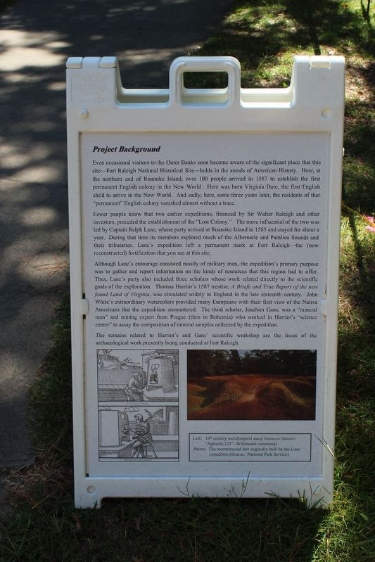
Even occasional visitors to the Outer Banks soon become aware of the significant place that this site—Fort Raleigh National Historical Site—holds in the annals of American History. Here, at the northern end of Roanoke Island, over 100 people arrived in 1587 to establish the first permanent English colony in the New World. Here was born Virginia Dare, the first English child to arrive in the New World. And sadly, here, some three years later, the residents of that "permanent" English colony vanished almost without a trace.
Fewer people know that two earlier expeditions, financed by Sir Walter Raleigh and other investors, preceded the establishment of the "Lost Colony." The more influential of the two was led by Captain Ralph Lane, whose party arrived at Roanoke Island in 1585 and stayed for about a year. During that time its members explored much of the Albemarle and Pamlico Sounds and their tributaries. Lane's expedition left a permanent mark at Fort Raleigh—the (now reconstructed) fortification that you see at this site.
Although Lane's entourage consisted mostly of military men, the expedition's primary purpose was to gather and report information on the kinds of resources that this region had to offer. Thus, Lane's party also included three scholars whose work related directly to the scientific goals of the exploration. Thomas Harriot's 1587 treatise, A Briefe and True Report of the new found Land of Virginia, was circulated widely in England in the late sixteenth century. John White's extraordinary watercolors provided many Europeans with their first view of the Native Americans that the expedition encountered, The third scholar, Joachim Gans, was a "mineral man" and mining expert from Prague (then in Bohemia) who worked in Harriot's "science center" to assay the composition of mineral samples collected by the expedition.
The remains related to Harriot's and Gans' scientific workshop are the focus of the archaeological work presently being conducted at Fort Raleigh.
Left: 16th century metallurgical assay furnaces (Source: "Agricola.223"--Wikimedia commons)
Above: The reconstructed fort originally built by the Lane expedition (Source: National Park Service).
Credits. This page was last revised on January 24, 2022. It was originally submitted on January 22, 2022, by Tom Bosse of Jefferson City, Tennessee. This page has been viewed 330 times since then and 33 times this year. Photos: 1, 2, 3, 4, 5. submitted on January 22, 2022, by Tom Bosse of Jefferson City, Tennessee. • Bernard Fisher was the editor who published this page.
