Lower Haight in San Francisco City and County, California — The American West (Pacific Coastal)
Haight-Fillmore Building
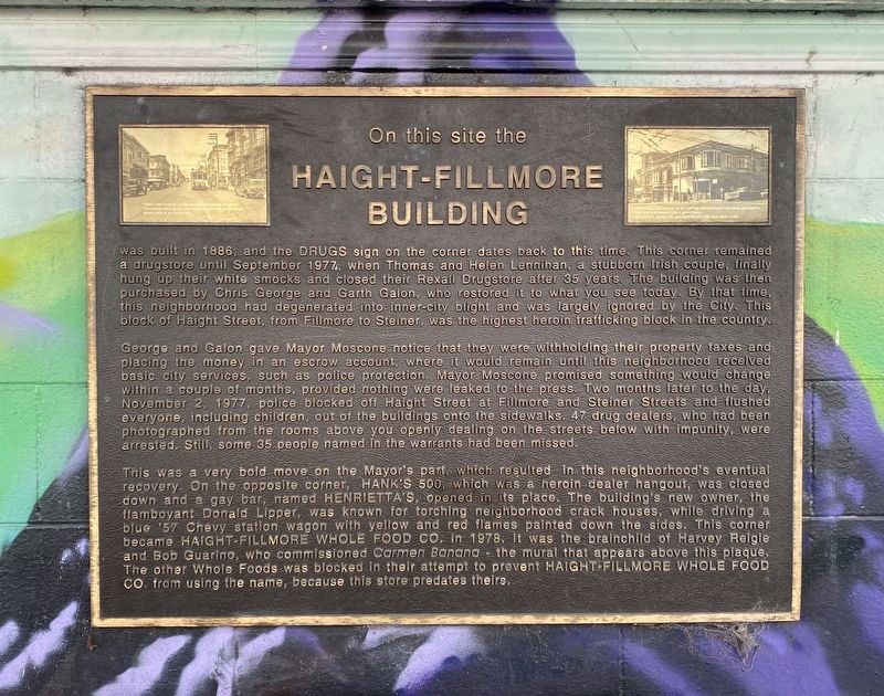
George and Galon gave Mayor Moscone notice that they were withholding their property taxes and placing the money in an escrow account, where it would remain until this neighborhood received basic city services, such as police protection. Mayor Moscone promised something would change within a couple of months, provided nothing were leaked to the press. Two months later to the day, November 2, 1977, police blocked off Haight Street at Fillmore and Steiner Streets and flushed everyone, including children, out of the buildings onto the sidewalks. 47 drug dealers, who had been photographed from the rooms above you openly dealing on the streets below with impunity, were arrested. Still, some 35 people named in the warrants had been missed.
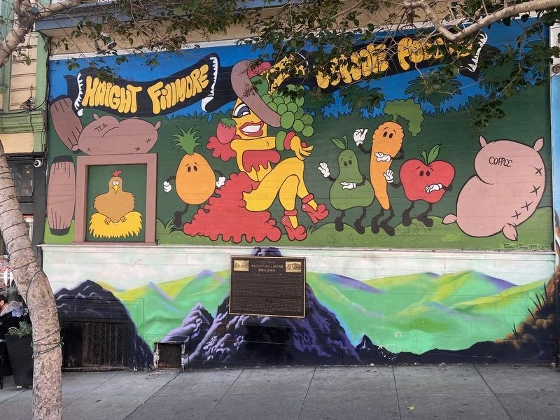
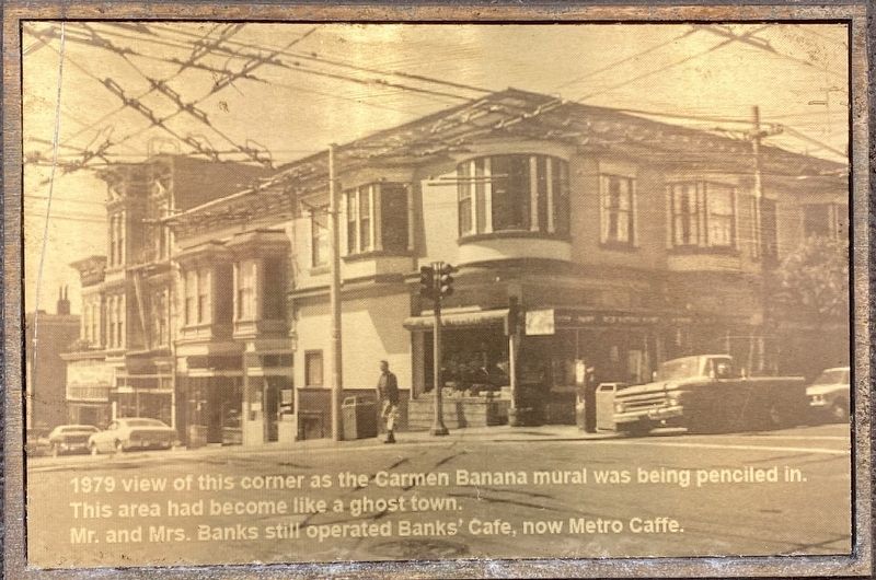
This was a very bold move on the Mayor's part, which resulted in this neighborhood's eventual recovery. On the opposite corner, HANK'S 500, which was a heroin dealer hangout, was closed down and a gay bar, named HENRIETTA'S, opened in its place. The building's new owner, the flamboyant Donald Lipper, was known for torching neighborhood crack houses, while driving a blue '57 Chevy station wagon with yellow and red flames painted down the sides. This corner became HAIGHT-FILLMORE WHOLE FOOD CO. in 1978. It was the brainchild of Harvey Reigle and Bob Guarino, who commissioned Carmen Banana - the mural that appears above this plaque. The other Whole Foods was blocked in their attempt to prevent HAIGHT FILLMORE WHOLE FOOD Co. from using the name, because this store predates theirs.
Erected 2018 by Chris George.
Topics. This historical marker is listed in these topic lists: Industry & Commerce • Law Enforcement. A significant historical date for this entry is November 2, 1977.
Location. 37° 46.319′ N, 122° 25.831′ W. Marker is in San Francisco, California, in San Francisco City and County. It is in Lower Haight. Marker is at the intersection of Fillmore Street and Fillmore Street, on the right when traveling south on Fillmore Street
. Touch for map. Marker is at or near this postal address: 501 Haight Street, San Francisco CA 94117, United States of America. Touch for directions.
Other nearby markers. At least 8 other markers are within walking distance of this marker. Watershed History (approx. 0.2 miles away); St. Francis Lutheran Church (approx. ¼ mile away); Mint Hill (approx. ¼ mile away); King of the Road! (approx. ¼ mile away); The Industrial Age (approx. ¼ mile away); California Volunteers' Memorial (approx. 0.3 miles away); Swedish American Hall (approx. 0.4 miles away); Audre Lorde (approx. half a mile away). Touch for a list and map of all markers in San Francisco.
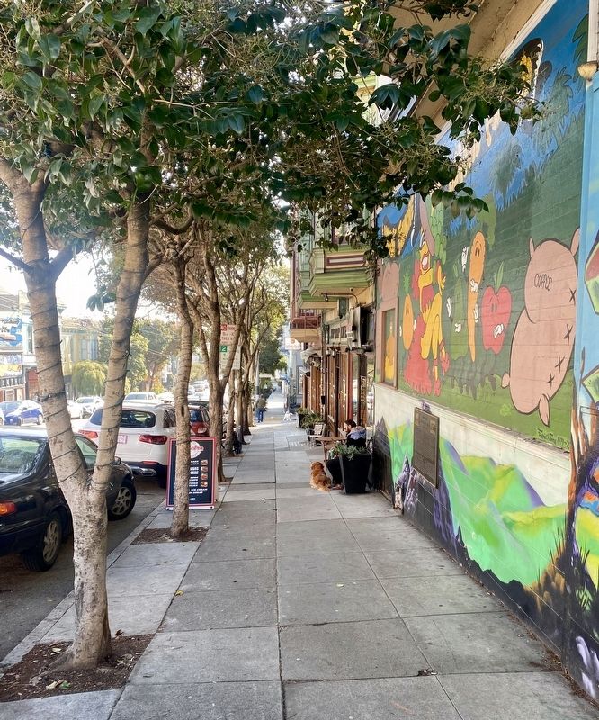
More about this marker. The marker is mounted on the eastern exterior wall of the Haight Fillmore Whole Foods Co.
Also see . . . A Huge SF Drug Raid in 1977, Now Immortalized On a Plaque (The Frisc, Jan. 25, 2022). Full title: A Huge SF Drug Raid in 1977, Now Immortalized On a Plaque, Changed a Black Neighborhood Forever - the article discusses the stories on the plaque, adds additional perspectives, examining the consequences of rampant drug use, policing, and gentrification. (Submitted on January 25, 2022, by Andrew Ruppenstein of Lamorinda, California.)
Additional keywords. gentrification lgbt lgbtq
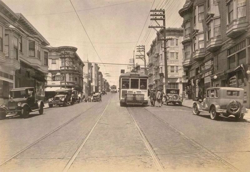
courtesy of UC Berkeley, Bancroft Library, 1928
4. North on Fillmore St. from Haight St. (source image for upper left marker photo)
Written on the inset photo: "1920s view looking up Fillmore St. across Haight St. The streets were paved with red brick and had no markings. Metro Caffe is on the far left."
The marker site would be on the left, on the wall, nearest the gap between the two parked cars. Note the "Drugs" sign mentioned on the marker is also visible.
Credits. This page was last revised on February 7, 2023. It was originally submitted on January 25, 2022, by Andrew Ruppenstein of Lamorinda, California. This page has been viewed 381 times since then and 48 times this year. Photos: 1, 2, 3, 4, 5. submitted on January 25, 2022, by Andrew Ruppenstein of Lamorinda, California.
