Near Beltsville in Prince George's County, Maryland — The American Northeast (Mid-Atlantic)
Three Sisters: Close Knit Communities of the Laurel Area
Inscription.
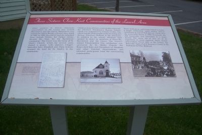
Other enclaves of African American ironworkers in the Laurel area include Bacontown and the Grove. Bacontown was named for Maria Bacon, a former slave freed in 1860. In 1880, the plot of land she inherited from Achsah Dorsey, her former owner, became the basis for the Bacontown Community. The Grove was the home of St. Mark’s Church, which for several years shared a pastor with Queen’s Chapel. Snowden heirs Elizabeth and Mary Jenkins donated the land for St. Mark’s to the community.
Children from all three communities attended the Muirkirk Freedmen’s Bureau School, which was supported by Charles Coffin. The school taught White pupils in the morning and African American students in the afternoon. In addition to the school, Abraham Hall opened its doors to members of Rossville, Bacontown and the Grove. The Groves’s annual Emancipation Day celebration was sponsored by St. Marks Church, the Benevolent Sons and Daughters of Abraham and other fraternal organizations, and attracted participants from the surrounding communities.
These institutions and events helped to foster a larger community spirit among African Americans in Laurel that did not vanish after the ironworks closed in 1920. Eventually the old ironworks was converted to a paint factory that made use of iron ore as an ingredient in paint pigment. Many former ironworkers found jobs at the factory, the Beltsville Agricultural Research Center or the Baltimore & Ohio Railroad.
[Illustrations:]
Certificate of Freedom for Maria Bacon, founder of Bacontown, who inherited land from her former owner, Achsah Dorsey. Bacon did not work at Muirkirk, but Bacontown’s residents had strong ties to the Muirkirk Ironworks and the communities of Rossville and the Grove. Courtesy Maryland State Archives.
Photograph of St. Mark’s United Methodist Episcopal Church, circa 1980.
Photograph of Laurel’s Emancipation Day celebration, circa 1910.
Erected 2008 by Department of Parks and Recreation, Prince George's County.
Topics. This historical marker is listed in these topic lists: African Americans • Churches & Religion • Civil Rights • Education • Settlements & Settlers. A significant historical year for this entry is 1860.
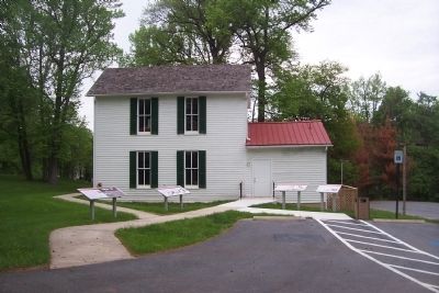
Location. This marker has been replaced by another marker nearby. It was located near 39° 3.552′ N, 76° 52.397′ W. Marker was near Beltsville, Maryland, in Prince George's County. Marker could be reached from Old Muirkirk Road. Marker is off the parking lot at the entrance to the recently restored Abraham Hall community center
on Old Muirkirk Road, a block north of Muirkirk Road, across the street from the Muirkirk West Neighborhood Park, and about half a mile east of Old Baltimore Pike. Note that Muirkirk Road is not directly accessible from U.S. 1 (the area's primary north-south thoroughfare). Travelers on U.S. 1 should turn east at Powder Mill Road (MD 201) in Beltsville, crossing the B&O RR tracks, to reach Old Baltimore Pike and then proceed north to Muirkirk Road. Touch for map. Marker was at or near this postal address: 7612 Old Muirkirk Road, Beltsville MD 20705, United States of America. Touch for directions.
Other nearby markers. At least 8 other markers are within walking distance of this location. Abraham Hall: An African American Benevolent Lodge (here, next to this marker); a different marker also named Three Sisters: Close Knit Communities of the Laurel Area (here, next to this marker); When the Iron was Hot: African American Ironworkers of Muirkirk (here, next to this marker); Iron Production: Maryland's Industrial Past / The Ironmaking Process (a few steps from this marker); Queen’s Chapel Methodist Church, Established 1868 (approx. 0.2 miles away); The Dinosaurs of Dinosaur Park (approx. 0.8 miles away); Welcome to Dinosaur Park (approx. 0.8 miles away); The Industrial Heritage of Dinosaur Park (approx. 0.8 miles away). Touch for a list and map of all markers in Beltsville.
Related marker. Click here for another marker that is related to this marker. This marker has been replaced by the linked marker.
Additional keywords. Reconstruction; Jim Crow; Laurel, Maryland.
Credits. This page was last revised on December 11, 2021. It was originally submitted on May 17, 2009, by Richard E. Miller of Oxon Hill, Maryland. This page has been viewed 1,798 times since then and 52 times this year. Photos: 1, 2. submitted on May 17, 2009, by Richard E. Miller of Oxon Hill, Maryland. • Christopher Busta-Peck was the editor who published this page.

