North Shore in Pittsburgh in Allegheny County, Pennsylvania — The American Northeast (Mid-Atlantic)
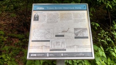
Allegheny Aqueduct
Three Rivers Heritage Trail
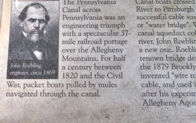
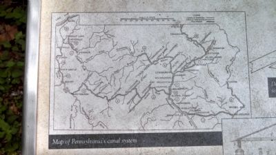
The Pennsylvania Canal across Pennsylvania was an engineering triumph with a spectacular 37-mile railroad portage over the Allegheny Mountains. For half a century between 1820 and the Civil War, packet boats pulled by mules navigated through the canal.
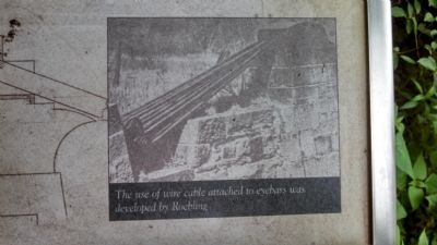
Canal boats crossed the Allegheny River to Pittsburgh on the world's first successful cable suspension aqueduct or "water bridge". When the original canal aqueduct collapsed into the river, John Roebling was hired to build a new one. Roebling became a world-renown bridge designer, famous for the 1879 Brooklyn Bridge. He invented "wire rope", a strong iron cable, and used it in all his bridges after his experiment here with the Allegheny Aqueduct in 1844.
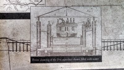
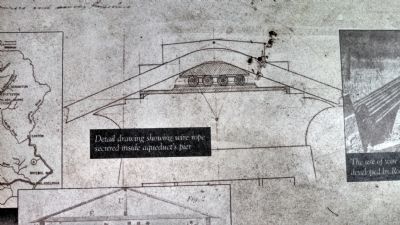
Roebling's aqueduct consisted of a wood trough filled with water and suspended from two iron cables. The cables were strung in place, wire by wire, and then anchored in eyebars embedded in masonry. The aqueduct was 160 feet long and contained 2,000 tons of water. Six boats loaded with passengers and goods could cross the river at the same time.
As the aqueduct filled with water for the first time, the event attracted one of the most enthusiastic crowds Pittsburgh had ever witnessed. Over 10,000 spectators watched while 100 guns saluted the first boats to float across the new aqueduct.
As canal technology became obsolete, Roebling's aqueduct was demolished in 1861 when the expanding Pennsylvania Railroad put the canal out of business.
Erected by Friends of the Riverfront with support from Pennsylvania Department of Conservation and Natural Resources, Steel Industry Heritage Corporation, City of Pittsburgh, Clearview Federal Credit Union.
Topics. This historical marker is listed in these topic lists: Industry & Commerce • Waterways & Vessels. A significant historical year for this entry is 1820.
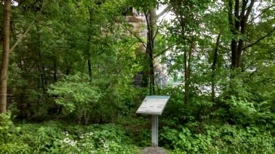
Location. 40° 26.955′ N, 79° 59.822′ W. Marker is in Pittsburgh, Pennsylvania, in Allegheny County. It is in North Shore. Marker can be reached from North Shore Trail. Marker is located on the North Shore Trail under the railroad bridge just west of the 16th Street (David McCullough) Bridge. Touch for map. Marker is in this post office area: Pittsburgh PA 15212, United States of America. Touch for directions.
Other nearby markers. At least 8 other markers are within walking distance of this marker. Lewis and Clark Expedition (approx. 0.2 miles away); Frederick J Osterling Office & Studio (approx. 0.2 miles away); Timber Court (approx. 0.2 miles away); Pittsburgh's Grand Hall at the Priory (approx. ¼ mile away); The Pittsburgh Platform (approx. ¼ mile away); Ninth Street Bridge (approx. ¼ mile away); Pauline H. Rosenberg (approx. ¼ mile away); "Pittsburgh Variations," 1984 (approx. 0.3 miles away). Touch for a list and map of all markers in Pittsburgh.
Credits. This page was last revised on February 2, 2023. It was originally submitted on May 26, 2015, by Mike Wintermantel of Pittsburgh, Pennsylvania. This page has been viewed 1,012 times since then and 105 times this year. Last updated on February 2, 2022, by Kelsey Ripper of Pittsburgh, Pennsylvania. Photos: 1, 2, 3, 4, 5, 6, 7. submitted on May 26, 2015, by Mike Wintermantel of Pittsburgh, Pennsylvania. • J. Makali Bruton was the editor who published this page.
