Boyle Heights in Los Angeles in Los Angeles County, California — The American West (Pacific Coastal)
Hollenbeck Park
1892
Photographed by Craig Baker, January 14, 2022
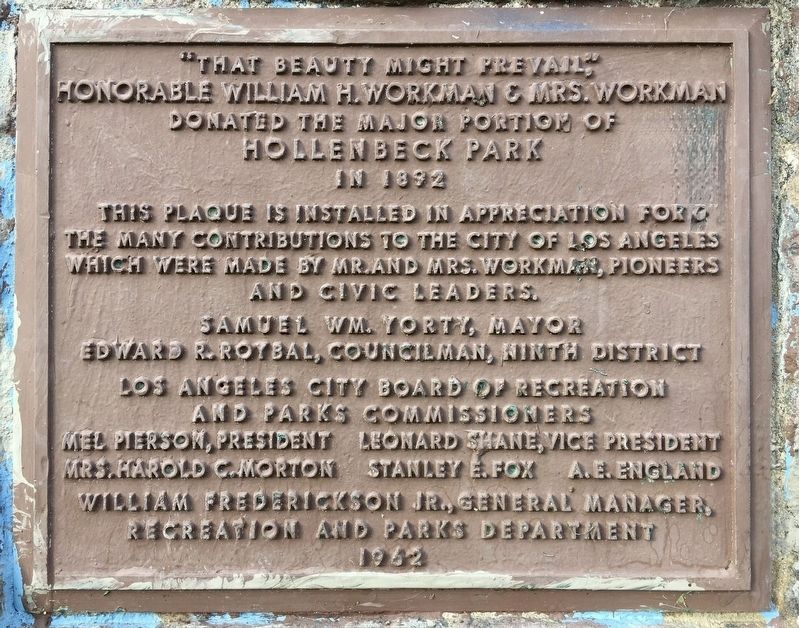
1. Hollenbeck Park Marker
“That beauty might prevail,” honorable William H.Workman & Mrs.Workman donated the major portion of Hollenbeck Park in 1892. This plaque is installed in appreciation for the many contributions to the City of Los Angeles which were made by Mr. and Mrs.Workman, pioneers and civic leaders.
Samuel Wm.Yorty, Mayor. Edward R.Roybal, Councilman, Ninth District. Los Angeles City Board of Recreation and Parks Commissioners.
Erected 1962 by City of Los Angeles.
Topics. This historical marker is listed in these topic lists: Charity & Public Work • Parks & Recreational Areas. A significant historical year for this entry is 1892.
Location. 34° 2.509′ N, 118° 12.956′ W. Marker is in Los Angeles, California, in Los Angeles County. It is in Boyle Heights. It is on St Louis Street just south of 4th Street, on the right when traveling south. Touch for map. Marker is at or near this postal address: 415 S St Louis St, Los Angeles CA 90033, United States of America. Touch for directions.

Regionally, this marker is in the Transverse Ranges. It is also on the American Pacific Coast. Globally, it is in North America,
this page online
Other nearby markers. At least 8 other markers are within walking distance of this marker: Hollenbeck Park Bridge (approx. 0.2 miles away); The Hollenbecks (approx. ¼ mile away); Santa Fe Coast Lines Hospital (approx. ¼ mile away); Mariachi Plaza (approx. 0.4 miles away); Otomisan Restaurant (approx. 0.4 miles away); Sixth Street Viaduct (approx. half a mile away); Boyle Hotel (approx. half a mile away); Japanese Hospital (approx. half a mile away). Touch for a list and map of all markers in Los Angeles.
Regarding Hollenbeck Park. The park was named for John Edward Hollenbeck (1829-1885), founder of First National Bank, whose widow, along with former L.A. Mayor William Workman, donated 21 acres of land in 1892. The park features grassy knolls and a man-made lake. In May 1929 the Laurel and Hardy film Men O' War was filmed here, back when there were still rental boats for the public. In the 1950s, the Golden State Freeway/Interstate
Photographed by Craig Baker, January 14, 2022
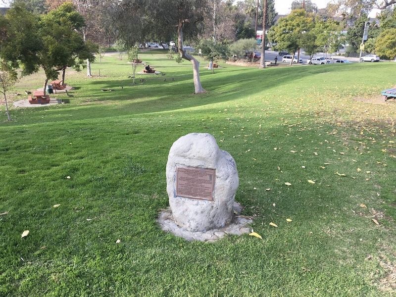
2. Hollenbeck Park and Marker
Credits. This page was last revised on January 4, 2026. It was originally submitted on February 4, 2022, by Craig Baker of Sylmar, California. This page has been viewed 1,090 times since then and 76 times this year. Photos: 1, 2. submitted on February 4, 2022, by Craig Baker of Sylmar, California.
