Ste. Genevieve in Ste. Genevieve County, Missouri — The American Midwest (Upper Plains)
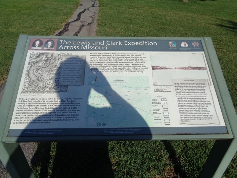
The Lewis and Clark Expedition Across Missouri
Inscription.
On Dec. 4, 1803, this site was passed early in the morning by a flotilla commanded by William Clark, co-leader of the upcoming Lewis and Clark Expedition. Traveling in a 55-foot long keelboat, two pirogues and other smaller boats, were Clark, his companion York, and some 23 men who would soon be enlisted in the Pacific-bound Corps of Discovery. Most of the day before had been spent by co-captains, Meriwether Lewis and Clark, wrapping up final affairs from a four-day layover at the newly founded American outpost of Fort Kaskaskia. This visit netted 12 new recruits for the expedition and needed supplies. Lewis decided to ride a horse from Fort Kaskaskia to Cahokia, Ill., to attend to urgent business across the river in St. Louis. Clark, meanwhile, brought the slower moving boats up the Mississippi to rendezvous with Lewis.
The flotilla left Kaskaskia late in the day, went three miles and pulled to shore on the west bank on the river where they set up their campsite in the dark. They were camped on the northern edge of a large agricultural common field, divided into long lots (see map), that was called the Grand Champs. On the morning of Dec. 4, the party was off before sunrise. They soon passed the mouth of "Gabia" [Gabouri] Creek which Clark knew to be the landing for the relocated town of Ste. Genevieve. Clark observed that a high bluff jutted up to the banks of the river 3/4 of a mile above Gabouri Creek. Clark saw a cave set high in this "tremendious Clift of rocks." Some 16.5 miles into their day's journey, the party passed the ruins Fort Chartres, which had originally been built by the French in 1721 and destroyed by the British in 1772. At 19.25 miles, the flotilla pulled into the lower point of an island and made camp.
(inset, left:)
"Set out this morning before Sunrise, at 3/4 of a mile passed the mouth of a Small Creek Called Gabia [Gabourie], at the mouth of this Creek is the landing place for the Tradeing Boats of St Genevieve, a Small town situated on the Spurs of the high land at 3/4 of a mile distant nearly South This Village contains (as I am informed) about 120 families, principally French… ."
William Clark, Dec. 4, 1803
(inset, right:)
Ste. Genevieve
The party of William Clark did not stop at Ste. Genevieve, although their campsite of December 3, 1803 was less than two miles from the village. The next day, as Gabouri Creek was passed, Clark took note of the nearby small village situated on the rising ground away from the Mississippi River floodplain. He had been informed that the village contained about 120 mainly French families (Nicholas de Finiels put the population of the town at 950 in 1797).
Despite
passing on secondhand information about Ste. Genevieve, Clark had firsthand acquaintance with the village. In 1797, he spent the night in Ste. Genevieve at the home of the Spanish-appointed commandant of the District of Ste. Genevieve, Francois Valle. Clark had passed through while on a journey to help settle the Revolutionary War debts of his older brother, George Rogers Clark. William Clark also knew that the village had been relocated. On Nov. 28, he had landed at Kaskaskia Landing, which he knew was directly opposite "old St. Genevie." He even knew the nickname for this flood prone community — "misar," or misery (misere in French). After disastrous floods beginning in the mid 1780s, Ste. Genevieve was relocated to the high and dry banks of Gabouri Creek.
Erected by Missouri Department of Natural Resources, Lewis and Clark National Historic Trail, National Park Service, U.S. Department of Interior, Missouri Lewis and Clark Bicentennial Commission, the City of Ste. Genevieve, and the Lewis and Clark Committee of Ste. Genevieve.
Topics and series. This historical marker is listed in these topic lists: Exploration • Forts and Castles • Waterways & Vessels. In addition, it is included in the Lewis & Clark Expedition series list. A significant historical date for this entry is December 3, 1803.
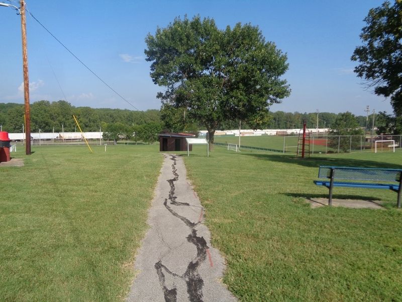
Location. 37° 59.789′ N, 90° 3.3′ W. Marker is in Ste. Genevieve, Missouri, in Ste. Genevieve County. Marker is on Matthews Drive west of Little Rock Road, on the right when traveling east. Marker is located at Pere Marquette Park. Touch for map. Marker is at or near this postal address: 21932 Kingsman Dr, Sainte Genevieve MO 63670, United States of America. Touch for directions.
Other nearby markers. At least 8 other markers are within 2 miles of this marker, measured as the crow flies. Sainte Genevieve Ferry (a few steps from this marker); Urban Design Levee (within shouting distance of this marker); In Memory of Prospect K. Robbins, 1782-1847 (approx. 1.2 miles away); Welcome to Sainte Genevieve Parish (approx. 1.3 miles away); In Honor of Milice de Ste. Genevieve (approx. 1.3 miles away); El Camino Real (approx. 1.3 miles away); Merchants Bank / Ste. Genevieve Savings Bank (approx. 1.3 miles away); Revolutionary War Patriots (approx. 1.3 miles away). Touch for a list and map of all markers in Ste. Genevieve.
Credits. This page was last revised on February 9, 2022. It was originally submitted on February 9, 2022, by Jason Voigt of Glen Carbon, Illinois. This page has been viewed 165 times since then and 19 times this year. Photos: 1, 2. submitted on February 9, 2022, by Jason Voigt of Glen Carbon, Illinois.

