Pray in Park County, Montana — The American West (Mountains)
Hepburn's Mesa
Inscription.
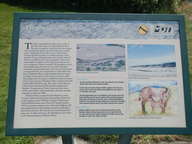
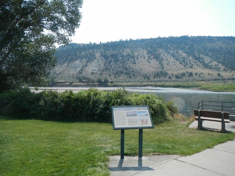
The black-capped bluffs located on the east side of the Yellowstone River are called Hepburn's Mesa. The mesa is capped by a basalt lava flow the erupted from a small local volcano vent that has long since eroded away. Geologically, the lava flow is very young, perhaps having erupted as recently as 2.2 million years ago. Large amounts of iron in the basalt make it dark colored. She of the iron crystallized as magnetite, which as the name implies is magnetic, and in large concentrations can cause compasses to behave erratically. The basalt flow overlies unconsolidated gravels, which in turn overlies older light-colored fine-grained sedimentary rocks that were deposited in an ancient lake that once occupied this site. The sedimentary beds of Hepburn's Mesa contain abundant Miocene fossils, including ancient rodents, moles, and a porto-horse called Merychippus, the first equine to exhibit the distinctive head of today's horses. On top of Hepburn's Mesa, overlying the basalt is glacial till of Pleistocene age. The surface these deposits is hummocky and is littered with abundant glacial erratic boulders. For generations, Native Americans drove bison off the mesa's cliffs to obtain food, hides, and other materials important to their way of life.
Hepburn's Mesa is named for John Hepburn, a local rancher, rockhound and amateur paleontologist. He arrived in the Emigrant area in 1909 after working in Yellowstone National Park for many years. From 1935 until his death in 1959, he operated a museum next to Secondary Highway 540 that displayed many of the geologic specimens and fossils he had found in this area. The museum was a local landmark for many years. It still stands next to the old highway and is listed on the National Register of Historic Places.
Geo-Facts:
• The fine-grained sedimentary rocks were deposited in a shallow, alkaline lake and on surrounding mudflats.
• Fossils discovered near Hepburn's Mesa indicate that this area had an arid to semi-arid climate during Miocene time about 11 to 18 million years ago.
• The Absaroka Range east of the highway is the western end of the Beartooth Plateau and consists mainly of Precambrian basement rocks with a local cover of volcanic rocks. The Beartooth Plateau pushed its way upward through sedimentary rock about 55 million years ago and contains some of the oldest exposed rock on earth.
Geo-Activity:
• Hepburn's Mesa is just one of the many igneous features in the Paradise Valley. See how many places you can spot for the car that look like they might be volcanic in origin. Can you give examples of what they might look like?
Erected by Montan Department of Transportation.
Topics. This historical marker is listed in these topic lists: Natural Features • Paleontology.
Location. 45° 17.693′ N, 110° 50.085′ W. Marker is in Pray, Montana, in Park County. Marker is on U.S. 89 at milepost 24 near Old Yellowstone Trail South, on the right when traveling north. The marker is located at the Emigrant Rest Area. Touch for map. Marker is at or near this postal address: 2366 US Highway 89, Pray MT 59065, United States of America. Touch for directions.
Other nearby markers. At least 5 other markers are within 14 miles of this marker, measured as the crow flies. Absaroka - Beartooth Wilderness (about 300 feet away, measured in a direct line); Emigrant Gulch (approx. 4.2 miles away); Yellowstone Cutthroat Trout (approx. 8.7 miles away); Take a walk through history on the Yankee Jim Trail (approx. 8.7 miles away); Along the Yellowstone River (approx. 13.1 miles away).
Credits. This page was last revised on February 10, 2022. It was originally submitted on February 10, 2022, by Barry Swackhamer of Brentwood, California. This page has been viewed 226 times since then and 17 times this year. Photos: 1, 2. submitted on February 10, 2022, by Barry Swackhamer of Brentwood, California.

