Rittenhouse Square in Philadelphia in Philadelphia County, Pennsylvania — The American Northeast (Mid-Atlantic)
18th & Walnut
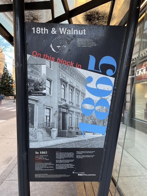
On this block in 1865
This handsome structure at the southeast corner of 18th & Walnut Streets, shown circa 1865, was home to William Weightman, a wealthy industrial magnate. The Rittenhouse Claridge, built in 1951, now stands on the site.
In 1865
President: Abraham Lincoln (R), Andrew Johnson (D)
Mayor: Alexander Henry (R)
Philadelphia population: 565,529
Money matters
U.S. Army Corporal's monthly pay: $20.00
Farm laborer's average monthly earnings: $12.75
Machinist's daily wage: $2.56
Philadelphia plasterer's daily wage: $2.29/week
Postage stamp: 3˘
Philadelphia passenger railway fares raised raised to 7˘
Events
April 3—News of the Union Army's capture of Richmond, Virginia reached Philadelphia, which initiated a great rejoicing. The State House bell was rung, blowing of steam whistles filled the streets, and striking of gongs took place in front of Independence Hall.
April 9—News of General Lee's Army surrender reached Philadelphia, which signified that the Union Army had won the Civil War.
April 15—The news of the assassination of Abraham Lincoln at Ford's Theatre in Washington, D.C. on the evening of Good Friday, April 14 reached Philadelphia, which resulted in general mourning throughout the city.
April 22—President Lincoln's body was escorted to Independence Hall by a large military and civic procession.
December 6—Slavery is abolished in the United States by the passing and ratification of the 13th Amendment.
Erected 2017 by Center City District, Philadelphia.
Topics and series. This historical marker is listed in these topic lists: Abolition & Underground RR • Industry & Commerce • Notable Buildings • War, US Civil. In addition, it is included in the Former U.S. Presidents: #16 Abraham Lincoln, and the Pennsylvania, Ride! Philadelphia series lists. A significant historical date for this entry is April 3, 1865.
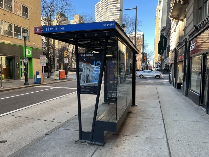
Location. 39° 57.009′ N, 75° 10.224′ W. Marker is in Philadelphia, Pennsylvania, in Philadelphia County. It is in Rittenhouse Square. Marker is on Walnut Street just east of South 18th Street, on the right when traveling west. Touch for map. Marker is at or near this postal address: 1735 Walnut St, Philadelphia PA 19103, United States of America. Touch for directions.
Other nearby markers. At least 8 other markers are within walking distance of this marker. Rittenhouse Square (about 300 feet away, measured in a direct line); The Latham Hotel (about 400 feet away); 17th & Walnut (about 400 feet away); Vincent Persichetti (about 500 feet away); 19th & Walnut (about 500 feet away); J. William White
Credits. This page was last revised on February 2, 2023. It was originally submitted on February 11, 2022, by Devry Becker Jones of Washington, District of Columbia. This page has been viewed 322 times since then and 98 times this year. Photos: 1, 2. submitted on February 11, 2022, by Devry Becker Jones of Washington, District of Columbia.

