Charlestown in Boston in Suffolk County, Massachusetts — The American Northeast (New England)
Paul Revere’s Landing
Boston National Historical Park
— Charlestown Navy Yard —
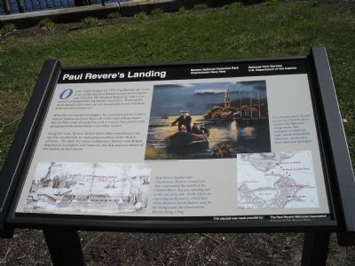
When Revere reached Lexington, he cautioned patriot leaders Samuel Adams and John Hancock of the impending danger. Revere then rode towards Concord to ensure that patriot arms and gunpowder stored there were safely hidden.
Along his route, Revere alerted other riders who fanned out into the countryside to warn patriot militias of the British advance. On April 19, patriot militiamen clashed with British Regulars in Lexington and Concord, the first major conflicts of the American Revolution.
This wayside was made possible by: The Paul Revere Memorial Association and Friends of City Square Park.
Erected by Boston National Historical Park.
Topics. This historical marker is listed in these topic lists: Notable Events • War, US Revolutionary. A significant historical date for this entry is April 18, 1775.
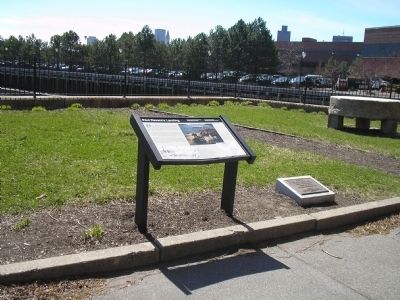
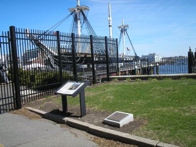
Location. 42° 22.35′ N, 71° 3.446′ W. Marker is in Boston, Massachusetts, in Suffolk County. It is in Charlestown. Marker can be reached from Constitution Road, on the right when traveling east. Marker is located in the Charlestown Navy Yard, near the USS Constitution. Touch for map. Marker is in this post office area: Charlestown MA 02129, United States of America. Touch for directions.
Other nearby markers. At least 8 other markers are within walking distance of this marker. Paul Revere (here, next to this marker); USS Constitution (a few steps from this marker); Gate One, Charlestown Navy Yard (a few steps from this marker); "A state of perfect chaos" (within shouting distance of this marker); Tudor Wharves (within shouting distance of this marker); Charlestown Navy Yard (within shouting distance of this marker); Breakthrough (within shouting distance of this marker); Explore the Navy Yard (about 300 feet away, measured in a direct line). Touch for a list and map of all markers in Boston.
More about this marker. The top of the marker features a picture of Paul Revere being rowed across the Charles River towards the site of the marker. It has the caption “Two friends rowed Revere across the Charles River. Despite the light of a rising moon, they managed to elude the night watch of the HMS Somerset, anchored a short distance upstream.” The bottom left of the marker contains a Revere engraving, courtesy of the American Antiquarian Society, of a view from the Charlestown Battery. Beside this is the caption “Paul Revere landed near Charlestown Battery, a small fort that commanded the mouth of
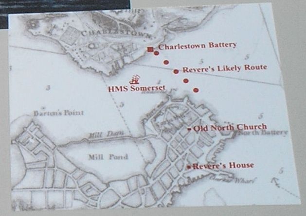
the Charles River. You are standing just to the east of its site. To the left is an engraving by Revere (c. 1762) that shows Boston’s North Battery and, in the background, the Charlestown Battery flying a flag.” The marker’s bottom right features a map of the likely route of Revere’s crossing of the Charles River (see below).
Also see . . .
1. Biography of Paul Revere. The American Revolution website. (Submitted on April 15, 2009, by Bill Coughlin of Woodland Park, New Jersey.)
2. The midnight Ride of Paul Revere. Text of the poem by Henry Wadsworth Longfellow. (Submitted on April 15, 2009, by Bill Coughlin of Woodland Park, New Jersey.)
Credits. This page was last revised on January 30, 2023. It was originally submitted on April 15, 2009, by Bill Coughlin of Woodland Park, New Jersey. This page has been viewed 3,262 times since then and 104 times this year. Last updated on February 11, 2022, by Carl Gordon Moore Jr. of North East, Maryland. Photos: 1, 2, 3, 4. submitted on April 15, 2009, by Bill Coughlin of Woodland Park, New Jersey. • J. Makali Bruton was the editor who published this page.


