Williamsport in Lycoming County, Pennsylvania — The American Northeast (Mid-Atlantic)
Booming Business
The Timber Trail
— Susquehanna Riverwalk —
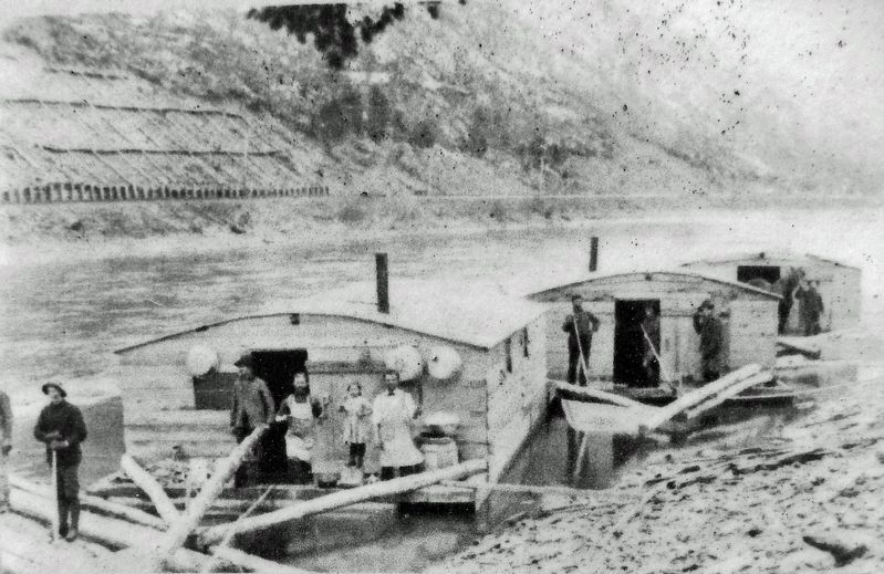
In a Susquehanna River log drive, tens of thousands of logs floated downstream like a freight train on water. Without some means of diverting them to riverside millyards, they'd surge right out to the Chesapeake Bay. Williamsport, settled along a long, flat stretch of the river at a wide bend that naturally pushed logs to one side, made an ideal stopping point.
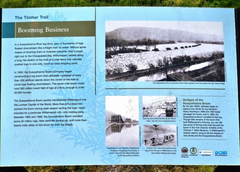
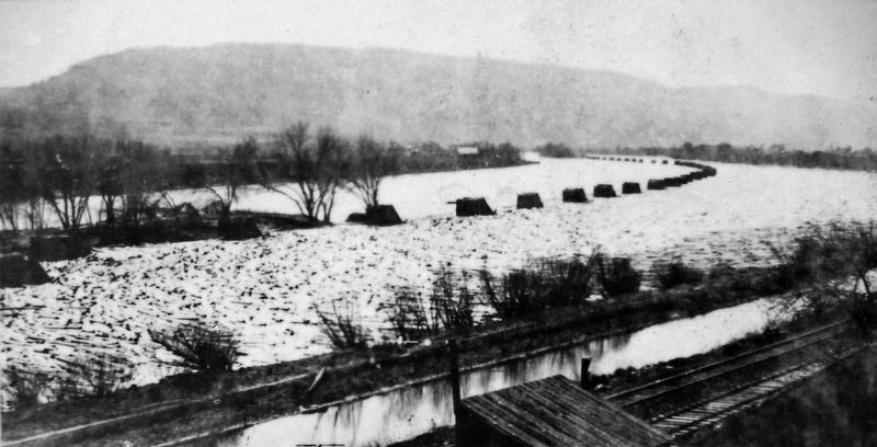
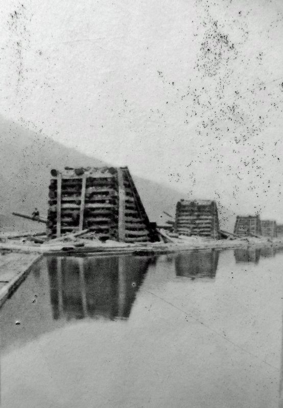
In 1850, the Susquehanna Boom Company began constructing a log boom that ultimately consisted of more than 400 artificial islands down the center of the river to corral logs floating downstream. The seven-mile boom could hold 300 million board feet of logs at a time, enough to build 30,000 houses.
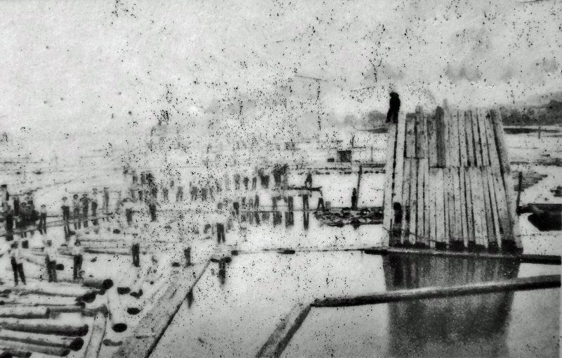
The Susquehanna Boom quickly transformed Williamsport into the Lumber Capital of the World. More than a hundred men worked the boom during peak season sorting the logs — each branded for a particular Williamsport mill — into holding pens. Between 1862 and 1898, the Susquehanna Boom corralled some 40 million logs. New sawmills sprang up, until more than twenty mills relied on the boom for their log supply.
Vestiges of the Susquehanna Boom
By the late 1800s, railroads began to replace river drives for log transport. Heavy flooding in 1889 and 1894 badly damaged the boom, and in 1909, the Susquehanna Boom corralled its last log. Though little remains of the boom that built Williamsport's fortunes, you can still see some of the log cribs that secured the boom in the river channel. Exhibits at the Thomas T. Taber Museum, in Williamsport's historic district, bring to life the heyday of river drives and the Susquehanna Boom.
Erected by Lumber Heritage Region of Pennsylvania, Inc., and Pennsylvania Department of Conservation & Natural Resources.
Topics. This historical marker is listed in these topic lists: Horticulture & Forestry • Industry & Commerce • Waterways & Vessels. A significant historical year for this entry is 1850.
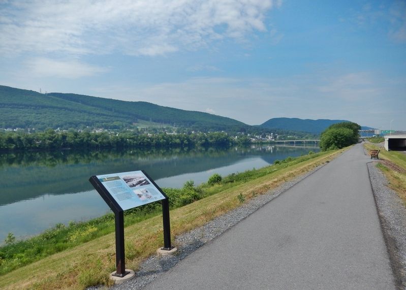
Location. 41° 14.063′ N, 77° 0.49′ W. Marker is in Williamsport, Pennsylvania, in Lycoming County. Marker can be reached from Market Street (U.S. 15) just south of Susquehanna Beltway (U.S. 220), on the right when traveling south. Marker is located along the Susquehanna Riverwalk, on the north side of the West Branch Susquehanna River, between Market Street and Maynard Street. Touch for map. Marker is in this post office area: Williamsport PA 17701, United States of America. Touch for directions.
Other nearby markers. At least 8 other markers are within walking distance of this marker. Julia C. Collins (about 300 feet away, measured in a direct line); The Mills that Made Williamsport (about 400 feet away); Spars and Sticks: Rafting the West Branch (approx. 0.2 miles away); Traveling Through a Rugged Region
(approx. ¼ mile away); Floods on the Susquehanna (approx. 0.3 miles away); Williamsport's Lumber Barons (approx. 0.3 miles away); Restoring the Forests (approx. 0.3 miles away); William 'Bill' Pickelner (approx. 0.4 miles away). Touch for a list and map of all markers in Williamsport.
Related markers. Click here for a list of markers that are related to this marker. The Timber Trail
Also see . . .
1. Inventing The Boom.
By 1846, three men, John Leighton & Major James, and John DuBois formed the Susquehanna Boom Co., and they created an area on the river to store logs. Leighton & Perkins were timbermen from Maine, where log booms were already in place. In Williamsport, where they joined with Dubois, they had been unheard of, and local men were skeptical it would work. The ideal location was right nearby. An area known as "Long Reach" formed the southern border of the town. The bend in the river at this point, and for miles above, naturally draws the logs to the south side of the stream, and the river is almost level for miles beyond, preventing swift currents during low water stages.(Submitted on February 14, 2022, by Cosmos Mariner of Cape Canaveral, Florida.)
2. Susquehanna Log Boom.
The boom consisted of 352 cribs, or man-made islands of stone and sunken timbers, that were 22 feet high. The booms were connected to each other by chains of floating logs. At the upper end of the boom was the 1,000-foot-long “sheer boom,” which could be opened and closed. It gathered the logs into the main boom, which could hold up to 300 million board feet of logs. At the lower end, men and boys as young as 12, known as "boom rats" would sort the logs by the sawmill brand that was burned into each log.(Submitted on February 14, 2022, by Cosmos Mariner of Cape Canaveral, Florida.)
3. Susquehanna Boom.
The Susquehanna Boom lost its profitability for three main reasons. First were the periodic floods that swept down the West Branch Valley, destroying boom components and sawmills. Second were the newly constructed railroads in North Central Pennsylvania. These railroads were able to transport the fresh timber more quickly and were less risky, expensive and dangerous than floating the logs down the West Branch Susquehanna River and its tributaries. Thirdly, little thought for the future was placed when the massive stands of old growth forest were harvested during the 19th century. The mountains were clear cut. Without trees, the sawmills could no longer process timber, the mills closed and eventually the boom itself was forced to close in 1908.(Submitted on February 14, 2022, by Cosmos Mariner of Cape Canaveral, Florida.)
Credits. This page was last revised on February 14, 2022. It was originally submitted on February 13, 2022, by Cosmos Mariner of Cape Canaveral, Florida. This page has been viewed 158 times since then and 24 times this year. Photos: 1, 2, 3, 4, 5, 6. submitted on February 14, 2022, by Cosmos Mariner of Cape Canaveral, Florida.
