Ausable in Clinton County, New York — The American Northeast (Mid-Atlantic)
Quaker Union
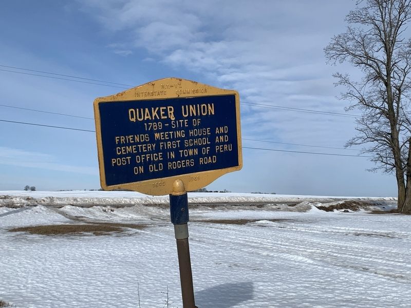
Photographed by Michael Basedow, February 13, 2022
1. Quaker Union Marker
Friends Meeting House and
Cemetery First School and
Post Office in Town of Peru
on Old Rogers Road
Erected 1959 by N.Y - VT Interstate Commission.
Topics. This historical marker is listed in these topic lists: Cemeteries & Burial Sites • Religion & Religious Structures • Settlements & Settlers. A significant historical year for this entry is 1789.
Location. 44° 32.668′ N, 73° 31.855′ W. Marker is in Ausable, New York, in Clinton County. It is at the intersection of Union Road (County Route 39) and Brown Road, on the right when traveling north on Union Road. Touch for map. Marker is in this post office area: Peru NY 12972, United States of America. Touch for directions.

Regionally, this marker is in Upstate New York, in the Adirondacks & North Country, and in the Champlain Valley. It is also in the American Northeast and in the Mid-Atlantic. Globally, it is in North America, the Great North Woods, the Western Hemisphere, the Western World, and the Anglosphere. Historically, it finds itself in what was once the Viceroyalty of New France, New Netherland, and one of the original
this page online
Other nearby markers. At least 8 other markers are within 4 miles of this marker, measured as the crow flies: A different marker also named Quaker Union (approx. 0.2 miles away); Keese Homestead (approx. 0.3 miles away); Underground Railroad (approx. 1.1 miles away); a different marker also named Underground Railroad (approx. 1.4 miles away); Nathan Lapham Home Underground RR Site (approx. 2.3 miles away); Goshen (approx. 2.3 miles away); Harkness Church (approx. 2.4 miles away); Evergreen Cemetery (approx. 3.3 miles away).
Credits. This page was last revised on November 27, 2023. It was originally submitted on February 13, 2022, by Michael Basedow of Peru, New York. This page has been viewed 650 times since then and 32 times this year. Photo 1. submitted on February 13, 2022, by Michael Basedow of Peru, New York. • Michael Herrick was the editor who published this page.
