Lorain in Lorain County, Ohio — The American Midwest (Great Lakes)
Founding of Lorain, Ohio
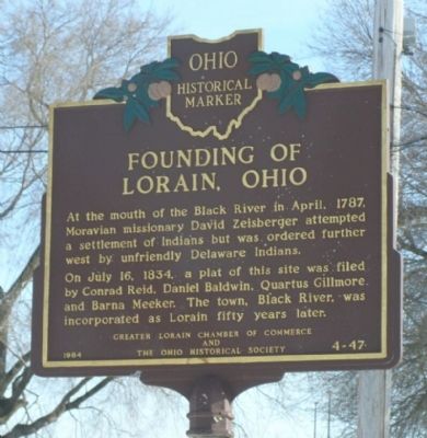
Photographed by Christopher Light, February 16, 2008
1. Founding of Lorain, Ohio Marker
Erected 1984 by The Greater Lorain Chamber of Commerce, The Ohio Historical Society. (Marker Number 4-47.)
Topics and series. This historical marker is listed in these topic lists: Indigenous Peoples and Communities • Settlements & Settlers. In addition, it is included in the Ohio Historical Society / The Ohio History Connection series list. A significant historical month for this entry is April 1787.
Location. 41° 28.279′ N, 82° 10.625′ W. Marker is in Lorain, Ohio, in Lorain County. It is at the intersection of Lakeside Avenue and Alabama Avenue, on the right when traveling west on Lakeside Avenue. Marker is on the east side of the Black River, near a boat ramp. From US 6 (East Erie Ave), east of the river (over the bridge) to Colorado Street (traffic light),
this page online

Regionally, this marker is in Greater Cleveland, on the Lake Erie Shore, and in the Western Reserve. It is also in the American Midwest. Globally, it is in North America, on the Great Lakes, in the Western Hemisphere, in the Western World, and in the Anglosphere. Historically, it finds itself in what was once the Haudenosaunee (Iroquois) Confederacy, the territory of the Mississippian Culture, and the Northwest Territory.
Other nearby markers. At least 8 other markers are within walking distance of this marker: Trading Post (a few steps from this marker); Lorain Station 100 (approx. ¼ mile away); Lorain West Breakwater Lighthouse / Saving the Lorain Lighthouse (approx. ¼ mile away); The Lorain Tornado, 1924 (approx. ¼ mile away); Veterans Memorial Park (approx. 0.3 miles away); Our Fathers (approx. 0.3 miles away); Veterans Memorial (approx. 0.3 miles away); Shipbuilding (approx. 0.4 miles away). Touch for a list and map
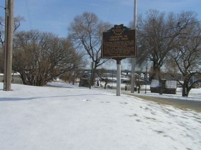
Photographed by Christopher Light, February 11, 2008
2. Founding of Lorain, Ohio Marker
Additional keywords. American Indian, indigenous
Credits. This page was last revised on February 18, 2022. It was originally submitted on February 20, 2008, by Christopher Light of Valparaiso, Indiana. This page has been viewed 1,817 times since then and 50 times this year. Last updated on February 17, 2022, by Sundance of Lorain County, Ohio. Photos: 1, 2. submitted on February 20, 2008, by Christopher Light of Valparaiso, Indiana. • Devry Becker Jones was the editor who published this page.
