Mercersburg in Franklin County, Pennsylvania — The American Northeast (Mid-Atlantic)
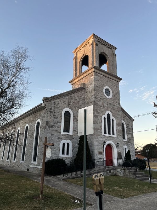
The Mercersburg Presbyterian Church
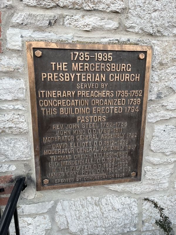
1735 - 1935

Photographed By Devry Becker Jones (CC0), February 19, 2022
1. The Mercersburg Presbyterian Church Marker
Itinerary Preachers 1735 - 1752
Congregation organized 1738
This building erected 1794
Pastors
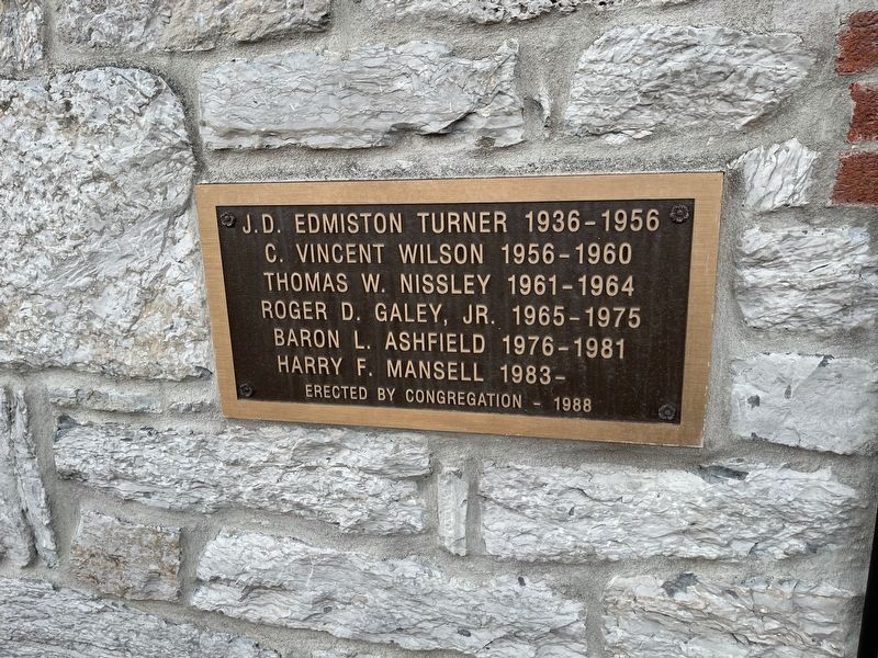
[Supplemental plaque added in 1988:]
J.D. Edmiston Turner 1936-1956 • C. Vincent Wilson 1956-1960 • Thomas W. Nissley 1961-1965 • Roger D. Galey, Jr. 1965-1975 • Baron L. Ashfield 1976-1981 • Harry F. Mansell 1983-
Erected 1935 by The Mercersburg Presbyterian Church Congregation.
Topics. This historical marker is listed in these topic lists: Churches & Religion • Colonial Era. A significant historical year for this entry is 1735.
Location. 39° 49.681′ N, 77° 54.338′ W. Marker is in Mercersburg, Pennsylvania, in Franklin County. Marker is at the intersection of West Seminary Street and South Park Avenue, on the left when traveling west on West Seminary Street. Touch for map. Marker is at or near this postal address: 34 W Seminary St, Mercersburg PA 17236, United States of America. Touch for directions.
Other nearby markers. At least 8 other markers are within walking distance of this marker. Col. Murphy's Hotel (about 500 feet away, measured in a direct line); Citizens Seized (about 500 feet away); James Buchanan (about 500 feet away); Lane House (about 500 feet away); The Irwin House (about 500 feet away); Buchanan House (about 500 feet away); John Darby, Lot 14, 1786 (about 500 feet away); Captain Robert Parker House (about 600 feet away). Touch for a list and map of all markers in Mercersburg.
Credits. This page was last revised on May 16, 2022. It was originally submitted on February 20, 2022, by Devry Becker Jones of Washington, District of Columbia. This page has been viewed 253 times since then and 13 times this year. Photos: 1, 2, 3. submitted on February 20, 2022, by Devry Becker Jones of Washington, District of Columbia.

