Logan Square in Philadelphia in Philadelphia County, Pennsylvania — The American Northeast (Mid-Atlantic)
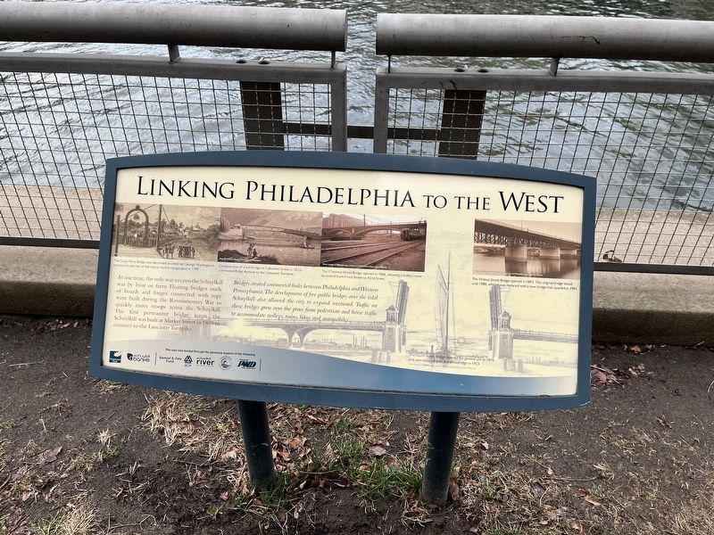
Linking Philadelphia to the West

Photographed By Devry Becker Jones (CC0), February 25, 2022
1. Linking Philadelphia to the West Marker
At one time, the only way to cross the Schuylkill was by boat or ferry. Floating bridges made of boards and barges connected with rope were built during the Revolutionary War to quickly move troops across the Schuylkill. The first permanent bridge across the Schuylkill was built at Market Street in 1805 to connect to the Lancaster Turnpike.
Bridges created commercial links between Philadelphia and Western Pennsylvania. The development of free public bridges over the tidal Schuylkill also allowed the city to expand westward. Traffic on these bridges grew over the years from pedestrian and horse traffic to accommodate trolleys, trains, bikes and automobiles.
[Captions:]
The Grays Ferry Bridge was decorated to celebrate George Washington's entrance to the city on the way to his first inauguration in 1789.
Construction of a toll bridge at Callowhill Street in 1812 connected Ridge Avenue to the Lancaster Turnpike.
The Chestnut Street Bridge opened in 1866, allowing a trolley route to extend from Front Street to 42nd Street.
The Walnut Street Bridge opened in 1893. The original bridge stood until 1988, when it was replaced with a new bridge that opened in 1991.
The South Street Bridge opened for general use in 1876 and was replaced with this drawbridge in 1923.
Erected by Fairmount Park Conservancy; Schuylkill Banks.
Topics and series. This historical marker is listed in these topic lists: Bridges & Viaducts • War, US Revolutionary • Waterways & Vessels. In addition, it is included in the Former U.S. Presidents: #01 George Washington series list. A significant historical year for this entry is 1805.
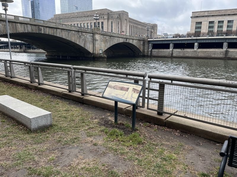
Location. 39° 57.299′ N, 75° 10.77′ W. Marker is in Philadelphia, Pennsylvania, in Philadelphia County. It is in Logan Square. Marker is on Schuylkill River Trail north of Market Street (Pennsylvania Route 3), on the right when traveling south. Touch for map. Marker is at or near this postal address: 2451 Market St, Philadelphia PA 19103, United States of America. Touch for directions.
Other nearby markers. At least 8 other markers are within walking distance of this marker. A Revolutionary River (a few steps from this marker); You Are Here, In the Year… (within shouting distance of this marker); Schuylkill Permanent Bridge (about 300 feet away, measured in a direct line); First Troop Philadelphia City Cavalry (about 700 feet away); Industry Transforms the Hidden River (approx. 0.2 miles away); Rolling Along (approx. 0.2 miles away); June 5th Memorial (approx. 0.2 miles away); The College of Physicians of Philadelphia Building (approx. 0.2 miles away). Touch for a list and map of all markers in Philadelphia.

Photographed By Devry Becker Jones (CC0), February 25, 2022
2. Linking Philadelphia to the West Marker
Credits. This page was last revised on February 2, 2024. It was originally submitted on February 27, 2022, by Devry Becker Jones of Washington, District of Columbia. This page has been viewed 124 times since then and 8 times this year. Photos: 1, 2. submitted on February 27, 2022, by Devry Becker Jones of Washington, District of Columbia.