Penn's Landing in Philadelphia in Philadelphia County, Pennsylvania — The American Northeast (Mid-Atlantic)
The Growth of the City / The Trees of the City

Photographed By Devry Becker Jones (CC0), February 26, 2022
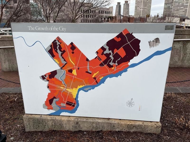
1. The Growth of the City side of the marker
The Growth of the City
[The City of Philadelphia's boundaries are shown as it expanded from 1800 to 1980.]
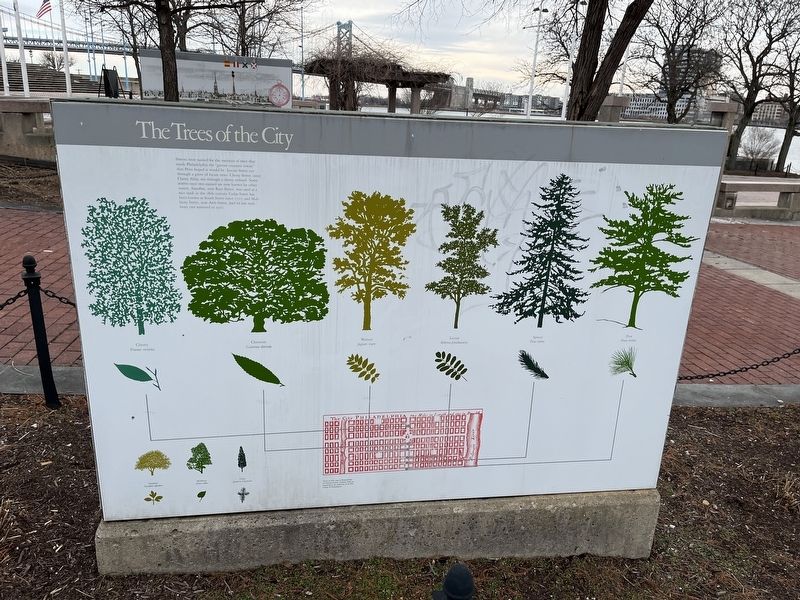
The Trees of the City
Streets were named for the varieties of trees that made Philadelphia the "greene countrie towne" that Penn hoped it would be. Locust Street cut through a grove of locust trees. Cherry Street, once Cherry Alley, ran through a cherry orchard. Some streets once tree-named are now known by other names. Sassafras, now Race Street, was used as a race track in the 18th century. Cedar Street has been known as South Street since 1707, and Mulberry Street, now Arch Street, had its last mulberry tree removed in 1917.
Topics. This historical marker is listed in these topic lists: Colonial Era • Horticulture & Forestry • Roads & Vehicles • Settlements & Settlers. A significant historical year for this entry is 1800.
Location. 39° 56.817′ N, 75° 8.421′ W. Marker is in Philadelphia, Pennsylvania, in Philadelphia County. It is in Penn's Landing. Marker is on South Christopher Columbus Boulevard north of Walnut Plaza, on the right when traveling north. Touch for map. Marker is at or near this postal address: 121 S Christopher Columbus Blvd, Philadelphia PA 19106, United States of America. Touch for directions.
Other nearby markers. At least 8 other markers are within walking distance of this marker. 1710 (here, next to this marker); 1855 (here, next to this marker); 1754 (here, next to this marker); 1689 (here, next to this marker); 1792 (here, next to this marker); 1832 (here, next to this marker); 1874 (a few steps from this marker); 1768 (a few steps from this marker). Touch for a list and map of all markers in Philadelphia.
Additional commentary.
1. About the City of Philadelphia
The borders of the City of Philadelphia are currently the same as the borders of Philadelphia County. They are the only municipality and county in the Commonwealth of Pennsylvania with conterminous borders.
— Submitted March 1, 2022, by Devry Becker Jones of Washington, District of Columbia.

Photographed By Devry Becker Jones (CC0), February 26, 2022
2. The Trees of the City side of the marker
Credits. This page was last revised on February 2, 2024. It was originally submitted on March 1, 2022, by Devry Becker Jones of Washington, District of Columbia. This page has been viewed 67 times since then and 15 times this year. Photos: 1, 2. submitted on March 1, 2022, by Devry Becker Jones of Washington, District of Columbia.