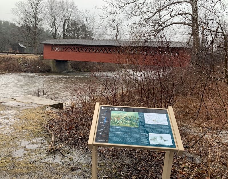
North Bennington in Bennington County, Vermont — The American Northeast (New England)
McWaters Park
A Brief History
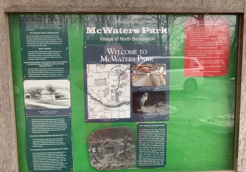
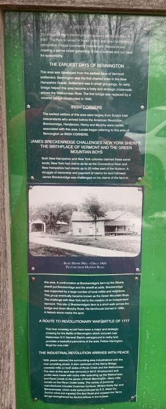
The Village of North Bennington established McWaters Park in 2007. The Park is named in honor of Rob and Jean McWaters in recognition of local community involvement. Residents are creating a perma forest consisting of berry bushes and nut tress for sustanibility.
The Earliest Days of Bennington
This area was developed from the earliest days of Vermont settlement. Bennington was the first charted town in the New Hampshire Grants. Settlement was in small groupings. An early bridge helped this area become a lively and strategic crossroads across the Walloomsac River. The first bridge was replaced by a covered bridge constructed in 1840.
Irish Corners
The earliest settlers of this area were largley from Scotch Irish descendants who arrived before the American Revolution. Breckenridge, Henderson, Henry and Murphy were names associated with this area. Locals began referring to this area of Bennington as IRISH CORNERS.
James Breckinridge Challenges New York Sheriff: The Birthplace Of Vermont And The Green Mountain Boys
Both New Hampshire and New York colonies claimed these same lands; New York had claims as far as the Connecticut River and New Hampshire had claims up to 20 miles east of the Hudson. A struggle of ownership and payment of claims for land followed. James Breckenridge was challenged on his claims of the farm in
(photo caption) Burt Henry Mill - Circa 1900. Picture from Murphy Road.
this area. A confrontation at Breckenridge's farm by the Albany sheriff put Breckenridge and the sheriff at odds. Breckenridge was supported by a large number of local militia and neighbors. This group eventually became known as the Green Mountain Boys. The challenge with New York led to the creation of an independent Vermont. This site of Breckenridge's farm is a short walk across the bridge and down Murphy Road. His farmhouse búrned in 1869. A historic stone marks the spot.
A Route to Revolutionary War Battle of 1777
This river crossing would have been a major and strategic crossing for the Battle of Bennington which occurred near Wallomsac N.Y: General Stark's campground is nearby and provides a beautiful panorama of the area. Follow Harrington Road for one mile.
The Industrial Revolution Arrives With Peace
With peace restored the surrounding area industrialized with the river providing power. A dam upstream of the Henry Bridge powered mills on both sides of Paran Creek and the Walloomsac. The dam at this spot was removed in 2013. Employment and profits were made with many mills extending up the Walloomsac and Paran Creek to the center of North Bennington. Many mills remain on the Paran Creek today. The variety of products manufactured included Cushman furniture, White's Kiddy Kar and Stereoscopes. Union suits ware produced by E.Z. Waist Co. Burden mine iron traveled Ore Bed Road and crossed the Henry Bridge strengthened by double rattices in the trusses.
High Water on the Walloomsac
The Walloomsac River flows 16.8 miles through Woodford and Bennington, VT on its way to the Hoosick River in North Woosick, NY. The Walloomsac drains a large area of the front range of the Green Mountains. Normally it is calm and flows between its banks. But at times it can be a wild river and overflow them. The river forms many channels in Bennington town, but it is united as it pasts here. This park stands on the Walloomsac’s 500-year flood plain. During Topical Storm Irene, August 28, 2011, the river rose quickly, completely covering McWaters’ Park. Eyewitness reports tell of the water lapping against the siding of the Henry Covered Bridge. At the time of Irene, the park was under development with just a few picnic tables. They survived in place because they were chained to mature trees. This original etched slate by North Bennington artist Muriel Rice shows such a period of high water.
(illustrations and photos)
North Bennington - Circa 1840’s
Historic River Crossing - Henry Covered Bridge - Circa 1840’s
Natural Habitat for Blue Herons, Ospreys, and Eagles. Sustainable Forest.
Topics. This historical marker is listed in these topic lists: Colonial Era • Industry & Commerce • Settlements & Settlers • War, US Revolutionary. A significant historical year for this entry is 2007.
Location. 42° 54.757′ N, 73° 15.235′ W. Marker is in North Bennington, Vermont, in Bennington County. Marker is at the intersection of River Road and Murphy Road, on the left when traveling west on River Road. Touch for map. Marker is in this post office area: North Bennington VT 05257, United States of America. Touch for directions.
Other nearby markers. At least 8 other markers are within 2 miles of this marker, measured as the crow flies. Hub of History (within shouting distance of this marker); Henry Covered Bridge (about 300 feet away, measured in a direct line); Seth Warner House (approx. 0.2 miles away); Birthplace of Vermont (approx. 0.3 miles away); Paper Mill History / Covered Bridges Span Rivers And Time (approx. one mile away); The Paper Mill Village Bridge (approx. one mile away); Park-McCullough House (approx. 1.2 miles away); Railroad Station (approx. 1½ miles away). Touch for a list and map of all markers in North Bennington.
Credits. This page was last revised on February 16, 2023. It was originally submitted on March 7, 2022, by Steve Stoessel of Niskayuna, New York. This page has been viewed 175 times since then and 42 times this year. Photos: 1, 2, 3, 4, 5. submitted on March 8, 2022, by Steve Stoessel of Niskayuna, New York. • Michael Herrick was the editor who published this page.
