Ossining in Westchester County, New York — The American Northeast (Mid-Atlantic)
Lower Main Street Ossining / Ossining de la Calle Lower Main
Ossining, New York
— The Museum in the Streets© —

Photographed By Devry Becker Jones (CC0), March 5, 2022
1. Lower Main Street Ossining / Ossining de la Calle Lower Main Marker
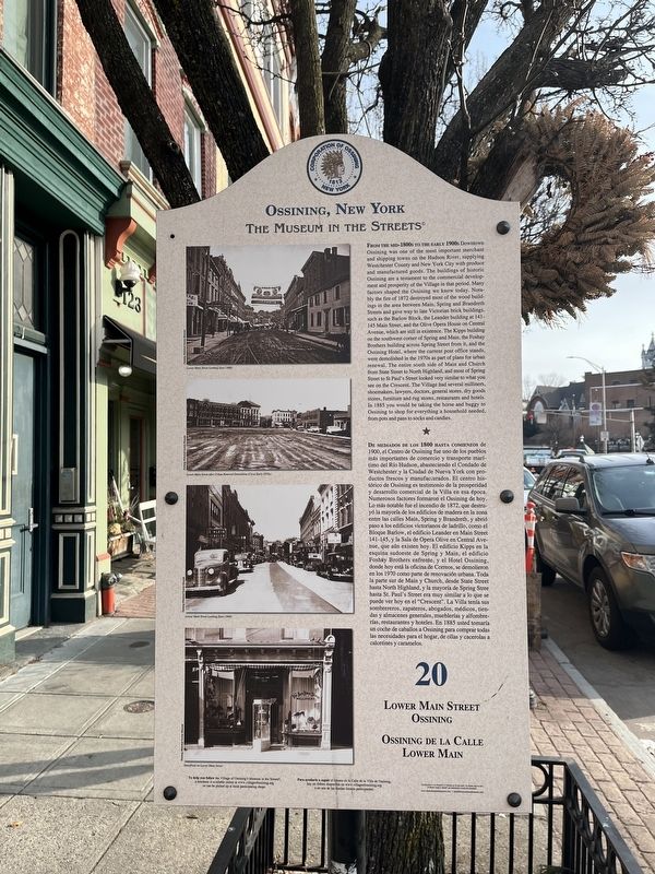
Lower Main Street Ossining
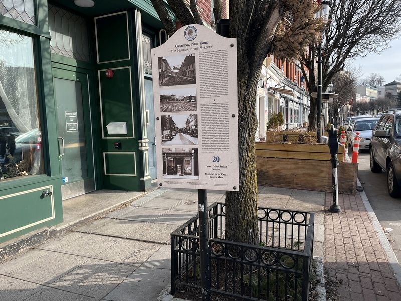
From the mid-1800s to the early 1900s Downtown Ossining was one of the most important merchant and shipping towns on the Hudson River, supplying Westchester County and New York City with produce and manufactured goods. The buildings of historic Ossining are a testament to the commercial development and prosperity of the Village in that period. Many factors shaped the Ossining we know today. Notably the fire of 1872 destroyed most of the wood buildings in the area between Main, Spring, and Brandreth Streets and gave way to late Victorian brick buildings, such as the Barlow Block, the Leander building at 141-145 Main Street, and the Olive Opera House on Central Avenue, which are still in existence. The Kipps building on the southwest corner of Spring and Main, the Foshay Brothers building across Spring Street from it, and the Ossining Hotel, where the current post office stands, were demolished in the 1970s as part of plans for urban renewal. The entire south side of Main and Church from State Street to North Highland, and most of Spring Street to St Paul's Street looked very similar to what you see on the Crescent. The Village had several milliners, shoemakers, lawyers, doctors, general stores, dry goods stores, furniture and rug stores, restaurants and hotels. In 1885 you would be taking the horse and buggy to Ossining to shop for everything a household needed, from pots and pans to socks and candles.
De mediados de los 1800 hasta comienzos de 1900, el Centro de Ossining fue uno de los pueblos más importantes de comercio y transporte marítimo del Río Hudson, abasteciendo el Condado de Westchester y la Ciudad de Nueva York con productos frescos y manufacturados. El centro histórico de Ossining es testimonio de la prosperidad y desarrollo comercial de la Villa en esa época. Numerosos factores formaron el Ossining de hoy. Lo más notable fue el incendio de 1872, que destruyó la mayoría de los edificios de madera en la zona entre las calles Main, Spring y Brndreth, y abrió paso a los edificios victorianos de ladrillo, como el Bloque Barlow, el edificio Leander en Main Street 141-145, y la Sala de Opera Olive en Central Avenue, que aún existen hoy. El edificio Kipps en la esquina sudoeste de Spring y Main, el edificio Foshay Brothers enfrente, y el Hotel Ossining, donde hoy está la oficina de Correos, se demolieron en los 1970 como parte de renovación urbana. Toda la parte sur de Main y Church, desde State

Photographed By Devry Becker Jones (CC0), March 5, 2022
2. Lower Main Street Ossining / Ossining de la Calle Lower Main Marker
Erected by The Museum in the Streets©. (Marker Number 20.)
Topics and series. This historical marker is listed in these topic lists: Industry & Commerce • Roads & Vehicles. In addition, it is included in the The Museum in the Streets®: Ossining, New York series list. A significant historical year for this entry is 1872.
Location. 41° 9.643′ N, 73° 51.861′ W. Marker is in Ossining, New York, in Westchester County. Marker is on Main Street south of Central Avenue, on the right when traveling south. Touch for map. Marker is at or near this postal address: 121 Main St, Ossining NY 10562, United States of America. Touch for directions.
Other nearby markers. At least 8 other markers are within walking distance of this marker. The Ossining National Bank / El Banco Nacional de Ossining (within shouting distance of this marker); Bella Vista and the Secor Road Stone Wall / Bella Vista y la Pared de Piedra de Secor Road (about 400 feet away, measured in a direct line); The Calvary Baptist Church and Annex / La Iglesia Bautista Calvary y Anexo (about 400 feet away); Ossining, New York (about 600 feet away); The Old Croton Aqueduct Promenade / El Paseo Marítimo del acueducto Old Croton (about 600 feet away); The Old Croton Aqueduct (about 600 feet away); The Double Arch / El Doble Arco (about 700 feet away); The Mount Pleasant Academy Library / La Biblioteca de la Academia Mount Pleasant (about 700 feet away). Touch for a list and map of all markers in Ossining.
Credits. This page was last revised on March 9, 2022. It was originally submitted on March 8, 2022, by Devry Becker Jones of Washington, District of Columbia. This page has been viewed 164 times since then and 28 times this year. Photos: 1, 2. submitted on March 8, 2022, by Devry Becker Jones of Washington, District of Columbia.