Near Williamsport in Washington County, Maryland — The American Northeast (Mid-Atlantic)
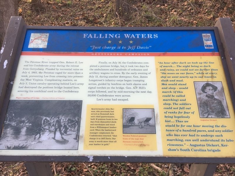
Falling Waters
"Just charge it to Jeff Davis"
— Gettysburg Campaign —
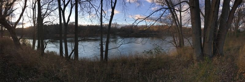
Finally, on July 10, the Confederates completed a pontoon bridge, but it took two days for the ambulances and hundreds of ordnance and artillery wagons to cross. By the early evening of July 13, during another downpour, Gen. James Longstreet's infantry corps began tramping across, guided by bonfires on both shores and signal torches on the bridge. Gen. A.P. Hill's corps followed, and by mid-morning the next day, 30,000 Confederates we across.
Lee's army had escaped.
(sidebar)
Quartermaster John Harman, who previously had served as Stonewall Jackson's chief quartermaster, built 16 pontoon boats in two days from dismantled sheds and warehouses and wood from a Williamsport lumberyard. When the lumberyard manager complained, the Confederates retorted: "Just charge it to Jeff Davis. Our army is worth more than all your lumber in gold."
(sidebar)
"An hour after dark we took up the line of march.... The night being so dark and rainy, we could not see farther than "the noses on our faces," while at every step we went nearly up to our knees in slush and mud. Men would stand and sleep - would march (if this could be called marching) and sleep. The soldiers could not fall out of ranks for fear of being hopelessly lost.... Thus we would be for one hour moving the distance of a hundred paces, and any soldier who has ever had to undergo such marching, can well understand its laboriousness." - Augustus Dickert, Kershaw's South Carolina brigade
(captions)
Wagon toppling off bridge. - Courtesy Library of Congress
Wooden Federal pontoon boats of the type that Harman constructed. - Courtesy Library of Congress
Augustus Dickert
Erected by Maryland Civil War Trails.
Topics and series. This historical marker is listed in this topic list: War, US Civil. In addition, it is included in the Maryland Civil War Trails series list. A significant historical date for this entry is July 10, 1863.
Location. 39° 33.437′ N, 77° 53.078′ W. Marker is near Williamsport, Maryland, in Washington County. Marker is located along the C&O Canal Trail. Touch for map. Marker is in this post office area: Williamsport MD 21795, United States of America. Touch for directions.
Other nearby markers. At least 8 other markers are within 2 miles of this marker, measured as the crow flies. A different marker also named Falling Waters (a few steps from this marker); Battles of Falling Waters (approx. ¼ mile away in West Virginia); Battle of Hoke's Run (approx. 0.4 miles away in West Virginia); Battle of Falling Waters (approx. 1½ miles away in West Virginia); a different marker also named Battle of Falling Waters (approx. 1.6 miles away in West Virginia); a different marker also named Battle of Falling Waters (approx. 1.7 miles away); Battle of Falling Waters (MD) Preservation Project (approx. 1.7 miles away); Stumpy’s Hollow (approx. 1.9 miles away in West Virginia). Touch for a list and map of all markers in Williamsport.
Also see . . . Chesapeake & Ohio Canal National Historical Park. National Park Service (Submitted on March 16, 2022.)
Credits. This page was last revised on March 16, 2022. It was originally submitted on March 15, 2022, by Pete Skillman of Townsend, Delaware. This page has been viewed 399 times since then and 53 times this year. Photos: 1, 2. submitted on March 15, 2022, by Pete Skillman of Townsend, Delaware. • Bernard Fisher was the editor who published this page.

