Lake Arbor in Prince George's County, Maryland — The American Northeast (Mid-Atlantic)
Northampton Plantation Slave Quarters
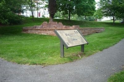
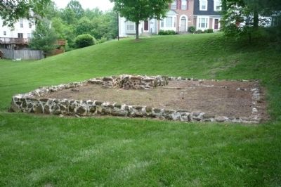
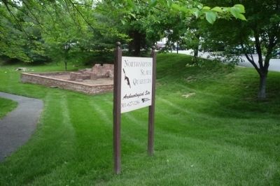
From the late 1600s to the mid-1800s, large tobacco plantations dominated the economic and social life of Prince George’s County. One of the most prominent plantations in the county was Northampton. Today, all that remains of Northampton are the ruins of the manor house, outbuildings, and slave quarters. This section of the park features the reconstructed ruins of two slave quarters.
In 1673, Charles Calvert , Esq., the third Lord Baltimore, granted Northampton Plantation, a 1,000-acre tract of land to Thomas Sprigg. The plantation was the home of the Sprigg Family and their slaves and servants for nearly 200 years. In 1865, Dr. John Contee Fairfax (Lord Fairfax, Baron of Cameron) purchased Northampton, which served as a working farm until the 1950s.
For almost 300 years, African Americans lived and worked at the Northampton Plantation. Archaeological excavations, historic documents, and oral histories provide information about the lives of slaves and tenant farmers at the plantation.
The Hawkins Family
Numerous descendants of the 18th and 19th century slaves and tenants who lived and worked at Northampton still reside in Prince George’s County. Many have linked their family’s past to a common ancestor, Elizabeth Hawkins who lived at Northampton during the 19th century. Two descendants, James and Raymond Smith, lived in the brick duplex with their grandmother, Susie Smith , in the 1920s. James and Raymond moved away in the mid-1920s, but often visited their grandmother during the summer months into the 1930s. Oral histories, along with artifacts discovered during excavations and historical documents, help to provide a detailed picture of life at the two quarters.
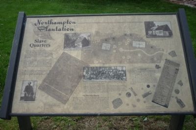
Photograph of Elizabeth Hawkins.
Census sheet recorded in 1870 showing Hawkins family embers living at Northampton, including Elizabeth.
Photograph of the descendants of Elizabeth Hawkins. Represented here are members of the Smith, Ponger, Savoy, Hawkins, Fletcher and Harkin clans (1993).
Statement from the descendants of Elizabeth Hawkins: “There are five living generations of descendants of the Hawkinses, the family that resided on this farm here in Prince George’s County. We total an excess of 400 people, and more that three fourths of those folks make their home within a 20 -mile radius of the location of the slave cabins in Lake Arbor. Its significance to this family is tremendous. It has been like a tie that binds us together. Toil and hard work have been the trademark of our heritage. We the descendants of Robert and Lizzie Savoy Hawkins remember the Northampton Plantation.”
Archaeology
Archaeologist have unearthed thousands
of artifacts from the slave quarters at Northampton. Many of these artifacts were found in subfloor storage pits, called root cellars. Root cellars were used to store vegetables, canned food, and personal belongings. Artifacts recovered from the root cellars, such as pieces of pottery, animal bones, buttons, glass bottles, tobacco pipes, and toys have helped archaeologists to determine when the cellars were used and abandoned. Analysis of the artifacts from the slave quarters has provided valuable information about the daily activities of African Americans living at Northampton.
Historic Building Survey photograph of the wooden frame structure, circa 1790, built on an ironstone (limonite) foundation. (1936)
Historic Building Survey photograph of the 1840s, brick, two family duplex. (1936)
Osborn Sprigg’s estate holdings [statement], inventoried 1750
[The marker text overlays images of the small artifacts discovered by archaeologists plus a map locating the “wooden frame structure” and the “brick two-family duplex” - buildings photographed in 1936, the foundations of which are preserved at the marker site.]
Erected by Dept. of Parks and Recreation, Prince George's County.
Topics. This historical marker is listed in these topic lists: African Americans
• Agriculture • Colonial Era • Settlements & Settlers. A significant historical year for this entry is 1673.
Location. This marker has been replaced by another marker nearby. It was located near 38° 54.2′ N, 76° 49.009′ W. Marker was in Lake Arbor, Maryland, in Prince George's County. Marker is on the walkway in the wooded area off Lake Overlook Drive between Water Point Court and Lake Overlook Place. Touch for map. Marker was in this post office area: Bowie MD 20721, United States of America. Touch for directions.
Other nearby markers. At least 8 other markers are within 2 miles of this location, measured as the crow flies. Northampton Slave Quarters and Archaeological Park (here, next to this marker); Seeking Freedom (here, next to this marker); Archaeology at the Frame Quarters (here, next to this marker); Archaeology at the Brick Quarters (a few steps from this marker); Weary Warriors (within shouting distance of this marker); “Mount Lubentia” (approx. 1.4 miles away); The Chesapeake Carousel (approx. 1.6 miles away); The History of Watkins Regional Park (approx. 1.8 miles away). Touch for a list and map of all markers in Lake Arbor.
More about this marker. Marker has been replaced with 4 other markers related to the archaeology of the area.
Additional commentary.
1. Elizabeth Savoy Hawkins
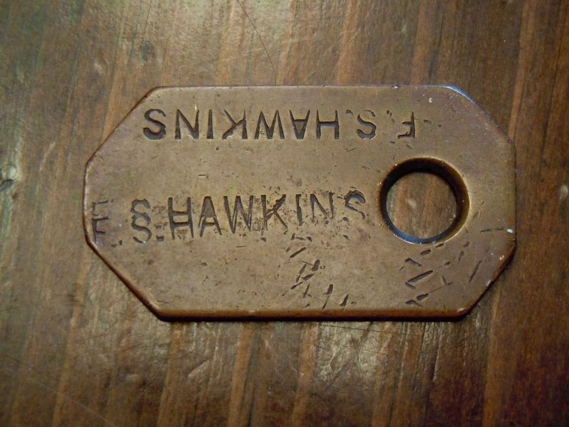
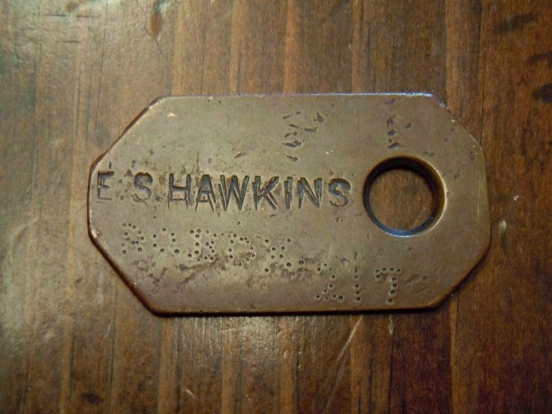
I was doing research on a number of items I have collected over the last 40 years. As I was going through a box of items I found a copper slave tag. The tag was embossed with the name E.S Hawkins. I then went to an article published by DeNeen L. Brown Dated April 28, 1998 which had the name Elizabeth Savoy Hawkins that worked on the Prince George Plantation as a slave. Photos of both sides of the tag are No. 5 and 6. Note To Editor only visible by Contributor and editor
— Submitted June 9, 2020, by John Campetti of Sherman, Connecticut.
Additional keywords. Reconstruction, slavery
Credits. This page was last revised on June 16, 2020. It was originally submitted on May 25, 2009, by Richard E. Miller of Oxon Hill, Maryland. This page has been viewed 4,806 times since then and 167 times this year. Photos: 1, 2, 3, 4. submitted on May 25, 2009, by Richard E. Miller of Oxon Hill, Maryland. 5, 6. submitted on June 9, 2020, by John Campetti of Sherman, Connecticut. • Christopher Busta-Peck was the editor who published this page.
