Marietta in Cobb County, Georgia — The American South (South Atlantic)
This Marks the Starting Point
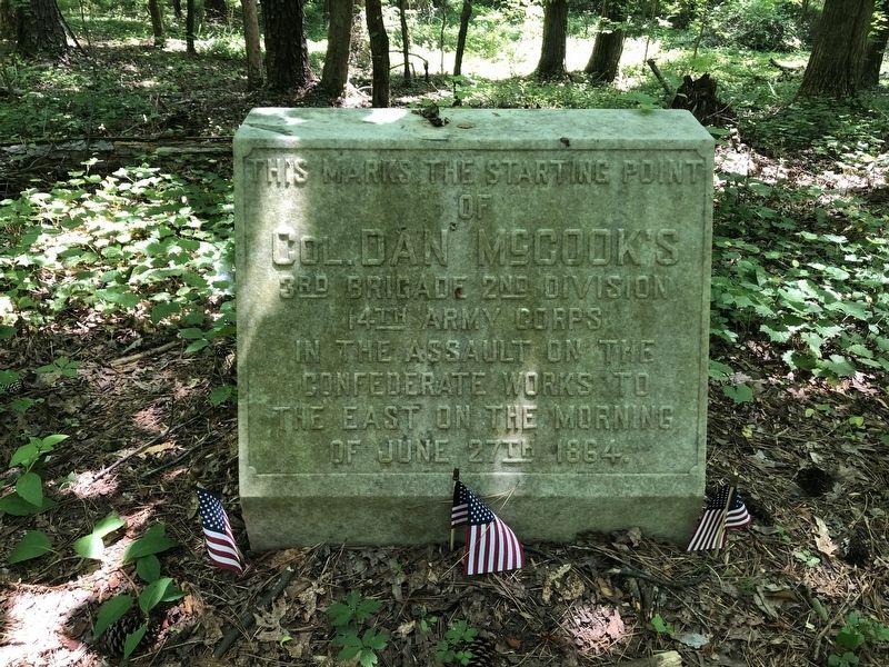
Photographed by Pete Skillman, May 29, 2019
1. This Marks the Starting Point Marker
Topics. This historical marker is listed in this topic list: War, US Civil. A significant historical date for this entry is June 27, 1864.
Location. 33° 56.056′ N, 84° 36.062′ W. Marker is in Marietta, Georgia, in Cobb County. It can be reached from Cheatham Hill Road 0.3 miles south of John Ward Road SW, on the left when traveling south. Marker is located along the Cheatham Hill Trail in Kennesaw Mountain National Battlefield Park. Touch for map. Marker is in this post office area: Marietta GA 30064, United States of America. Touch for directions.

Regionally, this marker is in the Piedmont and in Metro Atlanta. It is also in the American South and specifically in the Deep South. Globally, it is in North America, the Western Hemisphere, the Western World, and the Anglosphere. Historically, it finds itself in what was once the original Cherokee Nation, the territory of the Mississippian Culture, one of the original Thirteen Colonies, one of the
this page online
Other nearby markers. At least 8 other markers are within walking distance of this marker: Union Earthworks (about 700 feet away, measured in a direct line); The Assault Falters (about 800 feet away); Union Tunnel (about 800 feet away); Monument to the Fallen (about 800 feet away); Illinois Monument (about 800 feet away); The Dead Angle (approx. 0.2 miles away); Colonel Dan (approx. 0.2 miles away); An Unknown Soldier (approx. 0.2 miles away). Touch for a list and map of all markers in Marietta.
Also see . . . Kennesaw Mountain National Battlefield Park. National Park Service (Submitted on March 17, 2022.)
Credits. This page was last revised on March 17, 2022. It was originally submitted on March 16, 2022, by Pete Skillman of Wilmington, Delaware. This page has been viewed 404 times since then and 47 times this year. Photo 1. submitted on March 16, 2022, by Pete Skillman of Wilmington, Delaware. • Bernard Fisher was the editor who published this page.
