Trevilians in Louisa in Louisa County, Virginia — The American South (Mid-Atlantic)
Custer Rescued
An All-out Assault
| — | The Battle of Trevilian Station | — |
Photographed by Evan Dwyer, June 11, 2026
1. Custer Rescued Marker
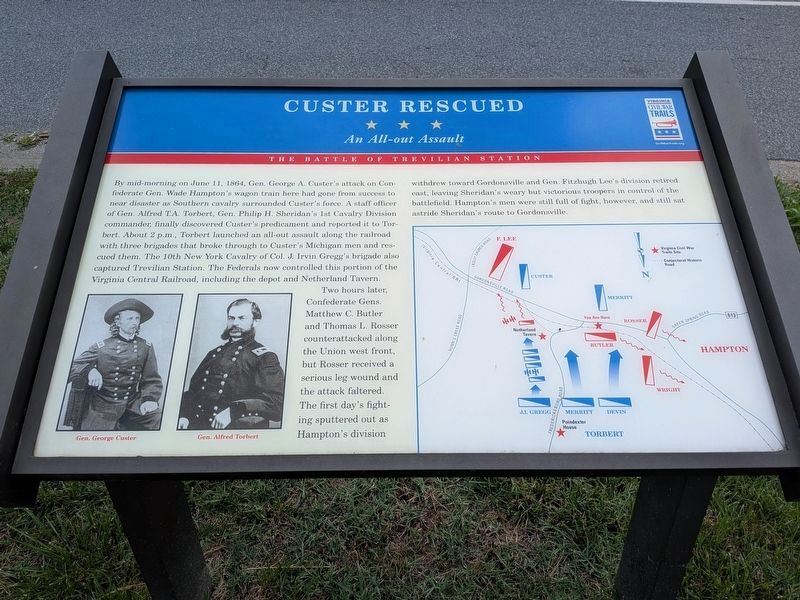
The original marker weathered and was replaced with a virtually identical marker, shown here. The text is identical. The only difference is the alignment of the righthand column. The map and images, as well as their captions, are all the same.
Two hours later, Confederate Gens. Matthew C. Butler and Thomas L. Rosser counterattacked along the Union west front, but Rosser received a serious leg wound and the attack faltered. The first day's fighting sputtered out as Hampton's division withdrew toward Gordonsville and Gen. Fitzhugh Lee's division retired east, leaving Sheridan's weary but victorious troopers in control of the battlefield. Hampton's
this page online
Erected by Virginia Civil War Trails.
Topics and series. This historical marker is listed in this topic list: War, US Civil. In addition, it is included in the Virginia Civil War Trails series list. A significant historical date for this entry is June 11, 1864.
Location. 38° 3.045′ N, 78° 4.433′ W. Marker is in Louisa, Virginia, in Louisa County. It is in Trevilians. It is at the intersection of Louisa Road (U.S. 33) and Danne Road (County Route 682), on the right when traveling west on Louisa Road. Located at the east entrance to the gas station. Touch for map. Marker is at or near this postal address: 17561 Louisa Road, Louisa VA 23093, United States of America. Touch for directions.

Regionally, this marker is in the Piedmont and in Central Virginia. It is also in the American South and specifically in the Upper South. Globally, it is in North America, the Western Hemisphere, the Western World, and the Anglosphere. Historically, it finds itself in what was once the territory of the Mississippian Culture, one of the original Thirteen
Photographed by Craig Swain, January 12, 2008
2. Custer Rescued Marker
This original marker wore out and was replaced but without changes to its text or content.
Other nearby markers. At least 8 other markers are within 3 miles of this marker, measured as the crow flies: Custer's First Last Stand (a few steps from this marker); Railroad Rails (about 400 feet away, measured in a direct line); Battle of Trevillians (about 800 feet away); Battle of Trevilian Station (about 800 feet away); The Netherland's Tavern (approx. ¾ mile away); Netherland Tavern (approx. 0.8 miles away); Ogg Farm (approx. 1.6 miles away); Bibb's Crossroads (approx. 2.8 miles away). Touch for a list and map of all markers in Louisa.
Other markers no longer nearby. Trevilian Station Battle (was within shouting distance of this marker but has been confirmed missing); Battle of Trevilians (was about 800 feet away but has been replaced with another marker now near it).
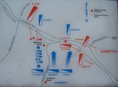
More about this marker. On the lower left the marker displays portraits of Gens. Custer and Torbert. On the right is a map depicting this phase of the battle.
Regarding Custer Rescued. This is one of several markers interpreting the Battle of Trevilian Station,
Photographed by Craig Swain, January 12, 2008
3. Battle Map
Note the north seeking arrow pointed to the bottom of the map.
Also of note, the reader may examine on the marker's map that J. Irvin Gregg's brigade remained east of the Fredericksburg Road during this part of the fighting - yet the marker text indicates one of his regiments captured Trevilian Station. This discrepancy - how could a brigade half a mile away capture a station that was instead directly within the path of two other brigades - led the marker's author, Eric J. Wittenberg, to later assert that the Civil War-era station was actually positioned next to Netherland Tavern. Since it was burned down in both 1863 and 1864, after the Civil War the station seems to have been moved half a mile west to its current location (but on the north, not south, side of the tracks). The map on this marker shows exactly why this discrepancy is noteworthy.
Also see . . .
1. American Battlefield Trust - Trevilian Station. An authoritative source for information on the battle and battlefield preservation. (Submitted on August 15, 2026, by Evan Dwyer of Richmond, Virginia.)
2. Trevilian Station Battlefield Foundation.
Photographed by Craig Swain, January 12, 2008
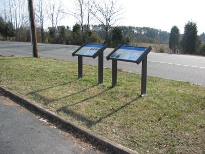
4. Trevilian Station Battlefield Driving Tour Stop Seven
3. Battle of Trevilian Station Virtual Tour by Markers. A set of markers that document the Battle of Trevilian Station, June 11-12, 1864. The order of appearance is generally aligned to the Trevilian Station Battlefield Foundation driving tour, with accommodations made for convenience both in the town of Louisa at the beginning of the tour, and on the eastbound side of Route 33 headed back towards the cemetery. Because the C.G. Trevilian House at the 'modern' station does not have its own marker, reviewing this database for accompanying information when reading about the railroad tracks there is recommended for added interpretive value. (Submitted on August 15, 2026, by Evan Dwyer of Richmond, Virginia.)
Photographed by Craig Swain, January 12, 2008
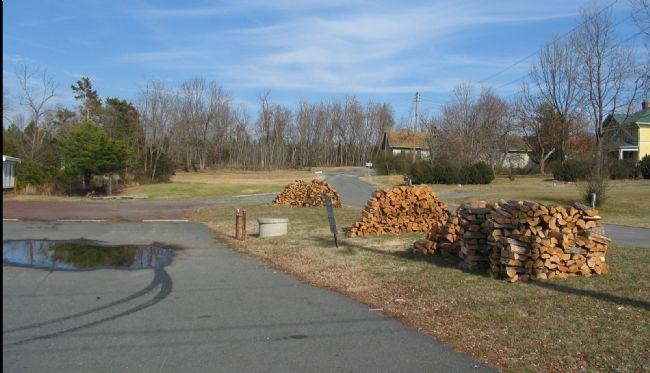
5. Butler's Defensive Line
The Virginia Central Railroad runs through the tree line in the distance behind the houses. Confederate Gen. Butler's brigade defended along the railroad line to the north of the marker location. The Confederates were forced out of these positions when Torbert drove his command to rescue Custer.
Photographed by Craig Swain, January 12, 2008
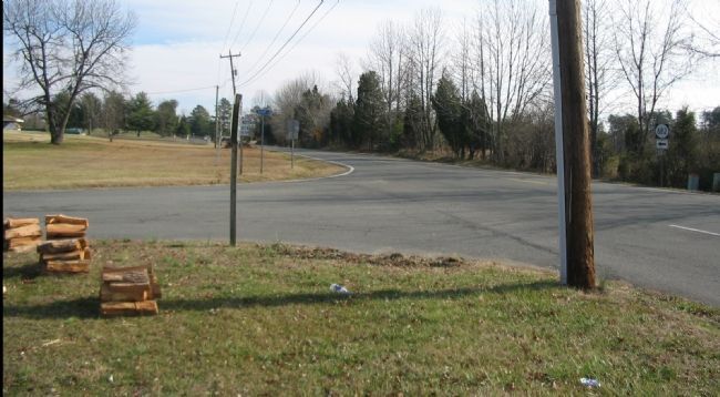
6. Looking East from the Marker Location
Devin's Federal Brigade crossed the railroad and the Gordonsville Road a few yards east of this point to link up with Custer's surrounded command. Custer's troopers had fallen back from their original position at Mildred Crossing, to the east, where Nunn's Creek Road intersects the Gordonsville Road.
Credits. This page was last revised on August 15, 2026. It was originally submitted on January 20, 2008, by Craig Swain of Leesburg, Virginia. This page has been viewed 2,153 times since then and 55 times this year. Last updated on March 17, 2022, by Bradley Owen of Morgantown, West Virginia. Photos: 1. submitted on August 14, 2026, by Evan Dwyer of Richmond, Virginia. 2, 3, 4. submitted on January 20, 2008, by Craig Swain of Leesburg, Virginia. 5, 6. submitted on January 21, 2008, by Craig Swain of Leesburg, Virginia. • J. Makali Bruton was the editor who published this page.
