Brockville in Leeds and Grenville United Counties, Ontario — Central Canada (North America)
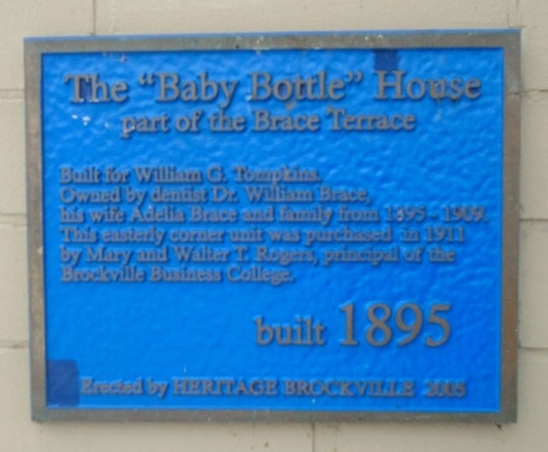
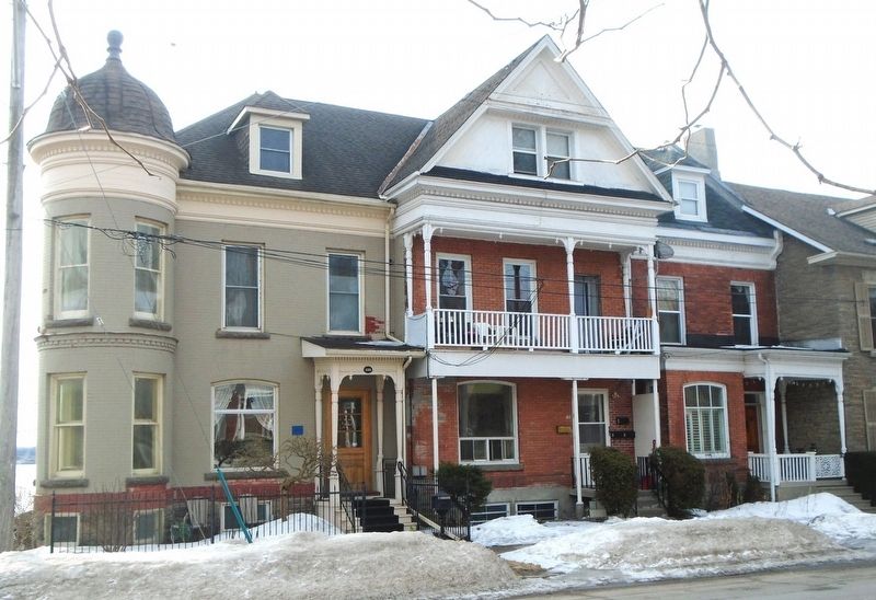
The "Baby Bottle" House
part of the Brace Terrace
| — | built 1895 | — |
Photographed by William Fischer, Jr., March 11, 2022
1. The "Baby Bottle" House Marker
Built for William G. Tompkins,
Owned by dentist Dr. William Brace,
his wife Adelia Brace and family from 1895-1909.
This easterly corner unit was purchased in 1911
by Mary and Walter T. Rogers, principal of the
Brockville Business College.
Erected 2005 by Heritage Brockville.
Topics. This historical marker is listed in this topic list: Notable Buildings. A significant historical year for this entry is 1911.
Location. 44° 35.608′ N, 75° 40.67′ W. Marker is in Brockville, Ontario, in Leeds and Grenville United Counties. It is at the intersection of King Street East (County Highway 2) and Ford Street, on the right when traveling east on King Street East. Touch for map. Marker is at or near this postal address: 135 King Street East, Brockville ON K6V 1B7, Canada. Touch for directions.

Regionally, this marker is in Eastern Ontario and specifically in Southeastern Ontario. It is also in Central Canada. Globally, it is in North America, the Western Hemisphere, the Western World, and the Anglosphere. Historically, it finds itself in what was once a British colony, the Viceroyalty of New France, the
this page online
Other nearby markers. At least 8 other markers are within walking distance of this marker: Richard Bradfield House (a few steps from this marker); St. Lawrence Terrace (within shouting distance of this marker); Thomas R. Sheffield House (within shouting distance of this marker); David Simpson House (within shouting distance of this marker); Henry and Ellen Soper House (within shouting distance of this marker); Bartholomew and Ruth Ann Carley House (about 90 meters away, measured in a direct line); William and Augusta Swift House (about 150 meters away); Centeen Memorial Dive Park (about 150 meters away). Touch for a list and map of all markers in Brockville.
Also see . . .
1. A Brief History of Brockville. (Submitted on March 18, 2022, by William Fischer, Jr. of Reynoldsburg, Ohio.)
2. Brockville Municipal Register of Cultural Heritage Properties. (Submitted on March 18, 2022, by William Fischer, Jr. of Reynoldsburg, Ohio.)
Photographed by William Fischer, Jr., March 11, 2022
2. The "Baby Bottle" House and Marker
Credits. This page was last revised on March 18, 2022. It was originally submitted on March 18, 2022, by William Fischer, Jr. of Reynoldsburg, Ohio. This page has been viewed 333 times since then and 21 times this year. Photos: 1, 2. submitted on March 18, 2022, by William Fischer, Jr. of Reynoldsburg, Ohio.
