
Cross Keys near Harrisonburg in Rockingham County, Virginia — The American South (Mid-Atlantic)
Kyles Mill House
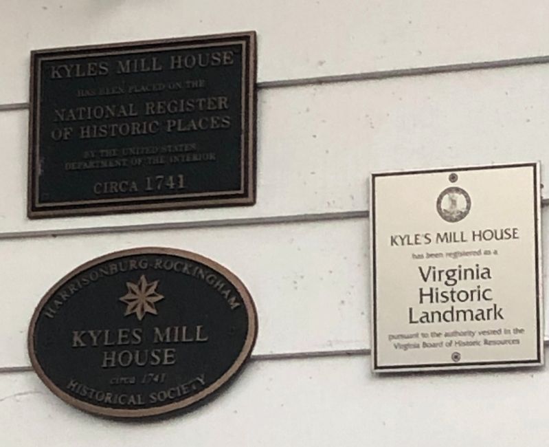
has been placed on the
National Register
of Historic Places
by the United States
Department of the Interior
circa 1741
Kyles Mill
House
circa 1741
Harrisonburg-Rockingham
Historical Society
Kyles Mill House
has been registered as a
Virginia
Historic
Landmark
pursuant to the authority vested in the
Virginia Board of Human Resources
Topics. This historical marker is listed in these topic lists: Architecture • Colonial Era • Industry & Commerce • Settlements & Settlers. A significant historical year for this entry is 1741.
Location. 38° 22.338′ N, 78° 49.619′ W. Marker is near Harrisonburg, Virginia, in Rockingham County. It is in Cross Keys. It can be reached from Cross Keys Road (Route 276) half a mile west of Oak Shade Road (Virginia Route 676), on the right when traveling west. Touch for map. Marker is at or near this postal address: 1764 Cross Keys Rd, Harrisonburg VA 22801, United States of America. Touch for directions.

Regionally, this marker is in Virginia’s Shenandoah Valley. It is also in the American South and specifically in the Upper South. Globally,
this page online
Other nearby markers. At least 8 other markers are within 2 miles of this marker, measured as the crow flies: Battle of Cross Keys (approx. 0.9 miles away); Cross Keys Cemetery (approx. 1.2 miles away); Union Church (approx. 1.3 miles away); Fighting in the Cemetery (approx. 1.3 miles away); Cross Keys Battlefield (approx. 1.3 miles away); a different marker also named Battle of Cross Keys (approx. 1.3 miles away); Milroy Moves Forward (approx. 1.3 miles away); Walker's Flank Attack (approx. 1.4 miles away).
Other markers no longer nearby. The Armies Brace for Battle (was approx. half a mile away but has been confirmed missing); a different marker also named The Battle of Cross Keys (was approx. 1.3 miles away but has been replaced with another marker now near it); a different marker also named Battle of Cross Keys (was approx. 1.3 miles
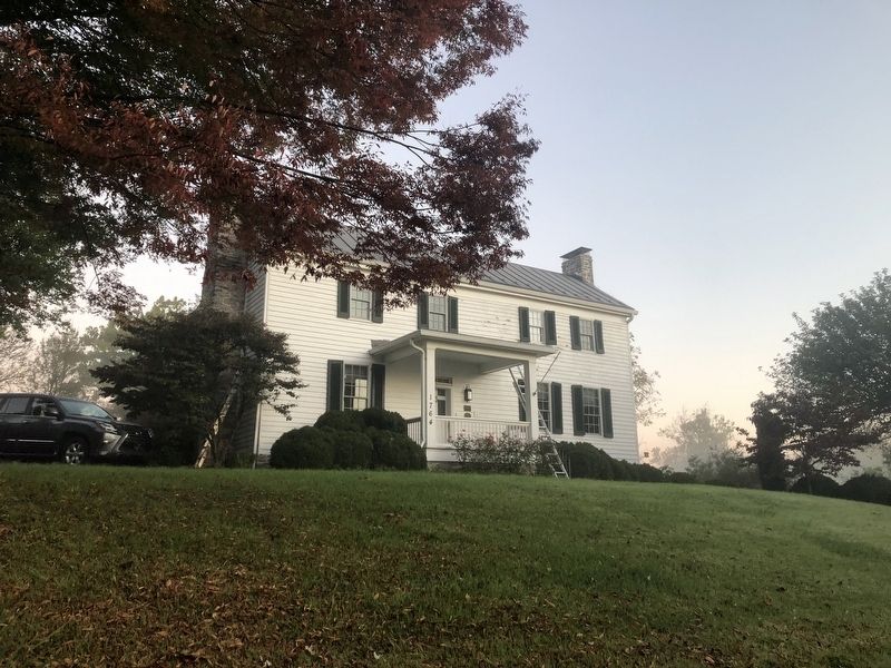
Regarding Kyles Mill House. The house was renovated in 1986 and added to the National Register of Historic Places on March 6, 2001.
Credits. This page was last revised on May 1, 2023. It was originally submitted on October 17, 2020, by Devry Becker Jones of Washington, District of Columbia. This page has been viewed 737 times since then and 35 times this year. Last updated on March 18, 2022, by Bradley Owen of Morgantown, West Virginia. Photos: 1, 2. submitted on October 17, 2020, by Devry Becker Jones of Washington, District of Columbia. • J. Makali Bruton was the editor who published this page.
