Liberty Grove in Door County, Wisconsin — The American Midwest (Great Lakes)
Town of Liberty Grove
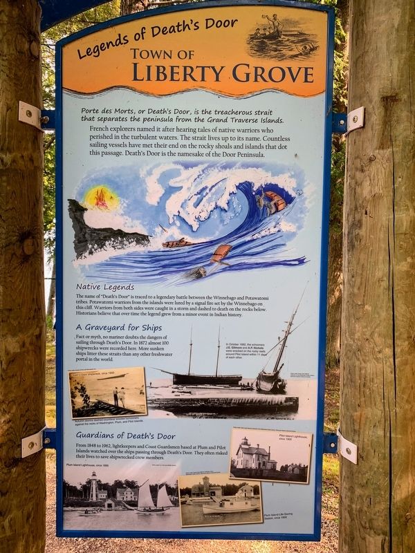
Legends of Death's Door
French explorers named it after hearing tales of native warriors who perished in the turbulent waters. The strait lives up to its name. Countless sailing vessels have met their end on the rocky shoals and islands that dot this passage. Death's Door is the namesake of the Door Peninsula.
Native Legends
The name of "Death's Door" is traced to a legendary battle between the Winnebago and Potawatomi tribes. Potawatomi warriors from the islands were lured by a signal fire set by the Winnebago on this cliff. Warriors from both sides were caught in a storm and dashed to death on the rocks below. Historians believe that over time the legend grew from a minor event in Indian history.
A Graveyard for Ships
Fact or myth, no mariner doubts the dangers of sailing through Death's Door. In 1872 almost 100 shipwrecks were recorded here. More sunken ships litter these straits than any other freshwater portal in the world.
Guardians of Death's Door
From 1848 to 1962, lightkeepers and Coast Guardsmen based at Plum and Pilot Islands watched over the ships passing through Death's Door. They often risked their lives to save shipwrecked crew members.
Erected by Door County Coastal Byway.
Topics. This historical marker is listed in this topic list: Waterways & Vessels.
Location. 45° 17.728′ N, 86° 59.181′ W. Marker is in Liberty Grove, Wisconsin, in Door County. Marker can be reached from North Port des Morts Drive north of State Highway 42, on the right when traveling west. The marker is in Port des Morts Park near the parking area. Touch for map. Marker is at or near this postal address: Port des Morts Park, 12832 Kenosha Drive, Ellison Bay WI 54210, United States of America. Touch for directions.
Other nearby markers. At least 8 other markers are within 2 miles of this marker, measured as the crow flies. The Niagara Escarpment (a few steps from this marker); Ancient Shorelines (within shouting distance of this marker); Pilot Island Site (approx. 0.6 miles away); Rudder from the "City of Glasgow" (approx. 1.7 miles away); Air Funnel (approx. 1.7 miles away); The Skipper (approx. 1.7 miles away); The Fishtug Skipper (approx. 1.7 miles away); Anchor (approx. 1.7 miles away). Touch for a list and map of all markers in Liberty Grove.
Credits. This page was last revised on March 20, 2022. It was originally submitted on March 19, 2022, by Devon Polzar of Port Washington, Wisconsin. This page has been viewed 104 times since then and 9 times this year. Photos: 1, 2, 3, 4. submitted on March 19, 2022, by Devon Polzar of Port Washington, Wisconsin. • J. Makali Bruton was the editor who published this page.


