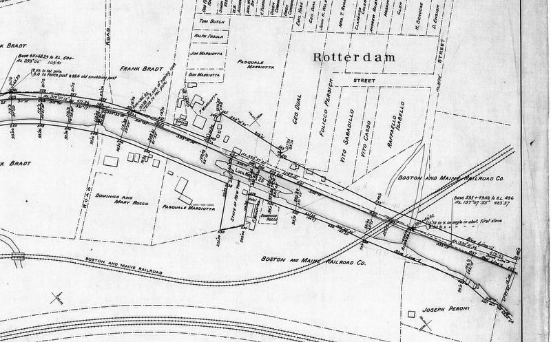
Rotterdam Junction in Schenectady County, New York — The American Northeast (Mid-Atlantic)
Lock 25
Rotterdam Junction, New York
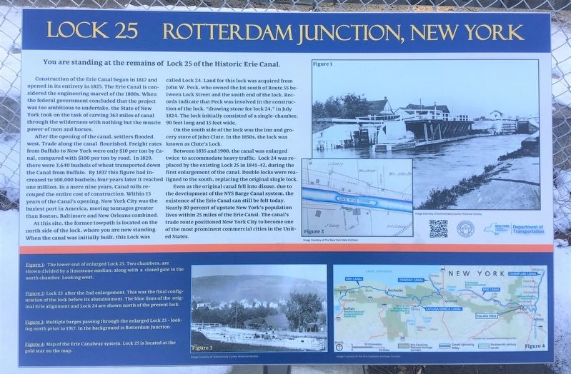
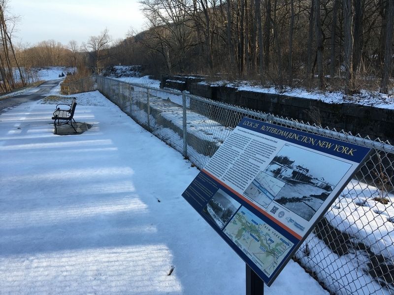
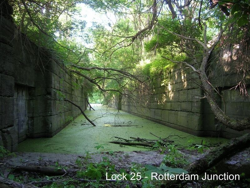
You are standing at the remains of Lock 25 of the Historic Erie Canal.
Construction of the Erie Canal began in 1817 and opened in its entirety in 1825. The Erie Canal is considered the engineering marvel of the 1800s. When the federal government concluded that the project was too ambitious to undertake, the State of New York took on the task of carving 363 miles of canal through the wilderness with nothing but the muscle power of men and horses.
After the opening of the canal, settlers flooded west. Trade along the canal flourished. Freight rates from Buffalo to New York were only $10 per ton by Canal, compared with $100 per ton by road. In 1829, there were 3,640 bushels of wheat transported down the Canal from Buffalo. By 1837 this figure had increased to 500,000 bushels; four years later it reached one million. In a mere nine years, Canal tolls recouped the entire cost of construction. Within 15 years of the Canal's opening, New York City was the busiest port in America, moving tonnages greater than Boston, Baltimore and New Orleans combined.
At this site, the former towpath is located on the north side of the lock, where you are now standing. When the canal was initially built, this Lock was called Lock 24. Land for this lock was acquired from John W. Peck, who owned the lot south of Route 5S between Lock Street and the south end of the lock. Records indicate that Peck was involved in the construction of the lock, "drawing stone for lock 24," in July 1824. The lock initially consisted of a single-chamber, 90 feet long and 15 feet wide.
On the south side of the lock was the inn and grocery store of John Clute. In the 1850s, the lock was known as Clute's Lock.
Between 1835 and 1900, the canal was enlarged twice to accommodate heavy traffic. Lock 24 was replaced by the existing Lock 25 in 1841-42, during the first enlargement of the canal. Double locks were realigned to the south, replacing the original single lock.
Even as the original canal fell into disuse, due to the development of the NYS Barge Canal system, the existence of the Erie Canal can still be felt today. Nearly 80 percent of upstate New York's population lives within 25 miles of the Erie Canal. The canal's trade route positioned New York City to become one of the most prominent commercial cities in the United States.
( photo captions )
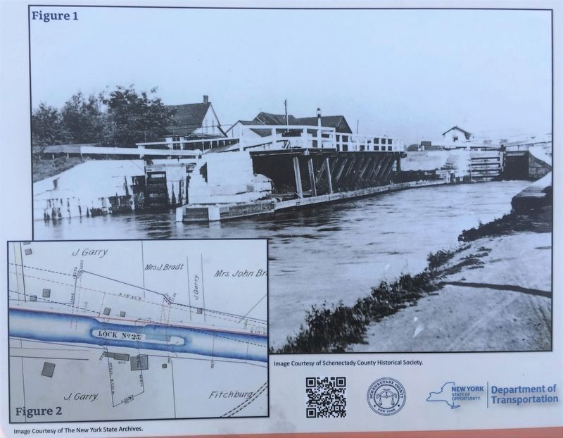
Figure 1: The lower end of enlarged Lock 25. Two chambers, are shown divided by a limestone median. along with a closed gate in the north chamber. Looking west.
Figure 2: Lock 25 after the 2nd enlargement. This was the final configuration of the lock before its abandonment. The blue lines of the original Erie
alignment and Lock 24 are shown north of the present lock.
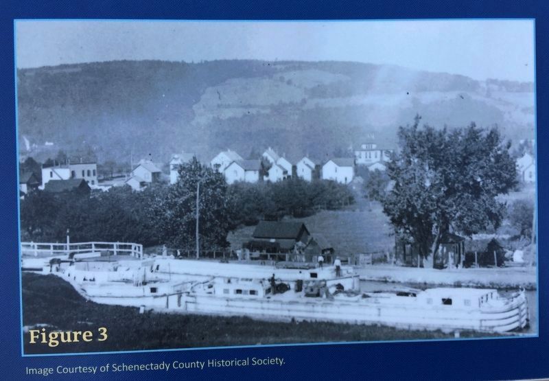
Figure 3: Multiple barges passing through the enlarged Lock 25 - looking north prior to 1917. In the background is Rotterdam Junction.
Figure 4: Map of the Erie Canalway system. Lock 25 is located at the gold star on the map.
Erected 2020 by Schenectady County & the New York State Department of Transportation.
Topics and series. This historical marker is listed in these topic lists: Industry & Commerce • Waterways & Vessels. In addition, it is included in the Erie Canal series list. A significant historical year for this entry is 1825.
Location. 42° 52.232′ N, 74° 2.61′ W. Marker is in Rotterdam Junction, New York, in Schenectady County. Marker can be reached from New York Empire State Trail south of Canal Street & Lock Street, on the left when traveling north. Located along the the Mohawk-Hudson Bike-Hike Tail. Also known as the Empire State Trail and the Erie Canalway Trail. Touch for map. Marker is in this post office area: Rotterdam Junction NY 12150, United States of America. Touch for directions.
Other nearby markers. At least 8 other markers are within 3 miles of this marker, measured as the crow flies. Jan Mabee House (approx. 0.7 miles away); a different marker also named Jan Mabee House (approx. 0.7 miles away); Josias Swart Homestead (approx. 1.2 miles away); Vedder Tavern
Photographed By Howard C. Ohlhous, March 10, 2022
3. Lock 25 Marker, Detail
Figure 1: The lower end of enlarged Lock 25. Two chambers, are shown divided by a limestone median. along with a closed gate in the north chamber. Looking west.
[Inset] Figure 2: Lock 25 after the 2nd enlargement. This was the final configuration of the lock before its abandonment. The blue lines of the original Erie alignment and Lock 24 are shown north of the present lock.
[Inset] Figure 2: Lock 25 after the 2nd enlargement. This was the final configuration of the lock before its abandonment. The blue lines of the original Erie alignment and Lock 24 are shown north of the present lock.
More about this marker. At the end of 2020 construction was wrapped up on New York State's effort to close gaps in the Empire State trail, spending $8M in the process of building a bike-pedestrian tunnel under the Pan Am Rail tracks at the end of Scrafford Lane, rehabbing a century-old maintenance tunnel under the CSX tracks two miles west, and building three miles of new trailway in the Rotterdam Junction area. Highlighting the area's scenic natural beauty, as well as the state’s rich history, the trail follows the route of the Erie Canal, with the trail adjacent to Lock 25.
Credits. This page was last revised on December 13, 2023. It was originally submitted on March 20, 2022, by Howard C. Ohlhous of Duanesburg, New York. This page has been viewed 607 times since then and 54 times this year. Photos: 1, 2, 3, 4, 5. submitted on March 20, 2022, by Howard C. Ohlhous of Duanesburg, New York. 6. submitted on November 18, 2023, by Howard C. Ohlhous of Duanesburg, New York. • Michael Herrick was the editor who published this page.
